TopoQuest Logo
Do you find TopoQuest useful?
Help keep TopoQuest running and adding new maps/features by donating!
Bitcoin:  19c7KJd3qBynnjoSw5npx9KScwjBe4ifkT
Litecoin:  LXs6TkuXGGXo1vDsWCkWVdjQX94eUKd6ui
Home View Maps Find Maps Find Places Resources & Links


Roff North, Oklahoma Topographic Map

USGS Map Title: Roff North, OK
USGS Map MRC: 34096F7
DRG (GeoTIFF) Download: o34096f7.tif


Neighboring USGS Topographic Map Quads:


  Stratford, OK  
34096G8
 

  Vanoss, OK  
34096G7
 

  Ada, OK  
34096G6
 

  Hart, OK  
34096F8
 

  Roff North, OK  
34096F7
 

  Ahloso, OK  
34096F6
 

  Sulphur North, OK  
34096E8
 

  Roff South, OK  
34096E7
 

  Fittstown, OK  
34096E6


Map MRC Location:

N35°
W97°
N35°
W96°
H8 H7 H6 H5 H4 H3 H2 H1
G8 G7 G6 G5 G4 G3 G2 G1
F8 F7 F6 F5 F4 F3 F2 F1
E8 E7 E6 E5 E4 E3 E2 E1
D8 D7 D6 D5 D4 D3 D2 D1
C8 C7 C6 C5 C4 C3 C2 C1
B8 B7 B6 B5 B4 B3 B2 B1
A8 A7 A6 A5 A4 A3 A2 A1
N34°
W97°
N34°
W96°

Roff North, OK USGS 1:24K Topographic Map Preview:
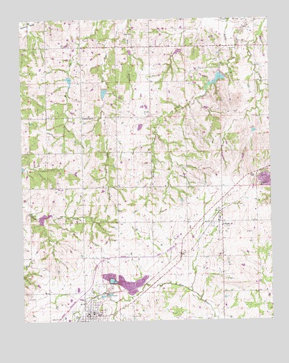
Roff North, OK USGS Topographic Map
Click on map above to begin viewing in our Map Viewer.

This topographic map contains these locations and features:
Feature Name Type Latitude Longitude GNIS ID View Map
Chimney HillSummitN34.6818°W96.7570°1091302View Map
Dry HollowValleyN34.7481°W96.8235°1092249View Map
East Hill CemeteryCemeteryN34.6270°W96.8222°1092407View Map
FitzhughPopulated PlaceN34.6659°W96.7750°1092853View Map
Fitzhugh Volunteer Fire DepartmentBuildingN34.6669°W96.7762°2657188View Map
Lightning Ridge CemeteryCemeteryN34.7103°W96.8455°2711559View Map
Lightning Ridge ChurchChurchN34.7093°W96.8442°1094635View Map
Oknoname 11904 DamDamN34.7251°W96.7920°1754052View Map
Oknoname 11904 ReservoirReservoirN34.7251°W96.7920°1754053View Map
Rodtky CreekStreamN34.7487°W96.7703°1097387View Map
RoffPopulated PlaceN34.6276°W96.8408°1097389View Map
Roff Elementary SchoolSchoolN34.6282°W96.8403°1819307View Map
Roff Fire Department Station 1BuildingN34.6277°W96.8419°2656948View Map
Roff Fire Department Station 2BuildingN34.6275°W96.8462°2657492View Map
Roff High SchoolSchoolN34.6282°W96.8403°1790452View Map
Roff Police DepartmentBuildingN34.6276°W96.8420°2757467View Map
Sandy Creek Site 11 DamDamN34.6684°W96.8670°1752243View Map
Sandy Creek Site 11 ReservoirReservoirN34.6679°W96.8645°1752244View Map
Sandy Creek Site 3 DamDamN34.7051°W96.7586°1757081View Map
Sandy Creek Site 3 ReservoirReservoirN34.7036°W96.7584°1757082View Map
Sandy Creek Site 33 DamDamN34.7368°W96.7953°1757075View Map
Sandy Creek Site 33 ReservoirReservoirN34.7368°W96.7953°1757076View Map
Sandy Creek Site 4 DamDamN34.7268°W96.7720°1757083View Map
Sandy Creek Site 4 ReservoirReservoirN34.7247°W96.7766°1757084View Map
Sandy Creek Site 6 DamDamN34.7368°W96.8203°1757085View Map
Sandy Creek Site 6 ReservoirReservoirN34.7363°W96.8200°1757086View Map
Sandy Creek Site 7 DamDamN34.7218°W96.8336°1757087View Map
Sandy Creek Site 7 ReservoirReservoirN34.7195°W96.8335°1757088View Map
Sandy Creek Site 8 DamDamN34.7268°W96.8503°1757089View Map
Sandy Creek Site 8 ReservoirReservoirN34.7248°W96.8508°1757090View Map
Town of FitzhughCivilN34.6581°W96.7665°2412627View Map
Town of RoffCivilN34.6288°W96.8411°2412569View Map
West Hill CemeteryCemeteryN34.6264°W96.8618°1099569View Map
Wilson ChurchChurchN34.7440°W96.8192°1099888View Map

Note: Coordinates in the location and feature list above are referenced to NAD83 datum.


Copyright (C) 2008-2025 Ryan Niemi / Sunset Dynamics ... All Rights Reserved