TopoQuest Logo
Do you find TopoQuest useful?
Help keep TopoQuest running and adding new maps/features by donating!
Bitcoin:  19c7KJd3qBynnjoSw5npx9KScwjBe4ifkT
Litecoin:  LXs6TkuXGGXo1vDsWCkWVdjQX94eUKd6ui
Home View Maps Find Maps Find Places Resources & Links


Romance, West Virginia Topographic Map

USGS Map Title: Romance, WV
USGS Map MRC: 38081E5
DRG (GeoTIFF) Download: o38081e5.tif


Neighboring USGS Topographic Map Quads:


  Kenna, WV  
38081F6
 

  Kentuck, WV  
38081F5
 

  Walton, WV  
38081F4
 

  Sissonville, WV  
38081E6
 

  Romance, WV  
38081E5
 

  Kettle, WV  
38081E4
 

  Pocatalico, WV  
38081D6
 

  Big Chimney, WV  
38081D5
 

  Blue Creek, WV  
38081D4


Map MRC Location:

N39°
W82°
N39°
W81°
H8 H7 H6 H5 H4 H3 H2 H1
G8 G7 G6 G5 G4 G3 G2 G1
F8 F7 F6 F5 F4 F3 F2 F1
E8 E7 E6 E5 E4 E3 E2 E1
D8 D7 D6 D5 D4 D3 D2 D1
C8 C7 C6 C5 C4 C3 C2 C1
B8 B7 B6 B5 B4 B3 B2 B1
A8 A7 A6 A5 A4 A3 A2 A1
N38°
W82°
N38°
W81°

Romance, WV USGS 1:24K Topographic Map Preview:
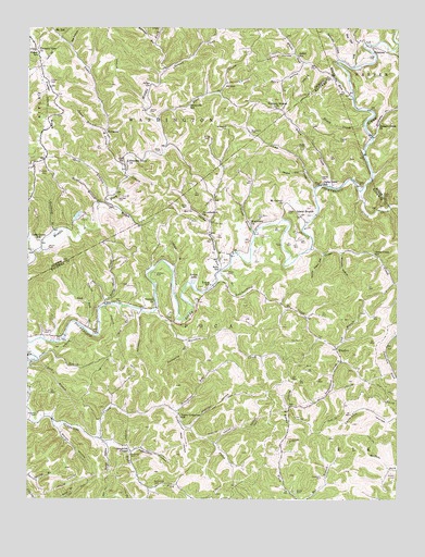
Romance, WV USGS Topographic Map
Click on map above to begin viewing in our Map Viewer.

This topographic map contains these locations and features:
Feature Name Type Latitude Longitude GNIS ID View Map
AdventPopulated PlaceN38.6104°W81.5587°1553700View Map
Advent Post OfficePost OfficeN38.6076°W81.5648°1559882View Map
Allen CreekStreamN38.5829°W81.5232°1534883View Map
Amos Haynes CemeteryCemeteryN38.5848°W81.5240°1540092View Map
Ashby School (historical)SchoolN38.6176°W81.5340°1535052View Map
Baxter CemeteryCemeteryN38.5018°W81.5340°1535315View Map
Belle School (historical)SchoolN38.5609°W81.5601°1535609View Map
Berry CemeteryCemeteryN38.5776°W81.5712°1535662View Map
Berry HollowValleyN38.5740°W81.5643°1535667View Map
Big HollowValleyN38.6201°W81.6107°1535863View Map
Blackshire CemeteryCemeteryN38.5973°W81.5498°1536067View Map
BlundonPopulated PlaceN38.5401°W81.5207°1536153View Map
Broadtree RunStreamN38.5231°W81.5751°1536375View Map
Brush CreekStreamN38.5990°W81.5115°1536463View Map
Camp CreekStreamN38.5818°W81.5282°1536913View Map
Camp Creek School (historical)SchoolN38.5840°W81.5257°1536923View Map
Carney (historical)Populated PlaceN38.5509°W81.5860°1741859View Map
Carney CemeteryCemeteryN38.6190°W81.6225°2574011View Map
Cedar Grove School (historical)SchoolN38.5684°W81.6204°1537135View Map
CiceronePopulated PlaceN38.6198°W81.5087°1554135View Map
Clendenin CemeteryCemeteryN38.5748°W81.5473°1537399View Map
Comer CemeteryCemeteryN38.6026°W81.5846°1537545View Map
Covey CemeteryCemeteryN38.5923°W81.5807°1537734View Map
Davis HollowValleyN38.6151°W81.5321°1538046View Map
Dawson CemeteryCemeteryN38.5593°W81.5818°1554268View Map
Dick BranchStreamN38.5362°W81.6240°1538174View Map
Dry BranchStreamN38.5515°W81.5940°1538341View Map
Fields CemeteryCemeteryN38.5959°W81.5662°1538952View Map
First CreekStreamN38.6001°W81.5815°1538975View Map
Fisher CemeteryCemeteryN38.6106°W81.6182°1538989View Map
Fisher RidgeRidgeN38.6048°W81.6171°1538994View Map
Fisher School (historical)SchoolN38.6176°W81.6221°1539002View Map
Fougharty CemeteryCemeteryN38.5056°W81.5254°1539171View Map
Goff School (historical)SchoolN38.5887°W81.5932°1539490View Map
Good Ford BranchStreamN38.5448°W81.6051°1539499View Map
Goose CreekStreamN38.5565°W81.5001°1539516View Map
Goose Creek School (historical)SchoolN38.5651°W81.5079°1539521View Map
Grapevine ChapelChurchN38.5129°W81.5901°1539599View Map
Green CreekStreamN38.5818°W81.5126°1539671View Map
Gunnell HollowValleyN38.5651°W81.5193°1539792View Map
Haynes CemeteryCemeteryN38.5951°W81.5198°1540093View Map
HicumbottomPopulated PlaceN38.5640°W81.5607°1741906View Map
Hicumbottom ChurchChurchN38.5754°W81.5662°1540232View Map
Hicumbottom RunStreamN38.5601°W81.5610°1540233View Map
Hunt CemeteryCemeteryN38.5806°W81.5048°1540590View Map
Island BranchStreamN38.5709°W81.5485°1540734View Map
Island BranchPopulated PlaceN38.5743°W81.5318°1554784View Map
Jacks BranchStreamN38.5370°W81.6212°1540768View Map
Johns BranchStreamN38.5979°W81.5990°1540961View Map
Jones CemeteryCemeteryN38.5759°W81.5373°1541008View Map
Lanham CemeteryCemeteryN38.5793°W81.5948°1541349View Map
Leatherwood CreekStreamN38.5581°W81.5607°1541591View Map
Lick BranchStreamN38.5395°W81.5210°1541868View Map
Lowe CemeteryCemeteryN38.6173°W81.5101°1542517View Map
Mangus CemeteryCemeteryN38.6095°W81.5837°1542708View Map
Martin HollowValleyN38.5187°W81.6146°1542816View Map
Matthews BranchStreamN38.5784°W81.6015°1542871View Map
Milam CemeteryCemeteryN38.5437°W81.6179°1543253View Map
Milam CemeteryCemeteryN38.5598°W81.5576°1543254View Map
Milam CemeteryCemeteryN38.5668°W81.6179°1543255View Map
Miller HollowValleyN38.5184°W81.5718°1543386View Map
Missionary ChurchChurchN38.5737°W81.5501°1543457View Map
Mount Carmel ChurchChurchN38.5784°W81.5387°1543625View Map
Mount TellPopulated PlaceN38.6243°W81.6168°1555177View Map
Newhouser CemeteryCemeteryN38.5037°W81.5812°1544151View Map
Opossum HollowValleyN38.5495°W81.5871°1544426View Map
Parsons HollowValleyN38.6181°W81.5357°1544608View Map
Pauley HollowValleyN38.5868°W81.5318°1544640View Map
Pernel BranchStreamN38.5606°W81.5762°1544717View Map
Pigeonroost HollowValleyN38.5129°W81.5896°1544833View Map
Pigeonroost RunStreamN38.6209°W81.5829°1544837View Map
Pleasant Grove Church CemeteryCemeteryN38.5895°W81.5910°2586153View Map
Pleasant Grove School (historical)SchoolN38.5895°W81.5915°1544989View Map
Pleasant View ChurchChurchN38.6193°W81.6229°1545044View Map
Raccoon CreekStreamN38.5495°W81.5821°1545358View Map
Ramp Patch HollowValleyN38.5648°W81.5251°1545399View Map
Red Oak RunStreamN38.6145°W81.5154°1545461View Map
Right Fork Grapevine CreekStreamN38.5001°W81.5682°1545647View Map
Rockheap BranchStreamN38.5701°W81.6160°1545961View Map
Rocky HollowValleyN38.5140°W81.5976°1546026View Map
Rocky Shoal CreekStreamN38.5515°W81.5987°1546036View Map
RomancePopulated PlaceN38.5973°W81.5987°1549904View Map
Romance Post OfficePost OfficeN38.5979°W81.5993°1560051View Map
Roosevelt School (historical)SchoolN38.6043°W81.5710°1546061View Map
Second CreekStreamN38.6137°W81.5793°1546545View Map
Shafer CemeteryCemeteryN38.5937°W81.5312°1546600View Map
Short BranchStreamN38.5798°W81.5976°1546720View Map
Spencer HollowValleyN38.5193°W81.5693°1547127View Map
Straight CreekStreamN38.5956°W81.5085°1547548View Map
Straight Creek ChurchChurchN38.5995°W81.5060°1547550View Map
Sugar CreekStreamN38.5859°W81.5923°1547631View Map
Sycamore CreekStreamN38.6165°W81.5207°1547830View Map
Thomas CemeteryCemeteryN38.5868°W81.6185°1548023View Map
Turkeywing RunStreamN38.5420°W81.5712°1548376View Map
Upper Grapevine School (historical)SchoolN38.5218°W81.5732°1548522View Map
Vance HollowValleyN38.5148°W81.5610°1548621View Map
Vandine CemeteryCemeteryN38.5218°W81.6218°1548627View Map
Vickers CemeteryCemeteryN38.5054°W81.5012°1548655View Map
Victory ChurchChurchN38.5523°W81.5823°1548659View Map
Welcome Mission ChurchChurchN38.6034°W81.5412°1548893View Map
Wheatcraft CemeteryCemeteryN38.5984°W81.5579°1548983View Map
White Oak RunStreamN38.6062°W81.5154°1549068View Map
Wolfpen BranchStreamN38.5765°W81.5935°1549320View Map
Woodrum Wildlife Management AreaParkN38.6218°W81.5815°2043560View Map
Yukon LakeReservoirN38.5582°W81.5689°1549475View Map
Yukon School (historical)SchoolN38.5568°W81.5632°1549476View Map

Note: Coordinates in the location and feature list above are referenced to NAD83 datum.


Copyright (C) 2008-2024 Ryan Niemi / Sunset Dynamics ... All Rights Reserved