TopoQuest Logo
Do you find TopoQuest useful?
Help keep TopoQuest running and adding new maps/features by donating!
Bitcoin:  19c7KJd3qBynnjoSw5npx9KScwjBe4ifkT
Litecoin:  LXs6TkuXGGXo1vDsWCkWVdjQX94eUKd6ui
Home View Maps Find Maps Find Places Resources & Links


Sissonville, West Virginia Topographic Map

USGS Map Title: Sissonville, WV
USGS Map MRC: 38081E6
DRG (GeoTIFF) Download: o38081e6.tif


Neighboring USGS Topographic Map Quads:


  Elmwood, WV  
38081F7
 

  Kenna, WV  
38081F6
 

  Kentuck, WV  
38081F5
 

  Bancroft, WV  
38081E7
 

  Sissonville, WV  
38081E6
 

  Romance, WV  
38081E5
 

  Saint Albans, WV  
38081D7
 

  Pocatalico, WV  
38081D6
 

  Big Chimney, WV  
38081D5


Map MRC Location:

N39°
W82°
N39°
W81°
H8 H7 H6 H5 H4 H3 H2 H1
G8 G7 G6 G5 G4 G3 G2 G1
F8 F7 F6 F5 F4 F3 F2 F1
E8 E7 E6 E5 E4 E3 E2 E1
D8 D7 D6 D5 D4 D3 D2 D1
C8 C7 C6 C5 C4 C3 C2 C1
B8 B7 B6 B5 B4 B3 B2 B1
A8 A7 A6 A5 A4 A3 A2 A1
N38°
W82°
N38°
W81°

Sissonville, WV USGS 1:24K Topographic Map Preview:
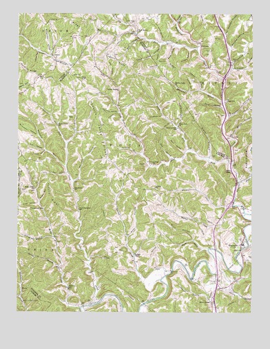
Sissonville, WV USGS Topographic Map
Click on map above to begin viewing in our Map Viewer.

This topographic map contains these locations and features:
Feature Name Type Latitude Longitude GNIS ID View Map
Albert E Humphreys Memorial CemeteryCemeteryN38.5300°W81.6290°2727527View Map
Albert E Humphreys Memorial CemeteryCemeteryN38.5301°W81.6296°1741835View Map
Albert E Humphreys Memorial ChurchChurchN38.5304°W81.6293°1741836View Map
Alec HollowValleyN38.5987°W81.7015°1534862View Map
Allen ForkStreamN38.5618°W81.6357°1534885View Map
Allens ChapelChurchN38.5931°W81.6968°1534890View Map
Asbury CemeteryCemeteryN38.5493°W81.6782°1535039View Map
Asbury CemeteryCemeteryN38.5817°W81.7207°1535040View Map
Asbury RidgeRidgeN38.5490°W81.7324°1535043View Map
Asbury School (historical)SchoolN38.5520°W81.6771°1535044View Map
Barn HollowValleyN38.5673°W81.6615°1535249View Map
Beane CemeteryCemeteryN38.5226°W81.6257°1535337View Map
Bells HollowValleyN38.6112°W81.6674°1535614View Map
Betty L School (historical)SchoolN38.5101°W81.7226°1535736View Map
Boggess CemeteryCemeteryN38.5615°W81.6823°1536189View Map
Boggess Family CemeteryCemeteryN38.6005°W81.6465°2586133View Map
Bonham ChapelChurchN38.5240°W81.6879°1536217View Map
Britton CemeteryCemeteryN38.5506°W81.7479°1536358View Map
Buck HollowValleyN38.5306°W81.6562°1536559View Map
Bumgardner HollowValleyN38.6076°W81.7329°1536719View Map
Cavelick RunStreamN38.5662°W81.6837°1537118View Map
Clark CemeteryCemeteryN38.5537°W81.7412°1537355View Map
Crank CemeteryCemeteryN38.5451°W81.6768°1537806View Map
Dan Slater HollowValleyN38.5784°W81.6649°1537978View Map
Dawson BranchStreamN38.5931°W81.6526°1538070View Map
Dawson CemeteryCemeteryN38.5379°W81.6257°1538072View Map
Derrick CreekStreamN38.5134°W81.6737°1538143View Map
Derrick Creek RidgeRidgeN38.5781°W81.7057°1538144View Map
Dog ForkStreamN38.6098°W81.6548°1538238View Map
Dry BranchStreamN38.5315°W81.7307°1538344View Map
Dudden ForkStreamN38.5976°W81.6398°1538404View Map
Duff CemeteryCemeteryN38.6148°W81.6460°1538408View Map
Edgewood Country Club Golf CourseLocaleN38.5153°W81.6765°2634077View Map
Ellison HollowValleyN38.5468°W81.7379°1538685View Map
Faber HollowValleyN38.5829°W81.6376°1538783View Map
Faber HollowValleyN38.6215°W81.6651°1538784View Map
First CreekStreamN38.5259°W81.6482°1538974View Map
Fisher CemeteryCemeteryN38.5126°W81.6421°1538987View Map
Fisher CemeteryCemeteryN38.6098°W81.6479°1538988View Map
Fisher Cemetery 1CemeteryN38.6017°W81.6321°2586294View Map
Fisher ChapelChurchN38.5593°W81.6362°1534763View Map
Fisher HollowValleyN38.6023°W81.6354°1538993View Map
Fisher KnobSummitN38.5979°W81.7168°1554457View Map
Fishers ChurchChurchN38.6051°W81.6351°1539003View Map
Frog CreekStreamN38.5029°W81.7099°1539273View Map
Frontz HollowValleyN38.5673°W81.7354°1539279View Map
Garden HollowValleyN38.5931°W81.6582°1539332View Map
Garnes HollowValleyN38.6115°W81.6365°1539340View Map
Glass HollowValleyN38.5451°W81.7393°1539451View Map
Glenn Mallett SpringSpringN38.5668°W81.7235°1678151View Map
GoldtownPopulated PlaceN38.6118°W81.6529°1539494View Map
Grapevine CreekStreamN38.5284°W81.6265°1539601View Map
Grasslick RunStreamN38.5606°W81.7243°1539623View Map
Grindstone HollowValleyN38.5818°W81.6732°1539758View Map
Guiding Light ChurchChurchN38.5954°W81.6668°1539781View Map
Haines CreekStreamN38.5445°W81.6351°1539844View Map
Harris CemeteryCemeteryN38.6048°W81.6754°1540006View Map
Harris RidgeRidgeN38.6040°W81.6726°1540014View Map
Hogpen RidgeRidgeN38.6056°W81.6974°1540367View Map
Interchange 114CrossingN38.5084°W81.6448°1741921View Map
Interchange 116CrossingN38.5451°W81.6373°1741922View Map
Interchange 119CrossingN38.5981°W81.6401°1559957View Map
Jeffers RidgeRidgeN38.6231°W81.7268°1540844View Map
Jim Lewis HollowValleyN38.6137°W81.6735°1540897View Map
Jim White HollowValleyN38.5740°W81.6357°1540901View Map
Joe Shamblen BranchStreamN38.6165°W81.6401°1540923View Map
Joes BranchStreamN38.5643°W81.6682°1540929View Map
John Bailey SpringSpringN38.6223°W81.7243°1678199View Map
Kelly CreekStreamN38.5018°W81.7162°1541137View Map
Kelly Creek ChurchChurchN38.5515°W81.7410°1541138View Map
Kelly Creek Church CemeteryCemeteryN38.5511°W81.7421°2727547View Map
Kirk HollowValleyN38.5681°W81.7362°1541238View Map
Koontz CemeteryCemeteryN38.6091°W81.6286°2586194View Map
LibertyPopulated PlaceN38.6051°W81.7299°1541812View Map
Liberty Post OfficePost OfficeN38.6054°W81.7296°1740736View Map
Liberty School (historical)SchoolN38.6065°W81.7299°1740735View Map
Lonesome Low School (historical)SchoolN38.5770°W81.6649°1542331View Map
Loom Tree HollowValleyN38.6118°W81.6740°1542444View Map
LoopPopulated PlaceN38.5734°W81.6357°1542451View Map
Middle ForkStreamN38.5545°W81.6323°1543169View Map
MillertownPopulated PlaceN38.5112°W81.6371°1741939View Map
Oak Grove ChurchChurchN38.5515°W81.7201°1544284View Map
Otis Bumgardner SpringSpringN38.6037°W81.7293°1678204View Map
Owl HollowValleyN38.5584°W81.7243°1544494View Map
Phillips HollowValleyN38.5545°W81.7196°1544785View Map
Pocatalico CreekStreamN38.5418°W81.6290°1545082View Map
Point Harmony School (historical)SchoolN38.5429°W81.7176°1545091View Map
Pringle HollowValleyN38.6095°W81.6582°1545275View Map
Pritt HollowValleyN38.5318°W81.6907°1545281View Map
Railroad HollowValleyN38.5840°W81.6965°1545384View Map
Rock Spring CemeteryCemeteryN38.6217°W81.6873°1545932View Map
Rock Spring ChurchChurchN38.6179°W81.6865°1545933View Map
Sayre HollowValleyN38.5856°W81.6407°1546473View Map
Sayre School (historical)SchoolN38.5884°W81.6387°1546474View Map
Second CreekStreamN38.5262°W81.6440°1546544View Map
Sillman HollowValleyN38.6087°W81.7393°1546779View Map
SissonvillePopulated PlaceN38.5281°W81.6310°1546843View Map
Sissonville Census Designated PlaceCensusN38.5042°W81.6398°2390302View Map
Sissonville Elementary SchoolSchoolN38.5290°W81.6298°1741993View Map
Sissonville Millertown Pocatalico and Guthrie Volunteer Fire Department Goff StationBuildingN38.5342°W81.6299°2578049View Map
Slater CemeteryCemeteryN38.5656°W81.6465°1546918View Map
Slater HollowValleyN38.5654°W81.6479°1546921View Map
Smith CemeteryCemeteryN38.5992°W81.7207°1546973View Map
Spencer BranchStreamN38.5054°W81.6471°1547126View Map
Spicewood BranchStreamN38.5876°W81.6401°1547144View Map
Spring BranchStreamN38.5104°W81.6448°1547181View Map
Spring BranchStreamN38.5190°W81.7274°1547182View Map
Sugar Grove School (historical)SchoolN38.5781°W81.7293°1547638View Map
Tanner ForkStreamN38.5701°W81.7243°1547894View Map
Trace ForkStreamN38.5670°W81.6579°1548216View Map
Trace Fork ChurchChurchN38.5779°W81.6646°1548236View Map
Tupper CreekStreamN38.5165°W81.6440°1548321View Map
Unexpected School (historical)SchoolN38.5431°W81.7365°1548461View Map
White ChapelPopulated PlaceN38.5034°W81.6460°1549025View Map
Wilkinson HollowValleyN38.5737°W81.7396°1549155View Map
WinterPopulated PlaceN38.5095°W81.7474°1556012View Map
Wolf HollowValleyN38.6145°W81.6851°1549278View Map

Note: Coordinates in the location and feature list above are referenced to NAD83 datum.


Copyright (C) 2008-2024 Ryan Niemi / Sunset Dynamics ... All Rights Reserved