TopoQuest Logo
Do you find TopoQuest useful?
Help keep TopoQuest running and adding new maps/features by donating!
Bitcoin:  19c7KJd3qBynnjoSw5npx9KScwjBe4ifkT
Litecoin:  LXs6TkuXGGXo1vDsWCkWVdjQX94eUKd6ui
Home View Maps Find Maps Find Places Resources & Links


Walton, West Virginia Topographic Map

USGS Map Title: Walton, WV
USGS Map MRC: 38081F4
DRG (GeoTIFF) Download: o38081f4.tif


Neighboring USGS Topographic Map Quads:


  Gay, WV  
38081G5
 

  Peniel, WV  
38081G4
 

  Spencer, WV  
38081G3
 

  Kentuck, WV  
38081F5
 

  Walton, WV  
38081F4
 

  Looneyville, WV  
38081F3
 

  Romance, WV  
38081E5
 

  Kettle, WV  
38081E4
 

  Clio, WV  
38081E3


Map MRC Location:

N39°
W82°
N39°
W81°
H8 H7 H6 H5 H4 H3 H2 H1
G8 G7 G6 G5 G4 G3 G2 G1
F8 F7 F6 F5 F4 F3 F2 F1
E8 E7 E6 E5 E4 E3 E2 E1
D8 D7 D6 D5 D4 D3 D2 D1
C8 C7 C6 C5 C4 C3 C2 C1
B8 B7 B6 B5 B4 B3 B2 B1
A8 A7 A6 A5 A4 A3 A2 A1
N38°
W82°
N38°
W81°

Walton, WV USGS 1:24K Topographic Map Preview:
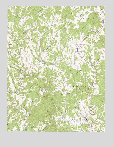
Walton, WV USGS Topographic Map
Click on map above to begin viewing in our Map Viewer.

This topographic map contains these locations and features:
Feature Name Type Latitude Longitude GNIS ID View Map
Bear ForkStreamN38.6934°W81.3946°1535360View Map
Bear HollowValleyN38.6587°W81.3960°1535373View Map
Beard HollowValleyN38.6379°W81.4440°1535410View Map
Bee RunStreamN38.6309°W81.4915°1535493View Map
Big CreekStreamN38.6387°W81.4298°1535820View Map
Big Creek School (historical)SchoolN38.6634°W81.4243°1535831View Map
Big Lick RunStreamN38.6573°W81.3937°1535886View Map
Big RunStreamN38.6806°W81.4793°1535911View Map
Boner HollowValleyN38.6545°W81.4260°1536214View Map
Buffalolick RunStreamN38.7318°W81.3771°1536663View Map
Cabbage ForkStreamN38.7040°W81.4568°1536819View Map
Caldwell BranchStreamN38.6251°W81.4587°1536856View Map
Canterbury CemeteryCemeteryN38.6251°W81.3837°1537018View Map
Carpenter BranchStreamN38.6604°W81.4560°1537049View Map
Cave ForkStreamN38.7254°W81.3898°1537110View Map
Chestnut PointCliffN38.6754°W81.4232°1537291View Map
Coon CreekStreamN38.7087°W81.4843°1537623View Map
Coon HollowValleyN38.6848°W81.4810°1740872View Map
Coon RunStreamN38.6848°W81.4807°1537635View Map
CountsvillePopulated PlaceN38.6934°W81.4407°1554200View Map
Cox ForkStreamN38.6862°W81.4785°1537759View Map
Crooked HollowValleyN38.6659°W81.4871°1537841View Map
Droddy CemeteryCemeteryN38.6376°W81.4051°1538324View Map
Droddy HollowValleyN38.6404°W81.4035°1538325View Map
Fishtrap HollowValleyN38.6331°W81.4479°1539011View Map
Flat ForkStreamN38.6309°W81.4723°1539046View Map
FlatforkPopulated PlaceN38.7076°W81.4965°1740882View Map
Flint TownPopulated PlaceN38.7493°W81.4976°1554476View Map
Gandee CemeteryCemeteryN38.6929°W81.4726°1539320View Map
GandeevillePopulated PlaceN38.7051°W81.4104°1539324View Map
Gandeeville - Harmony Volunteer Fire DepartmentBuildingN38.7078°W81.4090°2577689View Map
Gandeeville CemeteryCemeteryN38.7117°W81.4101°1539325View Map
Gandeeville Community ChurchChurchN38.7081°W81.4098°1740886View Map
Gandeeville Post OfficePost OfficeN38.7050°W81.4107°1740887View Map
GenevaPopulated PlaceN38.7390°W81.4893°1740889View Map
Givens HollowValleyN38.6634°W81.3987°1539418View Map
Gooseneck BendBendN38.6284°W81.4704°1539528View Map
Hanna RunStreamN38.7245°W81.4521°1740898View Map
HarmonyPopulated PlaceN38.6862°W81.4790°1539975View Map
Harmony Baptist ChurchChurchN38.6854°W81.4787°1740900View Map
Harmony Post OfficePost OfficeN38.6854°W81.4793°1740901View Map
Hebron ChurchChurchN38.7451°W81.3793°1540114View Map
Higby RunStreamN38.6573°W81.4907°1540237View Map
Huckleberry KnobSummitN38.6498°W81.4146°1554752View Map
Jesse ForkStreamN38.7456°W81.3760°1540885View Map
Jingo (historical)Populated PlaceN38.7243°W81.4785°1740916View Map
Johnson CreekStreamN38.6481°W81.3915°1540977View Map
Jones HollowValleyN38.6751°W81.3985°1541013View Map
Jones Mill (historical)LocaleN38.6523°W81.3946°1740918View Map
Kee RidgeRidgeN38.6698°W81.4635°1541096View Map
Kiser HollowValleyN38.6687°W81.4493°1541247View Map
Lee HollowValleyN38.6626°W81.4260°1541607View Map
Lee KnobSummitN38.6623°W81.4323°1554936View Map
Leo (historical)Populated PlaceN38.7443°W81.4171°1740933View Map
Looney CemeteryCemeteryN38.6501°W81.3910°1542446View Map
McKown CreekStreamN38.6326°W81.3985°1543028View Map
Missouri ForkStreamN38.7429°W81.3785°1543459View Map
Mount Hermon ChurchChurchN38.7359°W81.4923°1543652View Map
Mount Lebanon ChurchChurchN38.7265°W81.4671°1543666View Map
Panther RunStreamN38.6359°W81.4196°1544560View Map
Patsey (historical)Populated PlaceN38.6773°W81.4229°1740967View Map
Pigeon Roost RunStreamN38.6993°W81.4579°1544815View Map
Pleasant Valley ChurchChurchN38.7048°W81.4548°1545026View Map
Raines RidgeRidgeN38.6684°W81.4404°1545386View Map
Reedy BranchStreamN38.6737°W81.4246°1545490View Map
Rock CreekStreamN38.6265°W81.4554°1545903View Map
Rock Lick BranchStreamN38.6640°W81.4543°1545917View Map
RyanPopulated PlaceN38.6426°W81.4729°1555547View Map
Ryan ChapelChurchN38.6370°W81.4746°1546204View Map
Sam Shafer HollowValleyN38.6420°W81.4287°1546321View Map
Scale HollowValleyN38.6520°W81.4657°1546478View Map
Shadydale CemeteryCemeteryN38.7089°W81.4963°2586159View Map
Shadydale ChurchChurchN38.7106°W81.4979°1546599View Map
Silcott ForkStreamN38.6698°W81.3935°1546775View Map
Snake HollowValleyN38.6340°W81.3935°1547021View Map
Snyder HollowValleyN38.6645°W81.3979°1547046View Map
SpeedPopulated PlaceN38.7337°W81.3776°1555680View Map
Speed United Methodist ChurchChurchN38.7329°W81.3771°1741003View Map
Sugar Camp HollowValleyN38.6359°W81.4993°1547625View Map
Sugar RunStreamN38.7387°W81.3796°1547641View Map
Swallow BranchStreamN38.6573°W81.4576°1547786View Map
Sycamore BranchStreamN38.6356°W81.4065°1547820View Map
Trace ForkStreamN38.6420°W81.4723°1548218View Map
WaltonPopulated PlaceN38.6390°W81.4021°1555914View Map
Walton Elementary - Middle SchoolSchoolN38.6337°W81.4003°2088396View Map
Walton Junior-Senior High School (historical)SchoolN38.6373°W81.3987°1741034View Map
Walton Post OfficePost OfficeN38.6388°W81.4032°1741035View Map
Walton Public LibraryBuildingN38.6379°W81.4013°2727380View Map
Walton RidgeRidgeN38.6743°W81.4157°1548777View Map
Walton Volunteer Fire DepartmentBuildingN38.6369°W81.4004°2577749View Map
Western District (historical)CivilN38.6801°W81.4448°1928415View Map
White HollowValleyN38.6518°W81.3779°1549030View Map
Whited CemeteryCemeteryN38.6765°W81.4157°1549082View Map
Whited HollowValleyN38.6409°W81.4007°1549083View Map
Wolf RunStreamN38.6893°W81.3887°1549284View Map
Wolfcamp RunStreamN38.6993°W81.4835°1549303View Map
Wolfpen RunStreamN38.7093°W81.4468°1549337View Map
Woodyard (historical)Populated PlaceN38.6684°W81.4804°1741042View Map
ZonaPopulated PlaceN38.7220°W81.4557°1550002View Map
Zona School (historical)SchoolN38.7304°W81.4448°1549506View Map

Note: Coordinates in the location and feature list above are referenced to NAD83 datum.


Copyright (C) 2008-2024 Ryan Niemi / Sunset Dynamics ... All Rights Reserved