TopoQuest Logo
Do you find TopoQuest useful?
Help keep TopoQuest running and adding new maps/features by donating!
Bitcoin:  19c7KJd3qBynnjoSw5npx9KScwjBe4ifkT
Litecoin:  LXs6TkuXGGXo1vDsWCkWVdjQX94eUKd6ui
Home View Maps Find Maps Find Places Resources & Links


Big Springs, Arizona Topographic Map

USGS Map Title: Big Springs, AZ
USGS Map MRC: 36112E3
DRG (GeoTIFF) Download: o36112e3.tif


Neighboring USGS Topographic Map Quads:


  Toothpick Ridge, AZ  
36112F4
 

  Warm Springs Canyon, AZ  
36112F3
 

  Jacob Lake, AZ  
36112F2
 

  Sowats Spring, AZ  
36112E4
 

  Big Springs, AZ  
36112E3
 

  Telephone Hill, AZ  
36112E2
 

  Tapeats Amphitheater, AZ  
36112D4
 

  Timp Point, AZ  
36112D3
 

  De Motte Park, AZ  
36112D2


Map MRC Location:

N37°
W113°
N37°
W112°
H8 H7 H6 H5 H4 H3 H2 H1
G8 G7 G6 G5 G4 G3 G2 G1
F8 F7 F6 F5 F4 F3 F2 F1
E8 E7 E6 E5 E4 E3 E2 E1
D8 D7 D6 D5 D4 D3 D2 D1
C8 C7 C6 C5 C4 C3 C2 C1
B8 B7 B6 B5 B4 B3 B2 B1
A8 A7 A6 A5 A4 A3 A2 A1
N36°
W113°
N36°
W112°

Big Springs, AZ USGS 1:24K Topographic Map Preview:
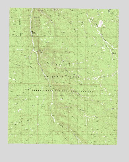
Big Springs, AZ USGS Topographic Map
Click on map above to begin viewing in our Map Viewer.

This topographic map contains these locations and features:
Feature Name Type Latitude Longitude GNIS ID View Map
Big SpringsPopulated PlaceN36.6017°W112.3499°1379View Map
Big Springs PointCliffN36.6128°W112.3393°1381View Map
Big Springs Ranger StationLocaleN36.6011°W112.3482°20656View Map
Castle CanyonValleyN36.5853°W112.3432°2524View Map
Castle PointCliffN36.5753°W112.3327°2538View Map
Castle SpringSpringN36.5862°W112.3415°37701View Map
Corral LakeLakeN36.6178°W112.2504°3291View Map
Cross Over TankReservoirN36.5853°W112.2728°2091828View Map
Little MountainSummitN36.6214°W112.3655°7151View Map
Lookout CanyonValleyN36.5855°W112.3474°7362View Map
Lost CanyonValleyN36.5369°W112.3252°7397View Map
Lost PointCliffN36.5300°W112.3163°7411View Map
Lower Moquitch TankReservoirN36.6120°W112.2913°44670View Map
Mangum CampLocaleN36.6203°W112.3374°7648View Map
Mangum SpringsSpringN36.6228°W112.3394°2364051View Map
Morning Dove SpringSpringN36.6164°W112.3479°8308View Map
North Fork Castle CanyonValleyN36.5847°W112.3374°8721View Map
Oquer CanyonValleyN36.5530°W112.3263°9000View Map
Oquer PointCliffN36.5442°W112.3171°9002View Map
Oquer TankReservoirN36.5314°W112.2847°2091831View Map
Pratt CanyonValleyN36.5169°W112.3196°33184View Map
Pressure TankReservoirN36.5858°W112.3608°2091827View Map
Riggs CanyonValleyN36.5603°W112.3302°10258View Map
Riggs PointCliffN36.5564°W112.3224°10267View Map
Riggs SpringSpringN36.5621°W112.3268°10271View Map
Sawmill TankReservoirN36.5576°W112.3689°44689View Map
South Fork Castle CanyonValleyN36.5847°W112.3374°11592View Map
Sowats Gravel PitBasinN36.5589°W112.3689°2091830View Map
Upper Moquitch TankReservoirN36.5850°W112.2581°2091829View Map
Willie ApronReservoirN36.5914°W112.3081°2092054View Map

Note: Coordinates in the location and feature list above are referenced to NAD83 datum.


Copyright (C) 2008-2025 Ryan Niemi / Sunset Dynamics ... All Rights Reserved