TopoQuest Logo
Do you find TopoQuest useful?
Help keep TopoQuest running and adding new maps/features by donating!
Bitcoin:  19c7KJd3qBynnjoSw5npx9KScwjBe4ifkT
Litecoin:  LXs6TkuXGGXo1vDsWCkWVdjQX94eUKd6ui
Home View Maps Find Maps Find Places Resources & Links


Sowats Spring, Arizona Topographic Map

USGS Map Title: Sowats Spring, AZ
USGS Map MRC: 36112E4
DRG (GeoTIFF) Download: o36112e4.tif


Neighboring USGS Topographic Map Quads:


  Gunsight Point, AZ  
36112F5
 

  Toothpick Ridge, AZ  
36112F4
 

  Warm Springs Canyon, AZ  
36112F3
 

  Jumpup Point, AZ  
36112E5
 

  Sowats Spring, AZ  
36112E4
 

  Big Springs, AZ  
36112E3
 

  Fishtail Mesa, AZ  
36112D5
 

  Tapeats Amphitheater, AZ  
36112D4
 

  Timp Point, AZ  
36112D3


Map MRC Location:

N37°
W113°
N37°
W112°
H8 H7 H6 H5 H4 H3 H2 H1
G8 G7 G6 G5 G4 G3 G2 G1
F8 F7 F6 F5 F4 F3 F2 F1
E8 E7 E6 E5 E4 E3 E2 E1
D8 D7 D6 D5 D4 D3 D2 D1
C8 C7 C6 C5 C4 C3 C2 C1
B8 B7 B6 B5 B4 B3 B2 B1
A8 A7 A6 A5 A4 A3 A2 A1
N36°
W113°
N36°
W112°

Sowats Spring, AZ USGS 1:24K Topographic Map Preview:
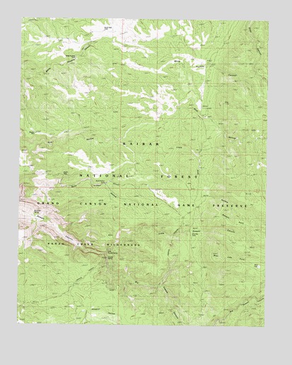
Sowats Spring, AZ USGS Topographic Map
Click on map above to begin viewing in our Map Viewer.

This topographic map contains these locations and features:
Feature Name Type Latitude Longitude GNIS ID View Map
Big Sowats CanyonValleyN36.5288°W112.4566°1366View Map
Bone Hollow TankReservoirN36.5579°W112.4572°1799View Map
Box Elder SpringSpringN36.5457°W112.4930°1909View Map
Eagle PassGapN36.5614°W112.4794°4241View Map
Little Pine HollowValleyN36.5747°W112.4519°7156View Map
Little Sowats CanyonValleyN36.5300°W112.4552°7188View Map
Little Sowats SpringSpringN36.5294°W112.4585°7189View Map
Pine Flat CampLocaleN36.5375°W112.4149°9458View Map
Pine Flat TankReservoirN36.5376°W112.4133°44687View Map
Pine Hollow TankReservoirN36.5744°W112.4544°2091825View Map
Pine Hollow Trick TankReservoirN36.5858°W112.4102°20957View Map
Ranger PassGapN36.5778°W112.4907°33373View Map
Ranger Pass Trick TankReservoirN36.5875°W112.4924°20973View Map
Sawmill PointCliffN36.5464°W112.3999°10982View Map
South Side TankReservoirN36.6203°W112.4585°44690View Map
Sowats SpringSpringN36.5274°W112.4554°11658View Map
Sowats TankReservoirN36.5008°W112.4664°2091826View Map
West LakeLakeN36.5245°W112.3792°13507View Map
West Lake PointCliffN36.5308°W112.4032°13508View Map
White Pockets TankReservoirN36.6087°W112.4732°44706View Map

Note: Coordinates in the location and feature list above are referenced to NAD83 datum.


Copyright (C) 2008-2025 Ryan Niemi / Sunset Dynamics ... All Rights Reserved