TopoQuest Logo
Do you find TopoQuest useful?
Help keep TopoQuest running and adding new maps/features by donating!
Bitcoin:  19c7KJd3qBynnjoSw5npx9KScwjBe4ifkT
Litecoin:  LXs6TkuXGGXo1vDsWCkWVdjQX94eUKd6ui
Home View Maps Find Maps Find Places Resources & Links


Root Creek, Wyoming Topographic Map

USGS Map Title: Root Creek, WY
USGS Map MRC: 42105F7
DRG (GeoTIFF) Download: o42105f7.tif


Neighboring USGS Topographic Map Quads:


  Parkerton, WY  
42105G8
 

  Glenrock, WY  
42105G7
 

  Careyhurst, WY  
42105G6
 

  Protsmans Knob, WY  
42105F8
 

  Root Creek, WY  
42105F7
 

  Hermit Rock, WY  
42105F6
 

  Buck Peak, WY  
42105E8
 

  Buffalo Peak, WY  
42105E7
 

  Blue Nose Creek, WY  
42105E6


Map MRC Location:

N43°
W106°
N43°
W105°
H8 H7 H6 H5 H4 H3 H2 H1
G8 G7 G6 G5 G4 G3 G2 G1
F8 F7 F6 F5 F4 F3 F2 F1
E8 E7 E6 E5 E4 E3 E2 E1
D8 D7 D6 D5 D4 D3 D2 D1
C8 C7 C6 C5 C4 C3 C2 C1
B8 B7 B6 B5 B4 B3 B2 B1
A8 A7 A6 A5 A4 A3 A2 A1
N42°
W106°
N42°
W105°

Root Creek, WY USGS 1:24K Topographic Map Preview:
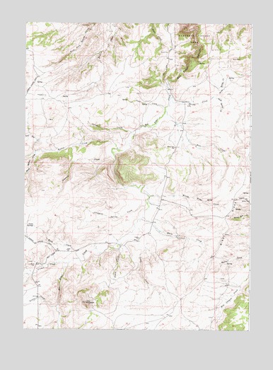
Root Creek, WY USGS Topographic Map
Click on map above to begin viewing in our Map Viewer.

This topographic map contains these locations and features:
Feature Name Type Latitude Longitude GNIS ID View Map
Badger ProspectMineN42.7147°W105.8606°1746901View Map
Beach ProspectMineN42.6911°W105.8403°1746902View Map
Beerman CreekStreamN42.6972°W105.8267°1590156View Map
Camp CreekStreamN42.6669°W105.8139°1586301View Map
Chas Smyth DamDamN42.6800°W105.8006°1606166View Map
Chas Smyth ReservoirReservoirN42.6800°W105.8006°1606167View Map
Converse County ParkParkN42.7433°W105.7844°1586941View Map
Count CreekStreamN42.7152°W105.7981°1587087View Map
Grant CemeteryCemeteryN42.6509°W105.8693°1589049View Map
Grant CreekStreamN42.6344°W105.8564°1589052View Map
Grant SchoolSchoolN42.6572°W105.8517°1589056View Map
Grant SpringsSpringN42.6672°W105.8697°1589059View Map
Gross CreekStreamN42.6969°W105.8692°1594752View Map
Howard HillSlopeN42.6789°W105.7531°1589775View Map
Indian CreekStreamN42.7047°W105.8144°1589876View Map
Jasper MineMineN42.7294°W105.8611°1746903View Map
Lacy MountainSummitN42.6361°W105.8408°1590451View Map
Lindgren Spring CreekStreamN42.6764°W105.8075°1590705View Map
Lone Tree CreekStreamN42.6977°W105.8692°1590944View Map
North Spring CreekStreamN42.7200°W105.7714°1592280View Map
Root CreekStreamN42.7139°W105.7972°1593642View Map
School CreekStreamN42.6589°W105.8222°1594001View Map
Smith DepositMineN42.7292°W105.8608°1746904View Map
South Spring CreekStreamN42.7200°W105.7711°1594738View Map
Spring CreekStreamN42.7200°W105.7936°1594836View Map
Stardust ClaimMineN42.7294°W105.8606°1746905View Map
Virden CreekStreamN42.6519°W105.8506°1595940View Map
White CreekStreamN42.6708°W105.8097°1596300View Map
Willow CreekStreamN42.6983°W105.8236°1596443View Map
Willow Dell SchoolSchoolN42.6994°W105.7919°1596456View Map
Windy RidgeRidgeN42.6847°W105.7542°1591042View Map
Windy Ridge CreekStreamN42.6791°W105.8061°1596545View Map
Wood CreekStreamN42.6539°W105.8447°1596595View Map

Note: Coordinates in the location and feature list above are referenced to NAD83 datum.


Copyright (C) 2008-2025 Ryan Niemi / Sunset Dynamics ... All Rights Reserved