TopoQuest Logo
Do you find TopoQuest useful?
Help keep TopoQuest running and adding new maps/features by donating!
Bitcoin:  19c7KJd3qBynnjoSw5npx9KScwjBe4ifkT
Litecoin:  LXs6TkuXGGXo1vDsWCkWVdjQX94eUKd6ui
Home View Maps Find Maps Find Places Resources & Links


Blue Nose Creek, Wyoming Topographic Map

USGS Map Title: Blue Nose Creek, WY
USGS Map MRC: 42105E6
DRG (GeoTIFF) Download: o42105e6.tif


Neighboring USGS Topographic Map Quads:


  Root Creek, WY  
42105F7
 

  Hermit Rock, WY  
42105F6
 

  La Prele Reservoir, WY  
42105F5
 

  Buffalo Peak, WY  
42105E7
 

  Blue Nose Creek, WY  
42105E6
 

  Maneater Creek, WY  
42105E5
 

  Warbonnett Peak, WY  
42105D7
 

  School Section Mountain, WY  
42105D6
 

  Saddleback Mountain, WY  
42105D5


Map MRC Location:

N43°
W106°
N43°
W105°
H8 H7 H6 H5 H4 H3 H2 H1
G8 G7 G6 G5 G4 G3 G2 G1
F8 F7 F6 F5 F4 F3 F2 F1
E8 E7 E6 E5 E4 E3 E2 E1
D8 D7 D6 D5 D4 D3 D2 D1
C8 C7 C6 C5 C4 C3 C2 C1
B8 B7 B6 B5 B4 B3 B2 B1
A8 A7 A6 A5 A4 A3 A2 A1
N42°
W106°
N42°
W105°

Blue Nose Creek, WY USGS 1:24K Topographic Map Preview:
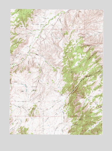
Blue Nose Creek, WY USGS Topographic Map
Click on map above to begin viewing in our Map Viewer.

This topographic map contains these locations and features:
Feature Name Type Latitude Longitude GNIS ID View Map
Badger CreekStreamN42.5275°W105.7394°1585026View Map
Baldy PointSummitN42.5280°W105.6289°1585081View Map
Beaulieu LakesLakeN42.5465°W105.7276°1585297View Map
Blue Nose CreekStreamN42.5794°W105.7233°1585689View Map
Buckhorn CreekStreamN42.5147°W105.7383°1598451View Map
Cache CreekStreamN42.5155°W105.7408°1586260View Map
Caffee PointSummitN42.5430°W105.7344°1586271View Map
Carbo DrawValleyN42.5500°W105.7472°1586360View Map
Chamberlain PlaceLocaleN42.5791°W105.7100°1597255View Map
Cow CreekStreamN42.6144°W105.6967°2635336View Map
Curtis CreekStreamN42.6039°W105.7061°1587299View Map
Dry Fork La Prele CreekStreamN42.5702°W105.7439°1587840View Map
Gata Number 2 ReservoirReservoirN42.5439°W105.7194°1605281View Map
Hay Press MeadowsFlatN42.5347°W105.6483°1589414View Map
Jackson CreekStreamN42.5127°W105.6772°1600575View Map
Lambe Ditch Number 1CanalN42.5925°W105.7183°1605329View Map
Little La Prele CreekStreamN42.5824°W105.7248°2635337View Map
Long ReservoirReservoirN42.5472°W105.7192°1590997View Map
Meadow CreekStreamN42.6002°W105.7103°1591422View Map
Moses ParkLocaleN42.5900°W105.6608°1591782View Map
Moss Agate SchoolSchoolN42.6091°W105.6897°1591794View Map
North Curtis CreekStreamN42.6080°W105.7019°1592134View Map
Orville DrawValleyN42.5230°W105.6803°1592483View Map
Perry CreekStreamN42.5789°W105.7261°1592676View Map
Point of RocksSummitN42.5216°W105.7194°1592895View Map
Point of Rocks CreekStreamN42.5361°W105.6756°1592896View Map
Red Fern CreekStreamN42.5994°W105.7178°1593285View Map
Redenbaugh PassGapN42.5164°W105.6567°1593356View Map
Spracklin BranchStreamN42.6197°W105.6836°1594802View Map
Spring CreekStreamN42.5775°W105.7275°1594833View Map
Virden PassGapN42.5630°W105.6686°1595941View Map
Wagon Hound FallsFallsN42.5587°W105.6486°1595971View Map
Wolf CreekStreamN42.6158°W105.6917°1596574View Map

Note: Coordinates in the location and feature list above are referenced to NAD83 datum.


Copyright (C) 2008-2024 Ryan Niemi / Sunset Dynamics ... All Rights Reserved