TopoQuest Logo
Do you find TopoQuest useful?
Help keep TopoQuest running and adding new maps/features by donating!
Bitcoin:  19c7KJd3qBynnjoSw5npx9KScwjBe4ifkT
Litecoin:  LXs6TkuXGGXo1vDsWCkWVdjQX94eUKd6ui
Home View Maps Find Maps Find Places Resources & Links


Hermit Rock, Wyoming Topographic Map

USGS Map Title: Hermit Rock, WY
USGS Map MRC: 42105F6
DRG (GeoTIFF) Download: o42105f6.tif


Neighboring USGS Topographic Map Quads:


  Glenrock, WY  
42105G7
 

  Careyhurst, WY  
42105G6
 

  Orpha, WY  
42105G5
 

  Root Creek, WY  
42105F7
 

  Hermit Rock, WY  
42105F6
 

  La Prele Reservoir, WY  
42105F5
 

  Buffalo Peak, WY  
42105E7
 

  Blue Nose Creek, WY  
42105E6
 

  Maneater Creek, WY  
42105E5


Map MRC Location:

N43°
W106°
N43°
W105°
H8 H7 H6 H5 H4 H3 H2 H1
G8 G7 G6 G5 G4 G3 G2 G1
F8 F7 F6 F5 F4 F3 F2 F1
E8 E7 E6 E5 E4 E3 E2 E1
D8 D7 D6 D5 D4 D3 D2 D1
C8 C7 C6 C5 C4 C3 C2 C1
B8 B7 B6 B5 B4 B3 B2 B1
A8 A7 A6 A5 A4 A3 A2 A1
N42°
W106°
N42°
W105°

Hermit Rock, WY USGS 1:24K Topographic Map Preview:
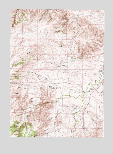
Hermit Rock, WY USGS Topographic Map
Click on map above to begin viewing in our Map Viewer.

This topographic map contains these locations and features:
Feature Name Type Latitude Longitude GNIS ID View Map
Beaver CreekStreamN42.6689°W105.6511°1585306View Map
Beaver SchoolSchoolN42.6702°W105.6528°1585331View Map
Boulder CreekStreamN42.6400°W105.7306°1585803View Map
Cottonwood Creek ProspectMineN42.7069°W105.6333°1746899View Map
Crazy Horse CreekStreamN42.6314°W105.6678°1587200View Map
Crazy Horse DitchCanalN42.6736°W105.6397°1587201View Map
Cross DrawValleyN42.6630°W105.6367°1587256View Map
Dead Man CrossingCrossingN42.6944°W105.6833°1597281View Map
Deadwood CreekStreamN42.6861°W105.6303°1587447View Map
Dogie DrawValleyN42.6775°W105.6958°1587690View Map
Elsie DamDamN42.6533°W105.6306°1608112View Map
Elsie ReservoirReservoirN42.6535°W105.6306°1608113View Map
Granite CreekStreamN42.6494°W105.7242°1589034View Map
Hart DrawValleyN42.6747°W105.6439°1589346View Map
Hatterman HillSummitN42.6375°W105.7158°1589378View Map
Hermit RockSummitN42.6672°W105.7425°1589492View Map
Hermit Rock CreekStreamN42.6733°W105.7097°1589493View Map
Hermit Rock Valley DitchCanalN42.6455°W105.6647°1589494View Map
Howard SpringSpringN42.6741°W105.6942°1589778View Map
Le Vasseur FallsFallsN42.6519°W105.7322°1590607View Map
Le Vasseur RanchLocaleN42.6533°W105.7211°1590608View Map
Moss Agate CreekStreamN42.6497°W105.6628°1591788View Map
Moss Agate HillSummitN42.6405°W105.6847°1591790View Map
Olin Brothers Property MineMineN42.6708°W105.7361°1746900View Map
Park DrawValleyN42.6494°W105.6608°1592579View Map
Rattlesnake CreekStreamN42.6325°W105.6672°1593188View Map
Red CanyonValleyN42.6580°W105.6947°1593252View Map
Red Canyon CreekStreamN42.6686°W105.6508°1593258View Map
Rice SpringSpringN42.6733°W105.6906°1593424View Map
Robert Curtis DamDamN42.6283°W105.6989°1606013View Map
Robert Curtis ReservoirReservoirN42.6283°W105.6989°1606014View Map
Round HillSummitN42.6594°W105.7228°1593668View Map
Sand CreekStreamN42.6550°W105.6542°1593831View Map
Sawmill CreekStreamN42.6522°W105.7219°1593963View Map
Semino CreekStreamN42.6769°W105.6408°1594094View Map
Spring Canyon CreekStreamN42.7416°W105.6603°1596711View Map
Station CreekStreamN42.6539°W105.6575°1594993View Map
William A Cross Ranch MineMineN42.7133°W105.6644°1746898View Map

Note: Coordinates in the location and feature list above are referenced to NAD83 datum.


Copyright (C) 2008-2024 Ryan Niemi / Sunset Dynamics ... All Rights Reserved