TopoQuest Logo
Do you find TopoQuest useful?
Help keep TopoQuest running and adding new maps/features by donating!
Bitcoin:  19c7KJd3qBynnjoSw5npx9KScwjBe4ifkT
Litecoin:  LXs6TkuXGGXo1vDsWCkWVdjQX94eUKd6ui
Home View Maps Find Maps Find Places Resources & Links


Roseville, Illinois Topographic Map

USGS Map Title: Roseville, IL
USGS Map MRC: 40090F6
DRG (GeoTIFF) Download: o40090f6.tif


Neighboring USGS Topographic Map Quads:


  Kirkwood West, IL  
40090G7
 

  Kirkwood East, IL  
40090G6
 

  Berwick, IL  
40090G5
 

  Raritan, IL  
40090F7
 

  Roseville, IL  
40090F6
 

  Greenbush, IL  
40090F5
 

  Blandinsville, IL  
40090E7
 

  Good Hope, IL  
40090E6
 

  Bushnell West, IL  
40090E5


Map MRC Location:

N41°
W91°
N41°
W90°
H8 H7 H6 H5 H4 H3 H2 H1
G8 G7 G6 G5 G4 G3 G2 G1
F8 F7 F6 F5 F4 F3 F2 F1
E8 E7 E6 E5 E4 E3 E2 E1
D8 D7 D6 D5 D4 D3 D2 D1
C8 C7 C6 C5 C4 C3 C2 C1
B8 B7 B6 B5 B4 B3 B2 B1
A8 A7 A6 A5 A4 A3 A2 A1
N40°
W91°
N40°
W90°

Roseville, IL USGS 1:24K Topographic Map Preview:
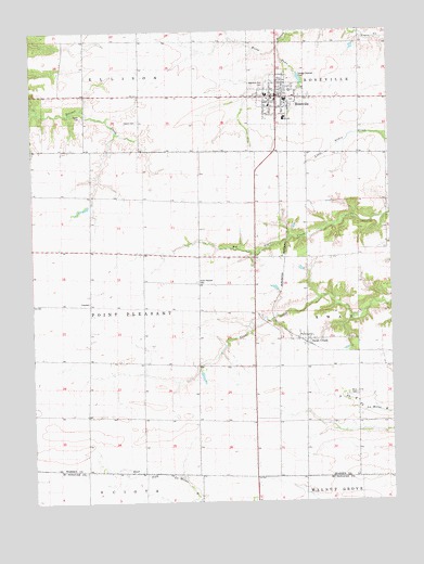
Roseville, IL USGS Topographic Map
Click on map above to begin viewing in our Map Viewer.

This topographic map contains these locations and features:
Feature Name Type Latitude Longitude GNIS ID View Map
Asbury CemeteryCemeteryN40.7262°W90.7127°403649View Map
Barker School (historical)SchoolN40.6464°W90.6926°1719278View Map
Center School (historical)SchoolN40.6781°W90.7304°1719279View Map
Chattanooga School (historical)SchoolN40.7073°W90.7290°1719281View Map
Colfax Post Office (historical)Post OfficeN40.6481°W90.7307°1823690View Map
Colfax School (historical)SchoolN40.6484°W90.7315°1719284View Map
Davis School (historical)SchoolN40.6762°W90.6926°1719287View Map
Earp Airport (historical)AirportN40.7408°W90.6651°427770View Map
Gilliam School (historical)SchoolN40.7039°W90.6537°1719291View Map
Mud College (historical)SchoolN40.7078°W90.6912°1719308View Map
Point Pleasant CemeteryCemeteryN40.6834°W90.6929°415975View Map
Point Pleasant TownhallBuildingN40.6781°W90.7304°1719313View Map
Raburn School (historical)SchoolN40.7325°W90.6926°1719314View Map
RosevillePopulated PlaceN40.7323°W90.6646°416966View Map
Roseville Area Ambulance ServiceBuildingN40.7320°W90.6616°2673882View Map
Roseville Elementary SchoolSchoolN40.7328°W90.6676°1823732View Map
Roseville Fire DepartmentBuildingN40.7320°W90.6616°2640357View Map
Roseville High SchoolSchoolN40.7270°W90.6615°1823733View Map
Roseville Memorial CemeteryCemeteryN40.7350°W90.6696°413389View Map
Roseville Post OfficePost OfficeN40.7329°W90.6632°2788859View Map
Salem CemeteryCemeteryN40.7275°W90.7324°417860View Map
Salem School (historical)SchoolN40.7345°W90.7315°1719316View Map
Sisson School (historical)SchoolN40.6462°W90.6549°1719319View Map
Stem School (historical)SchoolN40.7323°W90.6360°1719321View Map
Stice CemeteryCemeteryN40.6535°W90.6375°419133View Map
Swan CreekPopulated PlaceN40.6678°W90.6549°419451View Map
Swan Creek Post Office (historical)Post OfficeN40.6681°W90.6540°1823738View Map
Town BranchStreamN40.7456°W90.6635°424168View Map
Township of Point PleasantCivilN40.6762°W90.7308°429585View Map
Village of RosevilleCivilN40.7308°W90.6639°2399125View Map

Note: Coordinates in the location and feature list above are referenced to NAD83 datum.


Copyright (C) 2008-2025 Ryan Niemi / Sunset Dynamics ... All Rights Reserved