TopoQuest Logo
Do you find TopoQuest useful?
Help keep TopoQuest running and adding new maps/features by donating!
Bitcoin:  19c7KJd3qBynnjoSw5npx9KScwjBe4ifkT
Litecoin:  LXs6TkuXGGXo1vDsWCkWVdjQX94eUKd6ui
Home View Maps Find Maps Find Places Resources & Links


Kirkwood East, Illinois Topographic Map

USGS Map Title: Kirkwood East, IL
USGS Map MRC: 40090G6
DRG (GeoTIFF) Download: o40090g6.tif


Neighboring USGS Topographic Map Quads:


  Rozetta, IL  
40090H7
 

  Monmouth, IL  
40090H6
 

  Cameron, IL  
40090H5
 

  Kirkwood West, IL  
40090G7
 

  Kirkwood East, IL  
40090G6
 

  Berwick, IL  
40090G5
 

  Raritan, IL  
40090F7
 

  Roseville, IL  
40090F6
 

  Greenbush, IL  
40090F5


Map MRC Location:

N41°
W91°
N41°
W90°
H8 H7 H6 H5 H4 H3 H2 H1
G8 G7 G6 G5 G4 G3 G2 G1
F8 F7 F6 F5 F4 F3 F2 F1
E8 E7 E6 E5 E4 E3 E2 E1
D8 D7 D6 D5 D4 D3 D2 D1
C8 C7 C6 C5 C4 C3 C2 C1
B8 B7 B6 B5 B4 B3 B2 B1
A8 A7 A6 A5 A4 A3 A2 A1
N40°
W91°
N40°
W90°

Kirkwood East, IL USGS 1:24K Topographic Map Preview:
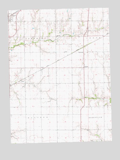
Kirkwood East, IL USGS Topographic Map
Click on map above to begin viewing in our Map Viewer.

This topographic map contains these locations and features:
Feature Name Type Latitude Longitude GNIS ID View Map
Center School (historical)SchoolN40.7620°W90.7301°405824View Map
Central Warren Fire Protection DistrictBuildingN40.8646°W90.7462°2640250View Map
Coonville School (historical)SchoolN40.8645°W90.6849°406547View Map
County Farm CemeteryCemeteryN40.8338°W90.6579°1719285View Map
Empire School (historical)SchoolN40.7909°W90.6935°408020View Map
Hickory Point CemeteryCemeteryN40.8495°W90.6909°1719296View Map
Hickory Point School (historical)SchoolN40.8478°W90.6918°410177View Map
KirkwoodPopulated PlaceN40.8659°W90.7485°411550View Map
LarchlandPopulated PlaceN40.8200°W90.6529°411831View Map
Liberty School (historical)SchoolN40.8206°W90.6926°412031View Map
Locust Grove School (historical)SchoolN40.8642°W90.7204°412495View Map
McCurdy School (historical)SchoolN40.7620°W90.6546°413242View Map
Meridian School (historical)SchoolN40.7909°W90.7312°413428View Map
New Lancaster (historical)Populated PlaceN40.7550°W90.7310°1823727View Map
Nichols School (historical)SchoolN40.8200°W90.7307°414513View Map
Picayune School (historical)SchoolN40.7900°W90.6568°415630View Map
PonemahPopulated PlaceN40.8206°W90.7057°416006View Map
South Henderson School (historical)SchoolN40.8492°W90.6518°418785View Map
Township of EllisonCivilN40.7624°W90.7311°428957View Map
Township of TompkinsCivilN40.8497°W90.7301°429836View Map
Tubbs School (historical)SchoolN40.8498°W90.7307°419907View Map
Village of KirkwoodCivilN40.8677°W90.7486°2398362View Map
Ward School (historical)SchoolN40.7614°W90.6937°420526View Map
Warren County Farm (historical)LocaleN40.8323°W90.6568°1719329View Map

Note: Coordinates in the location and feature list above are referenced to NAD83 datum.


Copyright (C) 2008-2025 Ryan Niemi / Sunset Dynamics ... All Rights Reserved