TopoQuest Logo
Do you find TopoQuest useful?
Help keep TopoQuest running and adding new maps/features by donating!
Bitcoin:  19c7KJd3qBynnjoSw5npx9KScwjBe4ifkT
Litecoin:  LXs6TkuXGGXo1vDsWCkWVdjQX94eUKd6ui
Home View Maps Find Maps Find Places Resources & Links


Rosine, Kentucky Topographic Map

USGS Map Title: Rosine, KY
USGS Map MRC: 37086D6
DRG (GeoTIFF) Download: o37086d6.tif


Neighboring USGS Topographic Map Quads:


  Dundee, KY  
37086E7
 

  Olaton, KY  
37086E6
 

  Falls of Rough, KY  
37086E5
 

  Horton, KY  
37086D7
 

  Rosine, KY  
37086D6
 

  Spring Lick, KY  
37086D5
 

  Cromwell, KY  
37086C7
 

  Flener, KY  
37086C6
 

  Welchs Creek, KY  
37086C5


Map MRC Location:

N38°
W87°
N38°
W86°
H8 H7 H6 H5 H4 H3 H2 H1
G8 G7 G6 G5 G4 G3 G2 G1
F8 F7 F6 F5 F4 F3 F2 F1
E8 E7 E6 E5 E4 E3 E2 E1
D8 D7 D6 D5 D4 D3 D2 D1
C8 C7 C6 C5 C4 C3 C2 C1
B8 B7 B6 B5 B4 B3 B2 B1
A8 A7 A6 A5 A4 A3 A2 A1
N37°
W87°
N37°
W86°

Rosine, KY USGS 1:24K Topographic Map Preview:
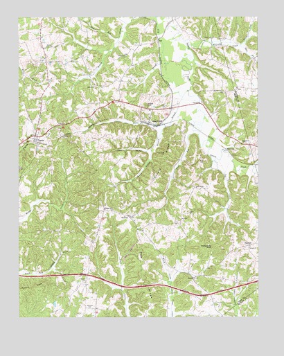
Rosine, KY USGS Topographic Map
Click on map above to begin viewing in our Map Viewer.

This topographic map contains these locations and features:
Feature Name Type Latitude Longitude GNIS ID View Map
Antioch ChurchChurchN37.4038°W86.6300°485983View Map
ArnoldPopulated PlaceN37.3914°W86.6589°507414View Map
Arnold RidgeRidgeN37.4395°W86.6744°486055View Map
Arnold Ridge CemeteryCemeteryN37.4431°W86.6736°486056View Map
Baizetown CemeteryCemeteryN37.3789°W86.7130°486234View Map
Cane Run ChurchChurchN37.4837°W86.6942°488802View Map
Cow CreekStreamN37.4403°W86.6478°490183View Map
Crow HollowValleyN37.4440°W86.6820°490408View Map
DanLocaleN37.4903°W86.6769°490544View Map
DogwalkPopulated PlaceN37.4048°W86.6303°507862View Map
East Fork McGrady CreekStreamN37.4878°W86.6342°491471View Map
Fairview CemeteryCemeteryN37.3900°W86.7158°491900View Map
Fairview ChurchChurchN37.4878°W86.7353°491920View Map
Ferguson CemeteryCemeteryN37.4473°W86.6319°492031View Map
Ford RunStreamN37.4526°W86.6589°492310View Map
Hickory KnobSummitN37.3887°W86.7414°494138View Map
Hopewell ChurchChurchN37.4692°W86.6442°494529View Map
Horse BranchPopulated PlaceN37.4559°W86.6767°494566View Map
Horse BranchStreamN37.4695°W86.6608°494569View Map
Horse Branch DivisionCivilN37.4519°W86.6994°1937067View Map
Jenny BranchStreamN37.4559°W86.6705°495212View Map
Leach CemeteryCemeteryN37.4186°W86.6615°496109View Map
Leach ChapelChurchN37.4287°W86.6575°496110View Map
McCord CemeteryCemeteryN37.4820°W86.7205°497801View Map
McGrady CreekStreamN37.4862°W86.6608°497869View Map
North Fork McGrady CreekStreamN37.4878°W86.6339°499556View Map
Pea RidgeRidgeN37.3762°W86.6808°500311View Map
Rattlesnake KnobSummitN37.4045°W86.6489°501599View Map
RenfrowPopulated PlaceN37.4167°W86.6922°508921View Map
Richland CreekStreamN37.4376°W86.6272°501822View Map
RosinePopulated PlaceN37.4503°W86.7414°502356View Map
Rosine Census Designated PlaceCensusN37.4524°W86.7373°2629673View Map
Rosine Fire DepartmentBuildingN37.4496°W86.7406°2636511View Map
Salem ChurchChurchN37.4709°W86.7111°502785View Map
Shiloh ChurchChurchN37.4914°W86.6494°503379View Map
Sled RunStreamN37.4914°W86.6972°503671View Map
Tunnel HillSummitN37.4500°W86.7242°505571View Map
Wade CemeteryCemeteryN37.4406°W86.6541°506090View Map
White RunPopulated PlaceN37.4448°W86.6419°509360View Map
Wildcat KnobSummitN37.4634°W86.6836°506739View Map
Wilson CemeteryCemeteryN37.4623°W86.6739°506889View Map
Windy HillPopulated PlaceN37.4198°W86.7053°506934View Map

Note: Coordinates in the location and feature list above are referenced to NAD83 datum.


Copyright (C) 2008-2024 Ryan Niemi / Sunset Dynamics ... All Rights Reserved