TopoQuest Logo
Do you find TopoQuest useful?
Help keep TopoQuest running and adding new maps/features by donating!
Bitcoin:  19c7KJd3qBynnjoSw5npx9KScwjBe4ifkT
Litecoin:  LXs6TkuXGGXo1vDsWCkWVdjQX94eUKd6ui
Home View Maps Find Maps Find Places Resources & Links


Spring Lick, Kentucky Topographic Map

USGS Map Title: Spring Lick, KY
USGS Map MRC: 37086D5
DRG (GeoTIFF) Download: o37086d5.tif


Neighboring USGS Topographic Map Quads:


  Olaton, KY  
37086E6
 

  Falls of Rough, KY  
37086E5
 

  McDaniels, KY  
37086E4
 

  Rosine, KY  
37086D6
 

  Spring Lick, KY  
37086D5
 

  Caneyville, KY  
37086D4
 

  Flener, KY  
37086C6
 

  Welchs Creek, KY  
37086C5
 

  Ready, KY  
37086C4


Map MRC Location:

N38°
W87°
N38°
W86°
H8 H7 H6 H5 H4 H3 H2 H1
G8 G7 G6 G5 G4 G3 G2 G1
F8 F7 F6 F5 F4 F3 F2 F1
E8 E7 E6 E5 E4 E3 E2 E1
D8 D7 D6 D5 D4 D3 D2 D1
C8 C7 C6 C5 C4 C3 C2 C1
B8 B7 B6 B5 B4 B3 B2 B1
A8 A7 A6 A5 A4 A3 A2 A1
N37°
W87°
N37°
W86°

Spring Lick, KY USGS 1:24K Topographic Map Preview:
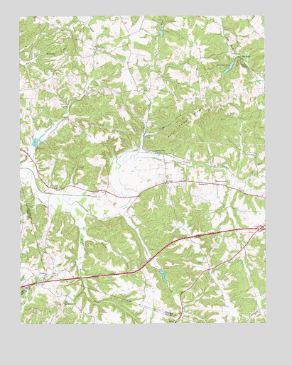
Spring Lick, KY USGS Topographic Map
Click on map above to begin viewing in our Map Viewer.

This topographic map contains these locations and features:
Feature Name Type Latitude Longitude GNIS ID View Map
Browns BranchStreamN37.4098°W86.5942°488026View Map
Brushy Pond CreekStreamN37.4220°W86.6061°488150View Map
Buck CreekStreamN37.4309°W86.5169°488212View Map
Cane RunStreamN37.4339°W86.5172°488788View Map
Dam Number 12DamN37.4473°W86.6179°517122View Map
Dam Number 9DamN37.3972°W86.5539°517136View Map
Do StopPopulated PlaceN37.4320°W86.5505°490936View Map
Dog CreekStreamN37.4181°W86.5719°490976View Map
Free Zion ChurchChurchN37.4864°W86.5855°492496View Map
Jarrett ForkStreamN37.4320°W86.5105°495176View Map
JugvillePopulated PlaceN37.4631°W86.5989°508363View Map
Kiper HollowValleyN37.4508°W86.5615°495785View Map
NeafusPopulated PlaceN37.3951°W86.6119°508676View Map
Peach Orchard RidgeRidgeN37.4567°W86.5408°500324View Map
Pine KnobPopulated PlaceN37.4834°W86.5119°500697View Map
Pine KnobSummitN37.4795°W86.5125°500701View Map
Pine Knob LakeReservoirN37.4785°W86.5183°500708View Map
Smalls Grove ChurchChurchN37.4323°W86.5255°503721View Map
SmithviewPopulated PlaceN37.4326°W86.5339°503815View Map
Spring CreekStreamN37.4434°W86.5667°504125View Map
Spring LickPopulated PlaceN37.4448°W86.5567°504147View Map
SteffPopulated PlaceN37.4298°W86.6055°507321View Map
Walnut Grove ChurchChurchN37.4439°W86.5055°506175View Map
Zion Harmony ChurchChurchN37.3831°W86.6025°507291View Map

Note: Coordinates in the location and feature list above are referenced to NAD83 datum.


Copyright (C) 2008-2025 Ryan Niemi / Sunset Dynamics ... All Rights Reserved