TopoQuest Logo
Do you find TopoQuest useful?
Help keep TopoQuest running and adding new maps/features by donating!
Bitcoin:  19c7KJd3qBynnjoSw5npx9KScwjBe4ifkT
Litecoin:  LXs6TkuXGGXo1vDsWCkWVdjQX94eUKd6ui
Home View Maps Find Maps Find Places Resources & Links


Falls of Rough, Kentucky Topographic Map

USGS Map Title: Falls of Rough, KY
USGS Map MRC: 37086E5
DRG (GeoTIFF) Download: o37086e5.tif


Neighboring USGS Topographic Map Quads:


  Fordsville, KY  
37086F6
 

  Glen Dean, KY  
37086F5
 

  Kingswood, KY  
37086F4
 

  Olaton, KY  
37086E6
 

  Falls of Rough, KY  
37086E5
 

  McDaniels, KY  
37086E4
 

  Rosine, KY  
37086D6
 

  Spring Lick, KY  
37086D5
 

  Caneyville, KY  
37086D4


Map MRC Location:

N38°
W87°
N38°
W86°
H8 H7 H6 H5 H4 H3 H2 H1
G8 G7 G6 G5 G4 G3 G2 G1
F8 F7 F6 F5 F4 F3 F2 F1
E8 E7 E6 E5 E4 E3 E2 E1
D8 D7 D6 D5 D4 D3 D2 D1
C8 C7 C6 C5 C4 C3 C2 C1
B8 B7 B6 B5 B4 B3 B2 B1
A8 A7 A6 A5 A4 A3 A2 A1
N37°
W87°
N37°
W86°

Falls of Rough, KY USGS 1:24K Topographic Map Preview:
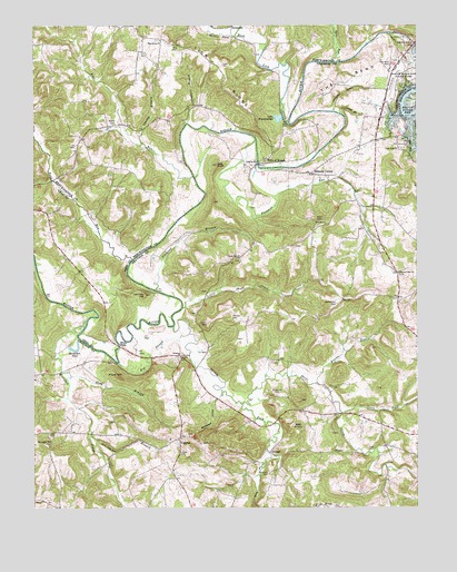
Falls of Rough, KY USGS Topographic Map
Click on map above to begin viewing in our Map Viewer.

This topographic map contains these locations and features:
Feature Name Type Latitude Longitude GNIS ID View Map
Allen CemeteryCemeteryN37.5742°W86.5314°485860View Map
Alum HillSummitN37.5342°W86.5978°485908View Map
Ball KnobSummitN37.5203°W86.5383°486292View Map
Big SloughGutN37.5392°W86.5872°487256View Map
Blaine RunStreamN37.5326°W86.5325°487429View Map
Boneyard HollowValleyN37.5275°W86.5665°487665View Map
Bugger HillSummitN37.5903°W86.5276°2742786View Map
Cane RunStreamN37.6159°W86.5269°488797View Map
Chambers BranchStreamN37.5998°W86.5739°489318View Map
Croquet HollowValleyN37.6039°W86.5269°490393View Map
Diamond BranchStreamN37.5567°W86.5844°490859View Map
Dry ForkStreamN37.5131°W86.5480°491205View Map
Duncan BranchStreamN37.6020°W86.5241°491291View Map
Duncan HillSummitN37.5167°W86.6214°491304View Map
Falls of RoughPopulated PlaceN37.5901°W86.5489°507976View Map
Falls of Rough Volunteer Fire DepartmentBuildingN37.5951°W86.5156°2636388View Map
Falls of Rough Volunteer Fire Department Station 2 Water RescueBuildingN37.6083°W86.5097°2637348View Map
Granny BranchStreamN37.5945°W86.5889°493109View Map
Greenbrier BranchStreamN37.5187°W86.6061°493312View Map
Harris ForkStreamN37.6223°W86.5589°493806View Map
Hickory CornerPopulated PlaceN37.5873°W86.5336°508228View Map
Hites FallsPopulated PlaceN37.5423°W86.5969°508255View Map
Hog KnobSummitN37.5889°W86.5644°494346View Map
Horseshoe PondLakeN37.5409°W86.6120°494612View Map
Iron Ore HillSummitN37.5551°W86.5883°495009View Map
Isaac ForkStreamN37.5245°W86.5241°495034View Map
Junction HillSummitN37.5531°W86.5250°495552View Map
Lake BreckinridgeReservoirN37.6010°W86.5450°487854View Map
Little Short CreekStreamN37.5517°W86.5761°496859View Map
Lone Hill ChurchChurchN37.5651°W86.5572°496996View Map
Lone Star ChurchChurchN37.5931°W86.5058°497008View Map
Long BranchStreamN37.5345°W86.6128°497037View Map
Macedonia ChurchChurchN37.6213°W86.5835°497417View Map
Mahurin CemeteryCemeteryN37.5089°W86.5489°497458View Map
McQuady GlenFlatN37.5890°W86.5399°2742795View Map
Mistaken CreekStreamN37.5484°W86.6078°498442View Map
Patterson CemeteryCemeteryN37.5298°W86.5458°500255View Map
Payton CemeteryCemeteryN37.5498°W86.5600°500300View Map
Pine Knob CreekStreamN37.5006°W86.5341°500707View Map
Pipe RunStreamN37.5859°W86.5725°500755View Map
Pleasant RunStreamN37.5953°W86.5516°500904View Map
Pleasant Run ChurchChurchN37.5609°W86.5061°500910View Map
Pond RunStreamN37.5645°W86.5922°501057View Map
Porters CemeteryCemeteryN37.5392°W86.5761°501153View Map
Rock Lick CreekStreamN37.5995°W86.5408°502135View Map
Rough River DamDamN37.6199°W86.5012°502391View Map
Rough River Dam State ParkParkN37.6109°W86.5047°502392View Map
Rough River State Park AirportAirportN37.6129°W86.5062°517371View Map
Short CreekStreamN37.5273°W86.5569°503444View Map
Short Creek DivisionCivilN37.5298°W86.5162°1937255View Map
Smith CemeteryCemeteryN37.5478°W86.5675°503762View Map
Spring ForkStreamN37.5467°W86.5794°504135View Map
The BendBendN37.6112°W86.5233°505108View Map
The Bend CemeteryCemeteryN37.6153°W86.5080°505110View Map
Tick RidgeRidgeN37.6145°W86.5625°505272View Map
TouseyPopulated PlaceN37.5145°W86.5478°509225View Map
Walker CemeteryCemeteryN37.5995°W86.5991°506117View Map
YeamanPopulated PlaceN37.5178°W86.5775°509418View Map
Yeaman ChurchChurchN37.5395°W86.5769°507203View Map

Note: Coordinates in the location and feature list above are referenced to NAD83 datum.


Copyright (C) 2008-2025 Ryan Niemi / Sunset Dynamics ... All Rights Reserved