TopoQuest Logo
Do you find TopoQuest useful?
Help keep TopoQuest running and adding new maps/features by donating!
Bitcoin:  19c7KJd3qBynnjoSw5npx9KScwjBe4ifkT
Litecoin:  LXs6TkuXGGXo1vDsWCkWVdjQX94eUKd6ui
Home View Maps Find Maps Find Places Resources & Links


Rossville, Iowa Topographic Map

USGS Map Title: Rossville, IA
USGS Map MRC: 43091B4
DRG (GeoTIFF) Download: o43091b4.tif


Neighboring USGS Topographic Map Quads:


  Hanover, IA  
43091C5
 

  Waukon, IA  
43091C4
 

  Church, IA  
43091C3
 

  Frankville, IA  
43091B5
 

  Rossville, IA  
43091B4
 

  Waterville, IA  
43091B3
 

  Postville, IA  
43091A5
 

  Monona, IA  
43091A4
 

  Giard, IA  
43091A3


Map MRC Location:

N44°
W92°
N44°
W91°
H8 H7 H6 H5 H4 H3 H2 H1
G8 G7 G6 G5 G4 G3 G2 G1
F8 F7 F6 F5 F4 F3 F2 F1
E8 E7 E6 E5 E4 E3 E2 E1
D8 D7 D6 D5 D4 D3 D2 D1
C8 C7 C6 C5 C4 C3 C2 C1
B8 B7 B6 B5 B4 B3 B2 B1
A8 A7 A6 A5 A4 A3 A2 A1
N43°
W92°
N43°
W91°

Rossville, IA USGS 1:24K Topographic Map Preview:
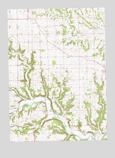
Rossville, IA USGS Topographic Map
Click on map above to begin viewing in our Map Viewer.

This topographic map contains these locations and features:
Feature Name Type Latitude Longitude GNIS ID View Map
Bailey PlotCemeteryN43.1500°W91.4168°1948932View Map
Bear CreekStreamN43.1297°W91.3762°454406View Map
Cleveland Post Office (historical)Post OfficeN43.1611°W91.4918°1948818View Map
Dundee PlotCemeteryN43.2261°W91.4493°1948969View Map
Ebenezer CemeteryCemeteryN43.2477°W91.4147°456218View Map
Evergreen CemeteryCemeteryN43.1631°W91.4930°456436View Map
Evergreen CemeteryCemeteryN43.2039°W91.4252°456437View Map
Fandon Post Office (historical)Post OfficeN43.2078°W91.4307°1948812View Map
Forest Mills Post Office (historical)Post OfficeN43.1555°W91.4571°1948811View Map
ManchesterLocaleN43.1611°W91.4871°463985View Map
Nelson PlotCemeteryN43.2444°W91.4251°1948933View Map
Norfolk CreekStreamN43.1614°W91.4679°459548View Map
Penny SpringsStreamN43.1441°W91.4335°465366View Map
Red BridgeBridgeN43.1308°W91.4249°1948970View Map
RossvillePopulated PlaceN43.1894°W91.3757°460817View Map
Rossville (historical)LocaleN43.1894°W91.3757°1948790View Map
Rossville CemeteryCemeteryN43.1943°W91.3763°460818View Map
Rossville Post Office (historical)Post OfficeN43.1894°W91.3757°1948810View Map
Smithfield CemeteryCemeteryN43.1254°W91.3905°461706View Map
Teeple CreekStreamN43.2108°W91.4951°462188View Map
Township of JeffersonCivilN43.2113°W91.4292°468128View Map
Volney CemeteryCemeteryN43.1319°W91.3763°1948931View Map
Williams CreekStreamN43.1441°W91.4354°463056View Map

Note: Coordinates in the location and feature list above are referenced to NAD83 datum.


Copyright (C) 2008-2024 Ryan Niemi / Sunset Dynamics ... All Rights Reserved