TopoQuest Logo
Do you find TopoQuest useful?
Help keep TopoQuest running and adding new maps/features by donating!
Bitcoin:  19c7KJd3qBynnjoSw5npx9KScwjBe4ifkT
Litecoin:  LXs6TkuXGGXo1vDsWCkWVdjQX94eUKd6ui
Home View Maps Find Maps Find Places Resources & Links


Rossville, Texas Topographic Map

USGS Map Title: Rossville, TX
USGS Map MRC: 29098A6
DRG (GeoTIFF) Download: o29098a6.tif


Neighboring USGS Topographic Map Quads:


  Lytle, TX  
29098B7
 

  Somerset, TX  
29098B6
 

  Thelma, TX  
29098B5
 

  Bigfoot, TX  
29098A7
 

  Rossville, TX  
29098A6
 

  Poteet, TX  
29098A5
 

  Schattel, TX  
28098H7
 

  Dobrowolski, TX  
28098H6
 

  Jourdanton, TX  
28098H5


Map MRC Location:

N30°
W99°
N30°
W98°
H8 H7 H6 H5 H4 H3 H2 H1
G8 G7 G6 G5 G4 G3 G2 G1
F8 F7 F6 F5 F4 F3 F2 F1
E8 E7 E6 E5 E4 E3 E2 E1
D8 D7 D6 D5 D4 D3 D2 D1
C8 C7 C6 C5 C4 C3 C2 C1
B8 B7 B6 B5 B4 B3 B2 B1
A8 A7 A6 A5 A4 A3 A2 A1
N29°
W99°
N29°
W98°

Rossville, TX USGS 1:24K Topographic Map Preview:
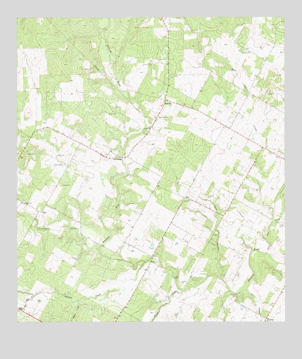
Rossville, TX USGS Topographic Map
Click on map above to begin viewing in our Map Viewer.

This topographic map contains these locations and features:
Feature Name Type Latitude Longitude GNIS ID View Map
Alvarado CemeteryCemeteryN29.0109°W98.6481°1351060View Map
AnchoragePopulated PlaceN29.0675°W98.7059°1379345View Map
Brite CemeteryCemeteryN29.1111°W98.6414°1352905View Map
Brown CemeteryCemeteryN29.0647°W98.7295°1352962View Map
Fern HollowValleyN29.0137°W98.6433°1357299View Map
Flores CemeteryCemeteryN29.0250°W98.6881°1357497View Map
Garcia CemeteryCemeteryN29.0689°W98.7320°1357860View Map
Grosco CemeteryCemeteryN29.0186°W98.6775°1358465View Map
IukaPopulated PlaceN29.0458°W98.7384°1379991View Map
Jimenez CemeteryCemeteryN29.0514°W98.6614°1360265View Map
Layer CemeteryCemeteryN29.0497°W98.6692°1361000View Map
Lott CemeteryCemeteryN29.0550°W98.6459°1361861View Map
Mile and a Half CreekStreamN29.0111°W98.7425°1362834View Map
Padilla CreekStreamN29.0250°W98.6903°1364684View Map
Palo Alto CreekStreamN29.0286°W98.6334°1375336View Map
Poteet DivisionCivilN29.1075°W98.6761°1939105View Map
RossvillePopulated PlaceN29.0914°W98.6806°1380460View Map
Rossville CemeteryCemeteryN29.0844°W98.6842°1366899View Map
Santa Anna CreekStreamN29.0133°W98.6736°1367745View Map
Siestedero CreekStreamN29.0294°W98.7120°1368262View Map
SueLocaleN29.0514°W98.6720°1369312View Map
Tank HollowValleyN29.0182°W98.6560°1369582View Map
Vanness CemeteryCemeteryN29.0161°W98.6734°1370589View Map
Willow CreekStreamN29.0089°W98.7220°1371635View Map

Note: Coordinates in the location and feature list above are referenced to NAD83 datum.


Copyright (C) 2008-2025 Ryan Niemi / Sunset Dynamics ... All Rights Reserved