TopoQuest Logo
Do you find TopoQuest useful?
Help keep TopoQuest running and adding new maps/features by donating!
Bitcoin:  19c7KJd3qBynnjoSw5npx9KScwjBe4ifkT
Litecoin:  LXs6TkuXGGXo1vDsWCkWVdjQX94eUKd6ui
Home View Maps Find Maps Find Places Resources & Links


Jourdanton, Texas Topographic Map

USGS Map Title: Jourdanton, TX
USGS Map MRC: 28098H5
DRG (GeoTIFF) Download: o28098h5.tif


Neighboring USGS Topographic Map Quads:


  Rossville, TX  
29098A6
 

  Poteet, TX  
29098A5
 

  Leming, TX  
29098A4
 

  Dobrowolski, TX  
28098H6
 

  Jourdanton, TX  
28098H5
 

  Pleasanton, TX  
28098H4
 

  Charlotte, TX  
28098G6
 

  Christine West, TX  
28098G5
 

  Christine East, TX  
28098G4


Map MRC Location:

N29°
W99°
N29°
W98°
H8 H7 H6 H5 H4 H3 H2 H1
G8 G7 G6 G5 G4 G3 G2 G1
F8 F7 F6 F5 F4 F3 F2 F1
E8 E7 E6 E5 E4 E3 E2 E1
D8 D7 D6 D5 D4 D3 D2 D1
C8 C7 C6 C5 C4 C3 C2 C1
B8 B7 B6 B5 B4 B3 B2 B1
A8 A7 A6 A5 A4 A3 A2 A1
N28°
W99°
N28°
W98°

Jourdanton, TX USGS 1:24K Topographic Map Preview:
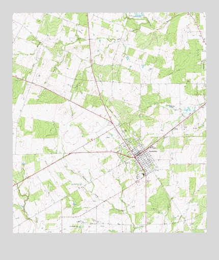
Jourdanton, TX USGS Topographic Map
Click on map above to begin viewing in our Map Viewer.

This topographic map contains these locations and features:
Feature Name Type Latitude Longitude GNIS ID View Map
Atascosa CountyCivilN28.8935°W98.5271°1383792View Map
Atascosa County Alternative School - JourdantonSchoolN28.9122°W98.5406°2003002View Map
Atascosa County Alternative School - PleasantonSchoolN28.9211°W98.5470°2003003View Map
Atascosa County Emergency Medical ServicesBuildingN28.9210°W98.5446°2655927View Map
Atascosa County Sheriff's OfficeBuildingN28.9177°W98.5440°2750367View Map
Bonita DamDamN28.9469°W98.5236°1860496View Map
Bonita LakeReservoirN28.9472°W98.5245°1860497View Map
City of JourdantonCivilN28.9138°W98.5410°2410153View Map
Hilburn CemeteryCemeteryN28.9858°W98.5831°1359236View Map
JourdantonPopulated PlaceN28.9180°W98.5464°1360436View Map
Jourdanton City HallBuildingN28.9200°W98.5431°2753727View Map
Jourdanton Elementary SchoolSchoolN28.9089°W98.5400°2003009View Map
Jourdanton High SchoolSchoolN28.9089°W98.5400°2003010View Map
Jourdanton Junior High SchoolSchoolN28.9089°W98.5400°2003011View Map
Jourdanton Police DepartmentBuildingN28.9198°W98.5429°2750532View Map
Jourdanton Post OfficePost OfficeN28.9201°W98.5425°2731606View Map
Jourdanton Volunteer Fire DepartmentBuildingN28.9179°W98.5444°2551920View Map
Mercy HospitalHospitalN28.9236°W98.5353°1362626View Map
Methodist Hospital SouthHospitalN28.9331°W98.5260°2015609View Map
Palmer Ranch LakeReservoirN28.9452°W98.5111°1864537View Map
Palmer Ranch Lake DamDamN28.9436°W98.5103°1864536View Map
Pleasanton Municipal AirportAirportN28.9543°W98.5195°1387334View Map
Salt BranchStreamN28.9941°W98.5375°1367382View Map
Scheidt DamDamN28.9969°W98.5420°1860498View Map
Scheidt LakeReservoirN28.9981°W98.5433°1860499View Map
The Church of Jesus Christ of Latter Day SaintsChurchN28.9533°W98.5058°2016519View Map
United Methodist ChurchChurchN28.9153°W98.5456°2016518View Map
Westfall Branch LibraryBuildingN28.9622°W98.5334°2014754View Map

Note: Coordinates in the location and feature list above are referenced to NAD83 datum.


Copyright (C) 2008-2025 Ryan Niemi / Sunset Dynamics ... All Rights Reserved