TopoQuest Logo
Do you find TopoQuest useful?
Help keep TopoQuest running and adding new maps/features by donating!
Bitcoin:  19c7KJd3qBynnjoSw5npx9KScwjBe4ifkT
Litecoin:  LXs6TkuXGGXo1vDsWCkWVdjQX94eUKd6ui
Home View Maps Find Maps Find Places Resources & Links


Rough Hollow, Texas Topographic Map

USGS Map Title: Rough Hollow, TX
USGS Map MRC: 30098A2
DRG (GeoTIFF) Download: o30098a2.tif


Neighboring USGS Topographic Map Quads:


  Yeager Creek, TX  
30098B3
 

  Henly, TX  
30098B2
 

  Dripping Springs, TX  
30098B1
 

  Payton, TX  
30098A3
 

  Rough Hollow, TX  
30098A2
 

  Driftwood, TX  
30098A1
 

  Fischer, TX  
29098H3
 

  Devils Backbone, TX  
29098H2
 

  Wimberley, TX  
29098H1


Map MRC Location:

N31°
W99°
N31°
W98°
H8 H7 H6 H5 H4 H3 H2 H1
G8 G7 G6 G5 G4 G3 G2 G1
F8 F7 F6 F5 F4 F3 F2 F1
E8 E7 E6 E5 E4 E3 E2 E1
D8 D7 D6 D5 D4 D3 D2 D1
C8 C7 C6 C5 C4 C3 C2 C1
B8 B7 B6 B5 B4 B3 B2 B1
A8 A7 A6 A5 A4 A3 A2 A1
N30°
W99°
N30°
W98°

Rough Hollow, TX USGS 1:24K Topographic Map Preview:
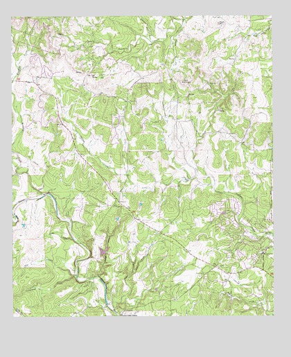
Rough Hollow, TX USGS Topographic Map
Click on map above to begin viewing in our Map Viewer.

This topographic map contains these locations and features:
Feature Name Type Latitude Longitude GNIS ID View Map
Big DamDamN30.0435°W98.1470°1863379View Map
Big Dam LakeReservoirN30.0435°W98.1470°1863380View Map
Cat HollowValleyN30.1238°W98.1676°1332315View Map
Cedar ForkStreamN30.0024°W98.2011°1332424View Map
Cottonwood CreekStreamN30.0174°W98.2192°1333455View Map
Dripping Springs-Wimberley DivisionCivilN30.1226°W98.1255°1938693View Map
Elm HollowValleyN30.0173°W98.2211°1335392View Map
Freestone BranchStreamN30.1144°W98.1814°1336187View Map
Garnett Ranch AirportAirportN30.0960°W98.1631°1387758View Map
Gatlin - Garrett CemeteryCemeteryN30.1188°W98.1325°1336440View Map
Jack MountainSummitN30.0985°W98.1686°1338555View Map
Jacobs WellWellN30.0344°W98.1261°1338613View Map
Jacobs Well CemeteryCemeteryN30.0255°W98.1292°1338614View Map
Jacobs Well SpringSpringN30.0344°W98.1264°1998582View Map
Mount SharpSummitN30.1002°W98.2122°1346979View Map
Mount Sharp CemeteryCemeteryN30.1005°W98.2075°1342115View Map
Peach MountainSummitN30.1219°W98.1506°1343720View Map
Pioneer TownBuildingN30.0588°W98.1467°2014600View Map
Pleasant Valley CemeteryCemeteryN30.0002°W98.2020°1376562View Map
Pleasant Valley CrossingPopulated PlaceN30.0005°W98.1997°1378889View Map
Rough HollowValleyN30.0170°W98.2094°1345648View Map
Seven H Ranch LakeReservoirN30.1019°W98.1303°1863386View Map
Seven H Ranch Lake DamDamN30.1019°W98.1303°1863385View Map
Turkey HollowValleyN30.0327°W98.2213°1348881View Map
Wanslow CreekStreamN30.0513°W98.2345°1349470View Map
Wimberley Volunteer Fire Department Jacobs Well StationBuildingN30.0292°W98.1258°2552497View Map

Note: Coordinates in the location and feature list above are referenced to NAD83 datum.


Copyright (C) 2008-2025 Ryan Niemi / Sunset Dynamics ... All Rights Reserved