TopoQuest Logo
Do you find TopoQuest useful?
Help keep TopoQuest running and adding new maps/features by donating!
Bitcoin:  19c7KJd3qBynnjoSw5npx9KScwjBe4ifkT
Litecoin:  LXs6TkuXGGXo1vDsWCkWVdjQX94eUKd6ui
Home View Maps Find Maps Find Places Resources & Links


Driftwood, Texas Topographic Map

USGS Map Title: Driftwood, TX
USGS Map MRC: 30098A1
DRG (GeoTIFF) Download: o30098a1.tif


Neighboring USGS Topographic Map Quads:


  Henly, TX  
30098B2
 

  Dripping Springs, TX  
30098B1
 

  Signal Hill, TX  
30097B8
 

  Rough Hollow, TX  
30098A2
 

  Driftwood, TX  
30098A1
 

  Mountain City, TX  
30097A8
 

  Devils Backbone, TX  
29098H2
 

  Wimberley, TX  
29098H1
 

  San Marcos North, TX  
29097H8


Map MRC Location:

N31°
W99°
N31°
W98°
H8 H7 H6 H5 H4 H3 H2 H1
G8 G7 G6 G5 G4 G3 G2 G1
F8 F7 F6 F5 F4 F3 F2 F1
E8 E7 E6 E5 E4 E3 E2 E1
D8 D7 D6 D5 D4 D3 D2 D1
C8 C7 C6 C5 C4 C3 C2 C1
B8 B7 B6 B5 B4 B3 B2 B1
A8 A7 A6 A5 A4 A3 A2 A1
N30°
W99°
N30°
W98°

Driftwood, TX USGS 1:24K Topographic Map Preview:
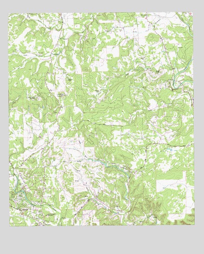
Driftwood, TX USGS Topographic Map
Click on map above to begin viewing in our Map Viewer.

This topographic map contains these locations and features:
Feature Name Type Latitude Longitude GNIS ID View Map
Blue Hole CampgroundLocaleN30.0044°W98.0906°1330909View Map
Bowen Intermediate SchoolSchoolN30.0285°W98.1017°2006614View Map
Chalk BluffCliffN30.0905°W98.0231°1332611View Map
City of WoodcreekCivilN30.0266°W98.1115°2412297View Map
DriftwoodPopulated PlaceN30.1230°W98.0308°1378229View Map
Driftwood Post OfficePost OfficeN30.1234°W98.0324°2731676View Map
Eagle Rock RanchLocaleN30.0247°W98.1192°1334857View Map
Flat CreekStreamN30.0894°W98.0103°1335894View Map
Hays CountyCivilN30.0582°W98.0311°1383890View Map
Hays County Sheriff's Office Wimberley - Lions Field SubstationBuildingN30.0036°W98.1074°2739414View Map
Joe Wimberley MountainSummitN30.0066°W98.0992°1338748View Map
Little Twin Sister PeaksSummitN30.0130°W98.1247°1340207View Map
Lone Man MountainSummitN30.0769°W98.0878°1340371View Map
Lone Woman MountainSummitN30.0755°W98.1067°1340410View Map
Nagel Brothers RanchLocaleN30.0855°W98.0839°1342357View Map
Newberry RanchLocaleN30.0983°W98.0325°1342561View Map
North Gatlin CreekStreamN30.1163°W98.0833°1375175View Map
Old BaldySummitN30.0097°W98.1161°1343112View Map
Rainbow RanchLocaleN30.0785°W98.0631°1344713View Map
Rocky BranchStreamN30.1130°W98.0028°1345431View Map
Scudder Primary SchoolSchoolN30.0025°W98.1106°2006636View Map
Smith CreekStreamN30.0066°W98.0475°1347267View Map
South Gatlin CreekStreamN30.1163°W98.0833°1347464View Map
Storm RanchLocaleN30.1013°W98.1033°1347976View Map
The Chapel in the Hills Community ChurchChurchN30.0310°W98.1014°2021022View Map
White Wings AirportAirportN30.0114°W98.0405°2675818View Map
Wimberley Church of ChristChurchN30.0535°W98.0945°2020068View Map
Wimberley High SchoolSchoolN30.0052°W98.1172°2006638View Map
Wimberley Post OfficePost OfficeN30.0043°W98.1010°2731772View Map
Wimberley Volunteer Fire Department Central StationBuildingN30.0019°W98.1061°2552486View Map
Wimberley Volunteer Fire Department Rolling Oaks StationBuildingN30.0507°W98.0222°2552493View Map
WoodcreekPopulated PlaceN30.0283°W98.1111°1388553View Map
Woodcreek City HallBuildingN30.0225°W98.1024°2753624View Map
Woodcreek Resort Airport (historical)AirportN30.0335°W98.1172°1387756View Map

Note: Coordinates in the location and feature list above are referenced to NAD83 datum.


Copyright (C) 2008-2025 Ryan Niemi / Sunset Dynamics ... All Rights Reserved