TopoQuest Logo
Do you find TopoQuest useful?
Help keep TopoQuest running and adding new maps/features by donating!
Bitcoin:  19c7KJd3qBynnjoSw5npx9KScwjBe4ifkT
Litecoin:  LXs6TkuXGGXo1vDsWCkWVdjQX94eUKd6ui
Home View Maps Find Maps Find Places Resources & Links


Round Spring, Missouri Topographic Map

USGS Map Title: Round Spring, MO
USGS Map MRC: 37091C4
DRG (GeoTIFF) Download: o37091c4.tif


Neighboring USGS Topographic Map Quads:


  Cedargrove, MO  
37091D5
 

  Gladden, MO  
37091D4
 

  Loggers Lake, MO  
37091D3
 

  Lewis Hollow, MO  
37091C5
 

  Round Spring, MO  
37091C4
 

  The Sinks, MO  
37091C3
 

  Summersville NE, MO  
37091B5
 

  Alley Spring, MO  
37091B4
 

  Eminence, MO  
37091B3


Map MRC Location:

N38°
W92°
N38°
W91°
H8 H7 H6 H5 H4 H3 H2 H1
G8 G7 G6 G5 G4 G3 G2 G1
F8 F7 F6 F5 F4 F3 F2 F1
E8 E7 E6 E5 E4 E3 E2 E1
D8 D7 D6 D5 D4 D3 D2 D1
C8 C7 C6 C5 C4 C3 C2 C1
B8 B7 B6 B5 B4 B3 B2 B1
A8 A7 A6 A5 A4 A3 A2 A1
N37°
W92°
N37°
W91°

Round Spring, MO USGS 1:24K Topographic Map Preview:
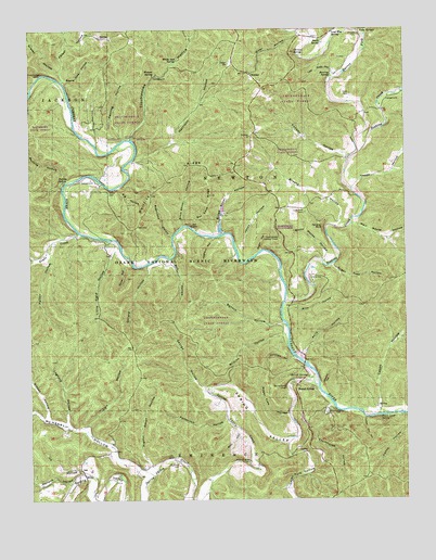
Round Spring, MO USGS Topographic Map
Click on map above to begin viewing in our Map Viewer.

This topographic map contains these locations and features:
Feature Name Type Latitude Longitude GNIS ID View Map
Alton ClubLocaleN37.3214°W91.4357°747874View Map
Alton Club Lake DamDamN37.3267°W91.4368°765417View Map
Barren ForkStreamN37.3420°W91.3904°748687View Map
Bat Cave RidgeRidgeN37.3298°W91.4404°713725View Map
Benton HollowValleyN37.2973°W91.4154°713967View Map
Big HollowValleyN37.3328°W91.4701°714172View Map
Big Solution HoleChannelN37.3464°W91.4813°736228View Map
Board Tree HollowValleyN37.3616°W91.4881°714453View Map
Boyds CreekStreamN37.3209°W91.4838°714600View Map
Boyds SchoolSchoolN37.3164°W91.4749°747873View Map
Brim HollowValleyN37.3006°W91.4149°714708View Map
Broad Shoal HollowValleyN37.3212°W91.4371°714728View Map
Brushy HollowValleyN37.3230°W91.3969°714912View Map
Burnt House HollowValleyN37.3132°W91.4025°715090View Map
Camp ZoeLocaleN37.3087°W91.4068°715295View Map
Capps HollowValleyN37.2739°W91.3843°749209View Map
Carr HollowValleyN37.2689°W91.4816°715427View Map
Cave SpringSpringN37.3637°W91.4960°715534View Map
Chrisco CemeteryCemeteryN37.3734°W91.3901°715806View Map
Chrisco SpringSpringN37.3684°W91.4110°715807View Map
Conway HollowValleyN37.3407°W91.3941°716214View Map
Courthouse HollowValleyN37.2749°W91.4007°716388View Map
Devils Well HollowValleyN37.3723°W91.4874°749650View Map
Dugan HollowValleyN37.3163°W91.4233°717160View Map
Dutch HollowValleyN37.3725°W91.4457°749755View Map
Fairview ChurchChurchN37.3464°W91.4268°717776View Map
Fairview SchoolSchoolN37.3414°W91.3935°747876View Map
Fillchew HollowValleyN37.2880°W91.4127°717910View Map
Fire Hydrant SpringSpringN37.3278°W91.4890°736230View Map
Footlog HollowValleyN37.3459°W91.4689°718055View Map
Forest Glen School (historical)SchoolN37.2689°W91.4387°747875View Map
George HollowValleyN37.2795°W91.4425°718398View Map
Gillard HollowValleyN37.3118°W91.4607°718450View Map
Grassy HollowValleyN37.2723°W91.4949°718726View Map
Grassy HollowValleyN37.3640°W91.4895°718727View Map
Happy HollowValleyN37.3324°W91.3922°750224View Map
Harrison HollowValleyN37.3394°W91.4655°719161View Map
Haven Wood AirportAirportN37.3363°W91.3936°758899View Map
Hoghair HollowValleyN37.3196°W91.4394°719691View Map
InkPopulated PlaceN37.2581°W91.4838°740954View Map
Ink HollowValleyN37.2577°W91.4841°720149View Map
Jacks Fork HollowValleyN37.2652°W91.4151°720199View Map
Jones HollowValleyN37.3151°W91.4292°720419View Map
Kelly HollowValleyN37.2877°W91.4097°720517View Map
Limekiln HollowValleyN37.2802°W91.4031°721069View Map
Little Field HollowValleyN37.3170°W91.4712°721230View Map
Logfield HollowValleyN37.2707°W91.4883°721428View Map
Lone Elm SpringSpringN37.3739°W91.3990°721448View Map
Lone Pine - Piatt CemeteryCemeteryN37.3264°W91.4087°721455View Map
Lone Pine Church (historical)ChurchN37.3259°W91.4176°747877View Map
Low Gap HollowValleyN37.3627°W91.3984°721634View Map
Mail Route HollowValleyN37.3233°W91.3915°750910View Map
McHenry HollowValleyN37.2570°W91.4629°722128View Map
Mill HollowValleyN37.3141°W91.4532°722351View Map
Panther BluffCliffN37.3223°W91.4024°723979View Map
Parker HollowValleyN37.3620°W91.4888°751499View Map
Patterson HollowValleyN37.2715°W91.4355°724091View Map
Patton HollowValleyN37.3161°W91.4936°724098View Map
Pigeon Roost HollowValleyN37.2592°W91.4607°724334View Map
Pulltite CabinBuildingN37.3342°W91.4899°736229View Map
Pulltite CampgroundLocaleN37.3350°W91.4796°755579View Map
Pulltite HollowValleyN37.3347°W91.4880°724993View Map
Pulltite RidgeRidgeN37.3381°W91.4485°724994View Map
Pulltite SpringSpringN37.3350°W91.4901°724995View Map
Pump Lead SpringSpringN37.2717°W91.3840°724997View Map
Rail HollowValleyN37.2682°W91.4309°725072View Map
River HollowValleyN37.3737°W91.4102°725339View Map
Roaring SpringSpringN37.3628°W91.3993°725377View Map
Round SpringPopulated PlaceN37.2806°W91.4112°725619View Map
Round SpringSpringN37.2825°W91.4076°725620View Map
Round Spring CampgroundLocaleN37.2837°W91.4065°755577View Map
Round Spring Natural BridgeArchN37.2825°W91.4076°1679013View Map
Round Spring State Park (historical)ParkN37.2834°W91.4090°725622View Map
Shannondale Lookout TowerTowerN37.3195°W91.4174°755402View Map
Shannondale State ForestForestN37.3403°W91.4165°742888View Map
Shop HollowValleyN37.3125°W91.4685°726406View Map
Sinking CreekStreamN37.3025°W91.4154°752179View Map
Sinking HollowValleyN37.3742°W91.3875°752180View Map
Slick Shoal HollowValleyN37.3228°W91.4492°726549View Map
Smith SpringSpringN37.3714°W91.4026°726633View Map
Spring ValleyValleyN37.2812°W91.4068°726949View Map
Spring Valley CreekStreamN37.2803°W91.4046°726954View Map
Sugar Tree HollowValleyN37.2723°W91.4146°727252View Map
Sugar Tree HollowValleyN37.3121°W91.3989°727253View Map
Sugarcamp HollowValleyN37.3196°W91.4528°727258View Map
Summer CemeteryCemeteryN37.2598°W91.4512°727281View Map
TimberPopulated PlaceN37.3631°W91.4265°741322View Map
Timber Community Fire Protection District SouthBuildingN37.3640°W91.4304°2621563View Map
Timber SchoolSchoolN37.3662°W91.4338°727668View Map
Township of NewtonCivilN37.3498°W91.4400°767402View Map
Troublesome HollowValleyN37.3462°W91.4665°752580View Map
Turkey Pen HollowValleyN37.2716°W91.3896°727879View Map
Twin SpringsSpringN37.3749°W91.3897°727933View Map
Union Hill SchoolSchoolN37.3167°W91.4079°747878View Map
Wallace HollowValleyN37.2545°W91.4879°728281View Map
Watson SpringSpringN37.3634°W91.4585°728429View Map
Weese CemeteryCemeteryN37.3320°W91.4737°728475View Map
Wellsford SchoolSchoolN37.3506°W91.4754°747872View Map
White Oak SpringSpringN37.3673°W91.4510°728761View Map
Wilhite HollowValleyN37.2939°W91.4154°728858View Map

Note: Coordinates in the location and feature list above are referenced to NAD83 datum.


Copyright (C) 2008-2025 Ryan Niemi / Sunset Dynamics ... All Rights Reserved