TopoQuest Logo
Do you find TopoQuest useful?
Help keep TopoQuest running and adding new maps/features by donating!
Bitcoin:  19c7KJd3qBynnjoSw5npx9KScwjBe4ifkT
Litecoin:  LXs6TkuXGGXo1vDsWCkWVdjQX94eUKd6ui
Home View Maps Find Maps Find Places Resources & Links


Rover, Arkansas Topographic Map

USGS Map Title: Rover, AR
USGS Map MRC: 34093H4
DRG (GeoTIFF) Download: o34093h4.tif


Neighboring USGS Topographic Map Quads:


  Havana, AR  
35093A5
 

  Danville, AR  
35093A4
 

  Danville Mountain, AR  
35093A3
 

  Bluffton, AR  
34093H5
 

  Rover, AR  
34093H4
 

  Plainview, AR  
34093H3
 

  Chula Mountain, AR  
34093G5
 

  Onyx, AR  
34093G4
 

  Steve, AR  
34093G3


Map MRC Location:

N35°
W94°
N35°
W93°
H8 H7 H6 H5 H4 H3 H2 H1
G8 G7 G6 G5 G4 G3 G2 G1
F8 F7 F6 F5 F4 F3 F2 F1
E8 E7 E6 E5 E4 E3 E2 E1
D8 D7 D6 D5 D4 D3 D2 D1
C8 C7 C6 C5 C4 C3 C2 C1
B8 B7 B6 B5 B4 B3 B2 B1
A8 A7 A6 A5 A4 A3 A2 A1
N34°
W94°
N34°
W93°

Rover, AR USGS 1:24K Topographic Map Preview:
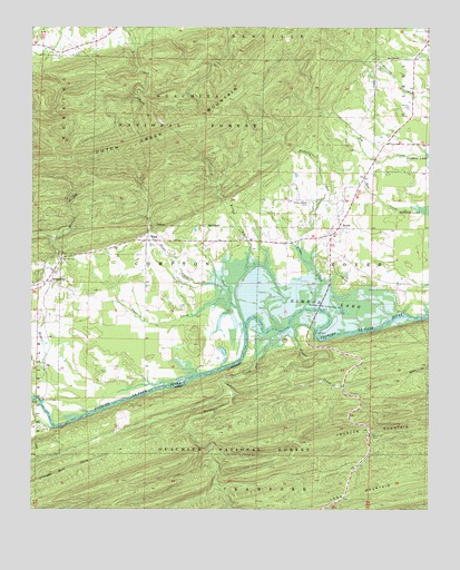
Rover, AR USGS Topographic Map
Click on map above to begin viewing in our Map Viewer.

This topographic map contains these locations and features:
Feature Name Type Latitude Longitude GNIS ID View Map
Atcheson CreekStreamN34.9426°W93.4169°70474View Map
Barnhart CreekStreamN34.9148°W93.4294°70517View Map
BriggsvillePopulated PlaceN34.9340°W93.4944°81846View Map
Briggsville Fire StationBuildingN34.9336°W93.4963°2116190View Map
Briggsville Post OfficePost OfficeN34.9340°W93.4944°84402View Map
Brogan CreekStreamN34.9193°W93.4169°70828View Map
Dutch Creek Volunteer Fire StationBuildingN34.9966°W93.4802°2116374View Map
Fourche Mountain Recreation AreaLocaleN34.8951°W93.3930°74349View Map
Fourche Work CenterLocaleN34.9370°W93.4057°74348View Map
Gilkey (historical)Populated PlaceN34.9993°W93.3757°67893View Map
Hunts Chapel CemeteryCemeteryN34.9545°W93.4132°72118View Map
Kinks CreekStreamN34.9359°W93.4110°72265View Map
Kirkos CreekStreamN34.9398°W93.4321°77413View Map
Liberty Grove Church (historical)ChurchN34.9884°W93.3760°67899View Map
Long MountainSummitN34.8762°W93.4105°72480View Map
Mount Zion CemeteryCemeteryN34.9404°W93.4913°72775View Map
Mount Zion Church (historical)ChurchN34.9395°W93.4905°67921View Map
RoverPopulated PlaceN34.9465°W93.4055°73424View Map
Rover Post OfficePost OfficeN34.9486°W93.4032°84410View Map
Rover Volunteer Fire DepartmentBuildingN34.9475°W93.4046°2117051View Map
Sinkler BranchStreamN34.9987°W93.4996°73588View Map
Stowe CreekStreamN34.9337°W93.4441°78469View Map
Tate Family CemeteryCemeteryN34.9959°W93.4971°2033676View Map
Township of ComptonCivilN34.9406°W93.4550°69871View Map
Township of RoverCivilN34.9356°W93.4055°69890View Map
Twomile CreekStreamN34.9281°W93.4432°73928View Map
Whitely BridgeBridgeN34.9031°W93.4977°74133View Map
WingPopulated PlaceN34.9448°W93.4644°78784View Map

Note: Coordinates in the location and feature list above are referenced to NAD83 datum.


Copyright (C) 2008-2024 Ryan Niemi / Sunset Dynamics ... All Rights Reserved