TopoQuest Logo
Do you find TopoQuest useful?
Help keep TopoQuest running and adding new maps/features by donating!
Bitcoin:  19c7KJd3qBynnjoSw5npx9KScwjBe4ifkT
Litecoin:  LXs6TkuXGGXo1vDsWCkWVdjQX94eUKd6ui
Home View Maps Find Maps Find Places Resources & Links


Ruch, Oregon Topographic Map

USGS Map Title: Ruch, OR
USGS Map MRC: 42123B1
DRG (GeoTIFF) Download: o42123b1.tif


Neighboring USGS Topographic Map Quads:


  Applegate, OR  
42123C2
 

  Mount Isabelle, OR  
42123C1
 

  Medford West, OR  
42122C8
 

  Tallowbox Mountain, OR  
42123B2
 

  Ruch, OR  
42123B1
 

  Sterling Creek, OR  
42122B8
 

  Carberry Creek, OR  
42123A2
 

  Squaw Lakes, OR  
42123A1
 

  Dutchman Peak, OR  
42122A8


Map MRC Location:

N43°
W124°
N43°
W123°
H8 H7 H6 H5 H4 H3 H2 H1
G8 G7 G6 G5 G4 G3 G2 G1
F8 F7 F6 F5 F4 F3 F2 F1
E8 E7 E6 E5 E4 E3 E2 E1
D8 D7 D6 D5 D4 D3 D2 D1
C8 C7 C6 C5 C4 C3 C2 C1
B8 B7 B6 B5 B4 B3 B2 B1
A8 A7 A6 A5 A4 A3 A2 A1
N42°
W124°
N42°
W123°

Ruch, OR USGS 1:24K Topographic Map Preview:
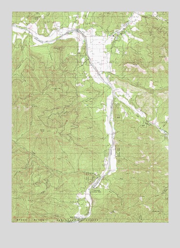
Ruch, OR USGS Topographic Map
Click on map above to begin viewing in our Map Viewer.

This topographic map contains these locations and features:
Feature Name Type Latitude Longitude GNIS ID View Map
Applegate Ranger StationBuildingN42.1507°W123.0609°1150347View Map
Applegate Valley Rural Fire Protection District 9 Station 2BuildingN42.1403°W123.0680°2576702View Map
Applegate Valley Rural Fire Protection District 9 Station 3 HeadquartersBuildingN42.2233°W123.0470°2576639View Map
Benson GulchValleyN42.1535°W123.0945°1137933View Map
Bishop CreekStreamN42.2498°W123.0295°1138160View Map
Boaz GulchValleyN42.1471°W123.0562°1138360View Map
Boaz MountainSummitN42.1325°W123.0451°1138361View Map
Buckhorn GulchValleyN42.2473°W123.0137°1134788View Map
Burton ButteSummitN42.1789°W123.0995°1139018View Map
Cameron (historical)Populated PlaceN42.1998°W123.0442°1158629View Map
Camp Meeting CreekStreamN42.2415°W123.0262°1153293View Map
Cantrall Buckley County ParkParkN42.2235°W123.0692°1159264View Map
Chapman CreekStreamN42.2379°W123.1150°1139570View Map
China DitchCanalN42.1807°W123.0195°1139674View Map
China GulchValleyN42.1393°W123.0681°1139678View Map
China GulchValleyN42.2396°W123.0709°1139681View Map
Cinnabar LookoutLocaleN42.1318°W123.0056°1167179View Map
Cinnabar MountainSummitN42.1313°W123.0072°1135060View Map
Cornstock DitchCanalN42.1596°W123.0498°1155053View Map
Eagle CanyonValleyN42.1815°W123.0078°1141462View Map
Flume GulchValleyN42.1251°W123.0812°1639307View Map
Fly By Night AirportAirportN42.2472°W123.0706°2646009View Map
Forest CreekStreamN42.2301°W123.0678°1142299View Map
Forrest Post Office (historical)Post OfficeN42.2373°W123.1123°1164369View Map
Hunter-Best ReservoirsReservoirN42.2432°W123.0331°1153294View Map
Lightning GulchValleyN42.1632°W123.1123°1145002View Map
Lime GulchValleyN42.1757°W123.0520°1145022View Map
Little Applegate RiverStreamN42.1987°W123.0453°1145070View Map
Long GulchValleyN42.2368°W123.1000°1145405View Map
Matney GulchValleyN42.2401°W123.0789°1135065View Map
McKee BridgePopulated PlaceN42.1276°W123.0762°1135061View Map
McKee Bridge Recreation SiteLocaleN42.1282°W123.0737°1145994View Map
Mill GulchValleyN42.1754°W123.0442°1146253View Map
Mount BaldySummitN42.1941°W123.1104°1137479View Map
Mud SpringSpringN42.2496°W123.1073°1135064View Map
Murphy GulchValleyN42.1643°W123.0442°1146680View Map
Neds GulchValleyN42.1535°W123.0462°1146745View Map
Negro Ben MountainSummitN42.2045°W123.0934°1146832View Map
Nineteenhundred Eighteen GulchValleyN42.1737°W123.1239°1146842View Map
O'Brien GulchValleyN42.2423°W123.1137°1135066View Map
O'Brien SpringSpringN42.2461°W123.1086°1135063View Map
Offenbacher GulchValleyN42.2268°W123.0987°1147162View Map
Offenbacher PointCapeN42.2276°W123.0881°1147163View Map
Palmer RidgeRidgeN42.1360°W123.1123°1135062View Map
Pursel Post Office (historical)Post OfficeN42.1526°W123.0539°1165827View Map
Rock GulchValleyN42.2026°W123.0523°1158453View Map
Rock GulchValleyN42.2293°W123.0400°1158454View Map
Rogue River Siskiyou National Forest Law Enforcement JacksonvilleBuildingN42.1500°W123.0591°2737872View Map
RuchPopulated PlaceN42.2365°W123.0423°1148830View Map
Ruch Branch LibraryBuildingN42.2364°W123.0437°2699760View Map
Ruch Census Designated PlaceCensusN42.2314°W123.0403°2611776View Map
Ruch Elementary SchoolSchoolN42.2356°W123.0449°1161958View Map
Ruch Post Office (historical)Post OfficeN42.2365°W123.0423°1165894View Map
Spencer GulchValleyN42.2137°W123.0478°1150114View Map
Squires PeakSummitN42.2184°W123.0256°1150306View Map
Star GulchValleyN42.1526°W123.0564°1150345View Map
Swayne DitchCanalN42.1471°W123.0567°1155054View Map
Uniontown Post Office (historical)Post OfficeN42.1985°W123.0442°1164747View Map
United States Forest Service Applegate Ranger DistrictBuildingN42.1500°W123.0591°2577060View Map
Wertz SpringSpringN42.2068°W123.0735°1153295View Map
Woodrat MountainSummitN42.2230°W123.0022°1152635View Map

Note: Coordinates in the location and feature list above are referenced to NAD83 datum.


Copyright (C) 2008-2024 Ryan Niemi / Sunset Dynamics ... All Rights Reserved