TopoQuest Logo
Do you find TopoQuest useful?
Help keep TopoQuest running and adding new maps/features by donating!
Bitcoin:  19c7KJd3qBynnjoSw5npx9KScwjBe4ifkT
Litecoin:  LXs6TkuXGGXo1vDsWCkWVdjQX94eUKd6ui
Home View Maps Find Maps Find Places Resources & Links


Mount Isabelle, Oregon Topographic Map

USGS Map Title: Mount Isabelle, OR
USGS Map MRC: 42123C1
DRG (GeoTIFF) Download: o42123c1.tif


Neighboring USGS Topographic Map Quads:


  Rogue River, OR  
42123D2
 

  Gold Hill, OR  
42123D1
 

  Sams Valley, OR  
42122D8
 

  Applegate, OR  
42123C2
 

  Mount Isabelle, OR  
42123C1
 

  Medford West, OR  
42122C8
 

  Tallowbox Mountain, OR  
42123B2
 

  Ruch, OR  
42123B1
 

  Sterling Creek, OR  
42122B8


Map MRC Location:

N43°
W124°
N43°
W123°
H8 H7 H6 H5 H4 H3 H2 H1
G8 G7 G6 G5 G4 G3 G2 G1
F8 F7 F6 F5 F4 F3 F2 F1
E8 E7 E6 E5 E4 E3 E2 E1
D8 D7 D6 D5 D4 D3 D2 D1
C8 C7 C6 C5 C4 C3 C2 C1
B8 B7 B6 B5 B4 B3 B2 B1
A8 A7 A6 A5 A4 A3 A2 A1
N42°
W124°
N42°
W123°

Mount Isabelle, OR USGS 1:24K Topographic Map Preview:
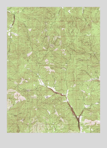
Mount Isabelle, OR USGS Topographic Map
Click on map above to begin viewing in our Map Viewer.

This topographic map contains these locations and features:
Feature Name Type Latitude Longitude GNIS ID View Map
Baldy MountainSummitN42.3135°W123.0679°1135099View Map
Black (historical)LocaleN42.3012°W123.0762°1132819View Map
Brushy GulchValleyN42.3679°W123.1164°1132817View Map
Bunny MeadowsFlatN42.2860°W123.0720°1135100View Map
Cantrall CreekStreamN42.3262°W123.0095°1132827View Map
Deadhorse SpringSpringN42.2677°W123.1125°1119753View Map
Draper (historical)Populated PlaceN42.3554°W123.1206°1132810View Map
Draper Post Office (historical)Post OfficeN42.3554°W123.1206°1165177View Map
East Branch Galls CreekStreamN42.3735°W123.0525°1132813View Map
George Black GulchValleyN42.2748°W123.0178°1132824View Map
Herling Post Office (historical)Post OfficeN42.2748°W123.0220°1165390View Map
Horn GulchValleyN42.3637°W123.1150°1132816View Map
Jacksonville DamDamN42.3198°W123.0012°1131280View Map
Jacksonville ReservoirReservoirN42.3197°W123.0009°1131281View Map
Left Fork Foots CreekStreamN42.3646°W123.1162°1123032View Map
Lennox GulchValleyN42.3204°W123.0437°1135093View Map
Lilly PrairieAreaN42.3476°W123.0159°1135092View Map
Log Town CemeteryCemeteryN42.2578°W123.0263°1123352View Map
Lonesome GulchValleyN42.3707°W123.1150°1132454View Map
Lucky Boy MineMineN42.2582°W123.0414°1132821View Map
Lyons GulchValleyN42.3735°W123.1248°1132818View Map
Marshall GulchValleyN42.2921°W123.0650°1135095View Map
Max GulchValleyN42.3596°W123.1025°1132815View Map
Middle Fork Foots CreekStreamN42.3640°W123.1170°1124111View Map
Miller MountainSummitN42.3046°W123.0331°1135096View Map
Moore GulchValleyN42.3498°W123.1220°1132811View Map
Mount IsabelleSummitN42.3032°W123.1048°1122291View Map
Norling GulchValleyN42.3271°W123.0123°1135094View Map
One Horse Town (historical)LocaleN42.3221°W123.0053°1132820View Map
Oregon Belle CreekStreamN42.2973°W123.0770°1125018View Map
Oregon Belle MineMineN42.2910°W123.1031°1125019View Map
Panther GulchValleyN42.2585°W123.0950°1125167View Map
Poormans CreekStreamN42.2646°W123.0298°1136981View Map
Rail GulchValleyN42.3132°W123.0464°1135098View Map
Right Fork Forest CreekStreamN42.2860°W123.0470°1132826View Map
Rock GulchValleyN42.3026°W123.0123°1132825View Map
Sailor GulchValleyN42.3023°W123.0034°1135097View Map
Sturgis MineMineN42.2807°W123.0450°1127682View Map
SugarloafSummitN42.2835°W123.1238°1127691View Map
Timber MountainSummitN42.3248°W123.0693°1128107View Map
Wellington ButteSummitN42.2623°W123.1070°1128794View Map
West Branch Galls CreekStreamN42.3735°W123.0525°1132814View Map
Winningham ReservoirReservoirN42.2813°W123.0454°1132823View Map

Note: Coordinates in the location and feature list above are referenced to NAD83 datum.


Copyright (C) 2008-2024 Ryan Niemi / Sunset Dynamics ... All Rights Reserved