TopoQuest Logo
Do you find TopoQuest useful?
Help keep TopoQuest running and adding new maps/features by donating!
Bitcoin:  19c7KJd3qBynnjoSw5npx9KScwjBe4ifkT
Litecoin:  LXs6TkuXGGXo1vDsWCkWVdjQX94eUKd6ui
Home View Maps Find Maps Find Places Resources & Links


Sterling Creek, Oregon Topographic Map

USGS Map Title: Sterling Creek, OR
USGS Map MRC: 42122B8
DRG (GeoTIFF) Download: o42122b8.tif


Neighboring USGS Topographic Map Quads:


  Mount Isabelle, OR  
42123C1
 

  Medford West, OR  
42122C8
 

  Medford East, OR  
42122C7
 

  Ruch, OR  
42123B1
 

  Sterling Creek, OR  
42122B8
 

  Talent, OR  
42122B7
 

  Squaw Lakes, OR  
42123A1
 

  Dutchman Peak, OR  
42122A8
 

  Siskiyou Peak, OR  
42122A7


Map MRC Location:

N43°
W123°
N43°
W122°
H8 H7 H6 H5 H4 H3 H2 H1
G8 G7 G6 G5 G4 G3 G2 G1
F8 F7 F6 F5 F4 F3 F2 F1
E8 E7 E6 E5 E4 E3 E2 E1
D8 D7 D6 D5 D4 D3 D2 D1
C8 C7 C6 C5 C4 C3 C2 C1
B8 B7 B6 B5 B4 B3 B2 B1
A8 A7 A6 A5 A4 A3 A2 A1
N42°
W123°
N42°
W122°

Sterling Creek, OR USGS 1:24K Topographic Map Preview:
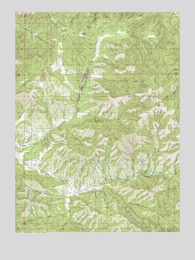
Sterling Creek, OR USGS Topographic Map
Click on map above to begin viewing in our Map Viewer.

This topographic map contains these locations and features:
Feature Name Type Latitude Longitude GNIS ID View Map
Anderson ButteSummitN42.2016°W122.8971°1137195View Map
Anderson Butte LookoutLocaleN42.2023°W122.8995°1167177View Map
Armstrong GulchValleyN42.1860°W122.9648°1137294View Map
Barr RanchLocaleN42.2357°W122.9045°1137541View Map
Bear GulchValleyN42.1571°W122.9128°1137713View Map
Bear Hunt GulchValleyN42.1296°W122.9542°1117386View Map
Birch CreekStreamN42.1582°W122.8956°1154719View Map
Blacksmith CreekStreamN42.1540°W122.8817°1154717View Map
Bray GulchValleyN42.1582°W122.8900°1154718View Map
Brown ReservoirReservoirN42.1786°W122.9818°1134781View Map
BuncomPopulated PlaceN42.1740°W122.9981°1138957View Map
Buncom Post Office (historical)Post OfficeN42.1740°W122.9981°1164982View Map
Cantrall GulchValleyN42.1585°W122.9731°1139316View Map
Cass RanchLocaleN42.1490°W122.8770°1139434View Map
Crump (historical)LocaleN42.1498°W122.9512°1154716View Map
Deep GulchValleyN42.1582°W122.9039°1154720View Map
Deming GulchValleyN42.1915°W122.9517°1140889View Map
Dutch GulchValleyN42.2246°W122.9392°1141430View Map
First Water GulchValleyN42.1357°W122.9598°1158233View Map
Gilson GulchValleyN42.1987°W122.9570°1142744View Map
Goat Cabin RidgeRidgeN42.1715°W122.8786°1142780View Map
Grouse CreekStreamN42.1640°W122.9950°1143125View Map
Grub GulchValleyN42.2123°W122.9437°1143143View Map
Hopkins GulchValleyN42.2132°W122.9512°1143727View Map
Hukill HollowValleyN42.1848°W122.9742°1143900View Map
Left Fork Lick GulchValleyN42.1410°W122.9159°1144921View Map
Lick GulchValleyN42.1518°W122.9348°1144989View Map
Little Applegate Recreation SiteParkN42.1499°W122.8789°1162386View Map
Little Lick CreekStreamN42.1507°W122.9331°1145199View Map
McCormick GulchValleyN42.1490°W122.9542°1145944View Map
Miller GulchValleyN42.2229°W122.9473°1146272View Map
Muddy GulchValleyN42.1590°W122.8984°1146616View Map
Nelson MeadowFlatN42.2373°W122.9512°1134783View Map
Nelson MountainSummitN42.2397°W122.9466°1134782View Map
Owl GulchValleyN42.1540°W122.8850°1134784View Map
Post GulchValleyN42.2360°W122.9081°1154724View Map
Rush CreekStreamN42.1493°W122.8792°1148846View Map
Sailor GulchValleyN42.2307°W122.9428°1148947View Map
Schlesinger ReservoirReservoirN42.1848°W122.9725°1134780View Map
Skate GulchValleyN42.1279°W122.9500°1149579View Map
Sleppy MineMineN42.2129°W122.8811°1149678View Map
Southwest Jackson DivisionCivilN42.1678°W122.9796°1938130View Map
Sterling CemeteryCemeteryN42.2148°W122.9509°1150408View Map
Sterling CreekStreamN42.1723°W122.9998°1150409View Map
Sterling DitchCanalN42.1982°W122.9470°1150410View Map
Sterlingville Post Office (historical)Post OfficeN42.2248°W122.9428°1165994View Map
Thunder GulchValleyN42.1554°W122.9234°1154721View Map
Trickle CreekStreamN42.2276°W122.9400°1154723View Map
Tunnel RidgeRidgeN42.1724°W122.9081°1128305View Map
Tunnel Ridge Recreation SiteParkN42.1642°W122.8932°1162385View Map
Waters GulchValleyN42.1304°W122.9620°1151956View Map
Wolf GapGapN42.1782°W122.9323°1152588View Map
Wolf GulchValleyN42.1557°W122.9295°1152589View Map
Yale CreekStreamN42.1485°W122.9575°1152689View Map

Note: Coordinates in the location and feature list above are referenced to NAD83 datum.


Copyright (C) 2008-2024 Ryan Niemi / Sunset Dynamics ... All Rights Reserved