TopoQuest Logo
Do you find TopoQuest useful?
Help keep TopoQuest running and adding new maps/features by donating!
Bitcoin:  19c7KJd3qBynnjoSw5npx9KScwjBe4ifkT
Litecoin:  LXs6TkuXGGXo1vDsWCkWVdjQX94eUKd6ui
Home View Maps Find Maps Find Places Resources & Links


Ruidoso Downs, New Mexico Topographic Map

USGS Map Title: Ruidoso Downs, NM
USGS Map MRC: 33105C5
DRG (GeoTIFF) Download: o33105c5.tif


Neighboring USGS Topographic Map Quads:


  Angus, NM  
33105D6
 

  Fort Stanton, NM  
33105D5
 

  Lincoln, NM  
33105D4
 

  Ruidoso, NM  
33105C6
 

  Ruidoso Downs, NM  
33105C5
 

  Sheeppen Canyon, NM  
33105C4
 

  Apache Summit, NM  
33105B6
 

  Whitetail, NM  
33105B5
 

  Pajarita Mountain, NM  
33105B4


Map MRC Location:

N34°
W106°
N34°
W105°
H8 H7 H6 H5 H4 H3 H2 H1
G8 G7 G6 G5 G4 G3 G2 G1
F8 F7 F6 F5 F4 F3 F2 F1
E8 E7 E6 E5 E4 E3 E2 E1
D8 D7 D6 D5 D4 D3 D2 D1
C8 C7 C6 C5 C4 C3 C2 C1
B8 B7 B6 B5 B4 B3 B2 B1
A8 A7 A6 A5 A4 A3 A2 A1
N33°
W106°
N33°
W105°

Ruidoso Downs, NM USGS 1:24K Topographic Map Preview:
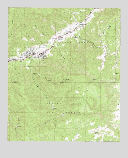
Ruidoso Downs, NM USGS Topographic Map
Click on map above to begin viewing in our Map Viewer.

This topographic map contains these locations and features:
Feature Name Type Latitude Longitude GNIS ID View Map
Allison CanyonValleyN33.3706°W105.5305°912797View Map
Baston SpringSpringN33.3134°W105.5977°903604View Map
Bear SpringSpringN33.2638°W105.6157°903668View Map
Beavers PitMineN33.3315°W105.5883°916211View Map
Blanche TankReservoirN33.3443°W105.5605°913305View Map
Cherokee Bill CanyonValleyN33.3237°W105.6247°905067View Map
City of Ruidoso DownsCivilN33.3312°W105.5968°2411014View Map
First Baptist ChurchChurchN33.3290°W105.6044°901799View Map
Fox TankReservoirN33.3626°W105.5211°913302View Map
Gavilan RidgeRidgeN33.3567°W105.6214°906510View Map
Grapevine CanyonValleyN33.3256°W105.6167°906698View Map
Hale CanyonValleyN33.3462°W105.5747°906807View Map
Hale Canyon TankReservoirN33.3245°W105.5522°913300View Map
Herrera DitchCanalN33.3279°W105.6067°906940View Map
Hollywood PitMineN33.3376°W105.5764°915304View Map
Johnson CanyonValleyN33.3381°W105.5883°907404View Map
KRUI-AM (Ruidoso Downs)TowerN33.3215°W105.5905°938745View Map
No Water TankReservoirN33.3074°W105.5277°909099View Map
Pajarita FlatsAreaN33.2779°W105.5017°909442View Map
Palo Verde CanyonValleyN33.3562°W105.5517°909450View Map
Pepper TankReservoirN33.3577°W105.5138°909563View Map
Pine CanyonValleyN33.3126°W105.5983°909649View Map
Pine SpringSpringN33.3068°W105.5818°909676View Map
Pine TankReservoirN33.3202°W105.5328°913301View Map
Pine TankReservoirN33.3079°W105.5611°909687View Map
Pothole LakeLakeN33.3494°W105.5228°909817View Map
Red Bluff TankReservoirN33.3543°W105.6036°913304View Map
Ruidoso Christian SchoolSchoolN33.3456°W105.6044°901557View Map
Ruidoso DownsPopulated PlaceN33.3290°W105.6044°923669View Map
Ruidoso Downs Police DepartmentBuildingN33.3304°W105.5911°2657632View Map
Ruidoso Downs Post OfficePost OfficeN33.3290°W105.6044°937945View Map
Ruidoso Downs Race TrackParkN33.3318°W105.6080°913303View Map
Ruidoso Word MinistriesChurchN33.3290°W105.5930°901959View Map
Salsbury CanyonValleyN33.3465°W105.5769°910569View Map
Seeping Springs LakesLakeN33.3599°W105.5448°910930View Map
Seventh Day Adventist ChurchChurchN33.3290°W105.6044°901713View Map
Stetson CemeteryCemeteryN33.3526°W105.5566°911409View Map
Turkey SpringSpringN33.2740°W105.5636°911894View Map
Turkey Spring CanyonValleyN33.3379°W105.5900°911898View Map
Turkey Spring Number TwoSpringN33.2806°W105.5759°911901View Map
Whitetail MountainSummitN33.2579°W105.5264°912339View Map

Note: Coordinates in the location and feature list above are referenced to NAD83 datum.


Copyright (C) 2008-2025 Ryan Niemi / Sunset Dynamics ... All Rights Reserved