TopoQuest Logo
Do you find TopoQuest useful?
Help keep TopoQuest running and adding new maps/features by donating!
Bitcoin:  19c7KJd3qBynnjoSw5npx9KScwjBe4ifkT
Litecoin:  LXs6TkuXGGXo1vDsWCkWVdjQX94eUKd6ui
Home View Maps Find Maps Find Places Resources & Links


Whitetail, New Mexico Topographic Map

USGS Map Title: Whitetail, NM
USGS Map MRC: 33105B5
DRG (GeoTIFF) Download: o33105b5.tif


Neighboring USGS Topographic Map Quads:


  Ruidoso, NM  
33105C6
 

  Ruidoso Downs, NM  
33105C5
 

  Sheeppen Canyon, NM  
33105C4
 

  Apache Summit, NM  
33105B6
 

  Whitetail, NM  
33105B5
 

  Pajarita Mountain, NM  
33105B4
 

  Firman Canyon, NM  
33105A6
 

  Elk-Silver, NM  
33105A5
 

  Turkey Peak, NM  
33105A4


Map MRC Location:

N34°
W106°
N34°
W105°
H8 H7 H6 H5 H4 H3 H2 H1
G8 G7 G6 G5 G4 G3 G2 G1
F8 F7 F6 F5 F4 F3 F2 F1
E8 E7 E6 E5 E4 E3 E2 E1
D8 D7 D6 D5 D4 D3 D2 D1
C8 C7 C6 C5 C4 C3 C2 C1
B8 B7 B6 B5 B4 B3 B2 B1
A8 A7 A6 A5 A4 A3 A2 A1
N33°
W106°
N33°
W105°

Whitetail, NM USGS 1:24K Topographic Map Preview:
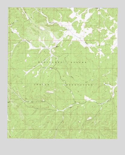
Whitetail, NM USGS Topographic Map
Click on map above to begin viewing in our Map Viewer.

This topographic map contains these locations and features:
Feature Name Type Latitude Longitude GNIS ID View Map
Bull TankReservoirN33.1767°W105.5120°886897View Map
Bull WellWellN33.1773°W105.5142°886900View Map
Encino SpringSpringN33.2498°W105.5207°888880View Map
Mescalero Apache Reservation Historical MarkerParkN33.2001°W105.6242°932964View Map
Mescalero DivisionCivilN33.1785°W105.6119°1937557View Map
Mescalero ReservationCivilN33.1785°W105.6120°924240View Map
North Fork Pine Tree CanyonValleyN33.1748°W105.5036°897426View Map
Pauls CanyonValleyN33.2109°W105.5772°893126View Map
Pine TankReservoirN33.1552°W105.5563°893285View Map
Pine Tree Canyon Damsite Number 1 DamDamN33.1468°W105.5639°923934View Map
Pine Tree Canyon Damsite Number 2 DamDamN33.1468°W105.5255°923935View Map
Pine Tree Canyon Damsite Number Seven DamDamN33.1551°W105.5455°923937View Map
Pine Tree Canyon Damsite Number Six DamDamN33.1484°W105.5589°923936View Map
WhitetailPopulated PlaceN33.2290°W105.5558°898612View Map
Whitetail CemeteryCemeteryN33.2173°W105.5730°896557View Map
Whitetail Dam Number FiveDamN33.2034°W105.5755°923942View Map
Whitetail Dam Number SixDamN33.2134°W105.5705°923943View Map
Whitetail LakeLakeN33.1922°W105.5767°896558View Map
Whitetail SpringSpringN33.2361°W105.5793°914374View Map
Whitetail SpringsSpringN33.2354°W105.5791°896559View Map
Whitetail TankReservoirN33.2130°W105.5716°896560View Map
Whitetail Weather StationLocaleN33.2290°W105.5558°931843View Map
Whitetail WellWellN33.2265°W105.6192°896561View Map
Woody TankReservoirN33.1930°W105.5813°896767View Map

Note: Coordinates in the location and feature list above are referenced to NAD83 datum.


Copyright (C) 2008-2025 Ryan Niemi / Sunset Dynamics ... All Rights Reserved