TopoQuest Logo
Do you find TopoQuest useful?
Help keep TopoQuest running and adding new maps/features by donating!
Bitcoin:  19c7KJd3qBynnjoSw5npx9KScwjBe4ifkT
Litecoin:  LXs6TkuXGGXo1vDsWCkWVdjQX94eUKd6ui
Home View Maps Find Maps Find Places Resources & Links


Ruskin, Tennessee Topographic Map

USGS Map Title: Ruskin, TN
USGS Map MRC: 36087B5
DRG (GeoTIFF) Download: o36087b5.tif


Neighboring USGS Topographic Map Quads:


  Erin, TN  
36087C6
 

  Ellis Mills, TN  
36087C5
 

  Slayden, TN  
36087C4
 

  Woolworth, TN  
36087B6
 

  Ruskin, TN  
36087B5
 

  Vanleer, TN  
36087B4
 

  McEwen, TN  
36087A6
 

  Tennessee City, TN  
36087A5
 

  Dickson, TN  
36087A4


Map MRC Location:

N37°
W88°
N37°
W87°
H8 H7 H6 H5 H4 H3 H2 H1
G8 G7 G6 G5 G4 G3 G2 G1
F8 F7 F6 F5 F4 F3 F2 F1
E8 E7 E6 E5 E4 E3 E2 E1
D8 D7 D6 D5 D4 D3 D2 D1
C8 C7 C6 C5 C4 C3 C2 C1
B8 B7 B6 B5 B4 B3 B2 B1
A8 A7 A6 A5 A4 A3 A2 A1
N36°
W88°
N36°
W87°

Ruskin, TN USGS 1:24K Topographic Map Preview:
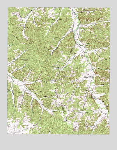
Ruskin, TN USGS Topographic Map
Click on map above to begin viewing in our Map Viewer.

This topographic map contains these locations and features:
Feature Name Type Latitude Longitude GNIS ID View Map
Adams CrossroadsPopulated PlaceN36.1814°W87.5208°1314561View Map
Adkins CemeteryCemeteryN36.2498°W87.5908°1275482View Map
Averitt HollowValleyN36.1941°W87.5541°1276010View Map
Balthrop BranchStreamN36.2134°W87.5361°1276250View Map
Balthrop CemeteryCemeteryN36.1481°W87.5808°1276251View Map
Balthrop CemeteryCemeteryN36.1976°W87.5497°1276252View Map
Bateman BranchStreamN36.1739°W87.6047°1276451View Map
Bateman CemeteryCemeteryN36.1662°W87.6070°1276453View Map
Bear CreekStreamN36.2342°W87.5383°1276598View Map
Bethany CemeteryCemeteryN36.2381°W87.5670°1277077View Map
Bethany ChurchChurchN36.2384°W87.5631°1277087View Map
Biffle HollowValleyN36.2400°W87.5463°1277221View Map
Black John HollowValleyN36.1906°W87.5190°1277582View Map
Bradford SpringSpringN36.1970°W87.5525°1278173View Map
Brown HollowValleyN36.1697°W87.6210°1278592View Map
Buckeye HollowValleyN36.2297°W87.5382°1278857View Map
Burgess HollowValleyN36.1594°W87.5856°1279040View Map
Cave BranchStreamN36.1895°W87.5206°1313311View Map
Cedar CreekStreamN36.2076°W87.5300°1280014View Map
Childress BranchStreamN36.2437°W87.5420°1305897View Map
Commissioner District 5CivilN36.2477°W87.6080°2464458View Map
Cooksey CemeteryCemeteryN36.2473°W87.5481°1281138View Map
Dickson CemeteryCemeteryN36.2095°W87.5178°1282454View Map
Dickson CemeteryCemeteryN36.2339°W87.5450°1282455View Map
Dickson CemeteryCemeteryN36.2387°W87.5047°1282456View Map
Dilley HollowValleyN36.1783°W87.5347°1306348View Map
Dobbins HollowValleyN36.2322°W87.6044°1282535View Map
Dodd BranchStreamN36.1514°W87.5083°1282550View Map
Dotson CemeteryCemeteryN36.1545°W87.5581°1282672View Map
Dotson CemeteryCemeteryN36.1576°W87.5872°1282673View Map
Dry HollowValleyN36.1688°W87.5249°1282994View Map
East Fork Yellow CreekStreamN36.1612°W87.5167°1269561View Map
EdgewoodPopulated PlaceN36.1817°W87.5308°1283521View Map
Edgewood CemeteryCemeteryN36.1856°W87.5286°1283524View Map
Edgewood School (historical)SchoolN36.1814°W87.5303°1324069View Map
Edgewood United Methodist ChurchChurchN36.1823°W87.5292°1324070View Map
Ennis BranchStreamN36.1745°W87.6056°1283804View Map
Etheridge CemeteryCemeteryN36.1473°W87.5692°1283869View Map
Fowler HollowValleyN36.1949°W87.5266°1284750View Map
Freeman BranchStreamN36.1759°W87.5200°1313323View Map
Freeman HollowValleyN36.1737°W87.5189°1284892View Map
Gravelly RunStreamN36.1823°W87.6206°1285944View Map
Hargrove CemeteryCemeteryN36.1623°W87.5675°1286871View Map
Hatcher HollowValleyN36.1623°W87.5942°1287110View Map
Hooper CemeteryCemeteryN36.1648°W87.5978°1288245View Map
Hooper CemeteryCemeteryN36.1717°W87.6056°1288246View Map
Horse HollowValleyN36.1568°W87.5080°1288404View Map
Hudson CemeteryCemeteryN36.1542°W87.5842°1288624View Map
Hunt BranchStreamN36.1823°W87.5197°1288713View Map
Jamison HollowValleyN36.1834°W87.6211°1289290View Map
Jones CemeteryCemeteryN36.2142°W87.5611°1289749View Map
Jones HollowValleyN36.2450°W87.5956°1289806View Map
Jordan BranchStreamN36.2470°W87.5325°1289834View Map
Long CemeteryCemeteryN36.1470°W87.5356°1291922View Map
Long CemeteryCemeteryN36.1678°W87.6028°1291923View Map
Marthas ChapelPopulated PlaceN36.2467°W87.5320°1313337View Map
Marthas ChapelChurchN36.2478°W87.5322°1292787View Map
Masterson HollowValleyN36.2385°W87.6080°1309105View Map
Mayhan HollowValleyN36.2238°W87.5412°1293015View Map
Murphy HollowValleyN36.1836°W87.5181°1295127View Map
Nesbitt CemeteryCemeteryN36.1976°W87.5289°1295400View Map
Newman HollowValleyN36.2328°W87.5189°1295695View Map
Nichols CemeteryCemeteryN36.2128°W87.5303°1295724View Map
Nubbin RidgeRidgeN36.1826°W87.5495°1296008View Map
Olivet ChurchChurchN36.1687°W87.5970°1296428View Map
Olivet School (historical)SchoolN36.1684°W87.5967°1316977View Map
Omega (historical)Populated PlaceN36.2417°W87.5389°1309108View Map
Patty CemeteryCemeteryN36.2048°W87.5447°1296989View Map
Potter CemeteryCemeteryN36.2300°W87.5467°1298350View Map
Ragan CemeteryCemeteryN36.2373°W87.5125°1298814View Map
Randolph HollowValleyN36.2125°W87.5309°1298904View Map
Robertson CemeteryCemeteryN36.2073°W87.6011°1299665View Map
Rock Ditch HollowValleyN36.1470°W87.5011°1299758View Map
Rogers SpringSpringN36.1681°W87.5250°1313351View Map
RuskinPopulated PlaceN36.1609°W87.5192°1306976View Map
Ruskin Cave SpringSpringN36.1609°W87.5206°1652310View Map
Ruskin School (historical)SchoolN36.1606°W87.5175°1324188View Map
Salmon Branch ChurchChurchN36.2292°W87.6053°1300586View Map
Sawmill Branch DamDamN36.1284°W87.5433°1302380View Map
Sawmill Branch LakeReservoirN36.1293°W87.5432°1302381View Map
Sheehy HollowValleyN36.1789°W87.6187°1269955View Map
Shoulder Strap BranchStreamN36.2273°W87.5442°1270226View Map
Skelton CemeteryCemeteryN36.2295°W87.5389°1270428View Map
Smith HollowValleyN36.1643°W87.5932°1270687View Map
Smith HollowValleyN36.2068°W87.5184°1270694View Map
Spring ValleyPopulated PlaceN36.2298°W87.6056°1309107View Map
Spring Valley School (historical)SchoolN36.2301°W87.6056°1309106View Map
Stanfield HollowValleyN36.2384°W87.6039°1271232View Map
Sylvia - Yellow Creek Fire DepartmentBuildingN36.1831°W87.5294°2654282View Map
Thompson CemeteryCemeteryN36.1495°W87.5111°1272527View Map
Thompson Crossroads School (historical)SchoolN36.1495°W87.5331°1324227View Map
Thompson HollowValleyN36.1515°W87.5124°1272550View Map
Thompsons CrossroadsPopulated PlaceN36.1501°W87.5317°1314396View Map
Tubbs HollowValleyN36.2069°W87.5706°1272930View Map
Union ChurchChurchN36.1531°W87.5025°1304231View Map
Union HollowValleyN36.1527°W87.5049°1273244View Map
Union School (historical)SchoolN36.1534°W87.5033°1324231View Map
Vanhook CemeteryCemeteryN36.1884°W87.5603°1273373View Map
Vanhook HollowValleyN36.1891°W87.5595°1273374View Map
Vanhook SpringSpringN36.1898°W87.5586°1273375View Map
Wesley Chapel School (historical)SchoolN36.2084°W87.5256°1324247View Map
Wesley Chapel United Methodist ChurchChurchN36.2081°W87.5272°1324248View Map
Whiteoak BranchStreamN36.1814°W87.5197°1313363View Map
Williams CemeteryCemeteryN36.1381°W87.5022°1274668View Map
Williams HollowValleyN36.1760°W87.6035°1274705View Map
Williamsville (historical)Populated PlaceN36.1384°W87.5017°1313364View Map
Wright CemeteryCemeteryN36.1334°W87.5231°1275162View Map
Yates CemeteryCemeteryN36.1364°W87.5495°1275249View Map
Yellow CreekPopulated PlaceN36.1528°W87.5050°1647712View Map
Yellow Creek ChurchChurchN36.1826°W87.5106°1275278View Map

Note: Coordinates in the location and feature list above are referenced to NAD83 datum.


Copyright (C) 2008-2025 Ryan Niemi / Sunset Dynamics ... All Rights Reserved