TopoQuest Logo
Do you find TopoQuest useful?
Help keep TopoQuest running and adding new maps/features by donating!
Bitcoin:  19c7KJd3qBynnjoSw5npx9KScwjBe4ifkT
Litecoin:  LXs6TkuXGGXo1vDsWCkWVdjQX94eUKd6ui
Home View Maps Find Maps Find Places Resources & Links


Woolworth, Tennessee Topographic Map

USGS Map Title: Woolworth, TN
USGS Map MRC: 36087B6
DRG (GeoTIFF) Download: o36087b6.tif


Neighboring USGS Topographic Map Quads:


  Stewart, TN  
36087C7
 

  Erin, TN  
36087C6
 

  Ellis Mills, TN  
36087C5
 

  Halls Creek, TN  
36087B7
 

  Woolworth, TN  
36087B6
 

  Ruskin, TN  
36087B5
 

  Waverly, TN  
36087A7
 

  McEwen, TN  
36087A6
 

  Tennessee City, TN  
36087A5


Map MRC Location:

N37°
W88°
N37°
W87°
H8 H7 H6 H5 H4 H3 H2 H1
G8 G7 G6 G5 G4 G3 G2 G1
F8 F7 F6 F5 F4 F3 F2 F1
E8 E7 E6 E5 E4 E3 E2 E1
D8 D7 D6 D5 D4 D3 D2 D1
C8 C7 C6 C5 C4 C3 C2 C1
B8 B7 B6 B5 B4 B3 B2 B1
A8 A7 A6 A5 A4 A3 A2 A1
N36°
W88°
N36°
W87°

Woolworth, TN USGS 1:24K Topographic Map Preview:
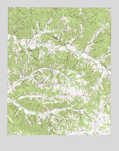
Woolworth, TN USGS Topographic Map
Click on map above to begin viewing in our Map Viewer.

This topographic map contains these locations and features:
Feature Name Type Latitude Longitude GNIS ID View Map
Adams CemeteryCemeteryN36.2070°W87.7350°1275462View Map
Arnold HollowValleyN36.1827°W87.7220°1275892View Map
Bateman HollowValleyN36.1493°W87.6890°1276454View Map
Batson CemeteryCemeteryN36.2278°W87.7072°1276471View Map
Bentons Mill (historical)LocaleN36.1501°W87.6747°1316914View Map
Blowing SpringSpringN36.2159°W87.7089°1277731View Map
Brigham HollowValleyN36.2182°W87.7366°1278383View Map
Brown HollowValleyN36.1447°W87.7054°1278588View Map
Cable HollowValleyN36.1885°W87.6957°1279273View Map
Campground HollowValleyN36.2158°W87.6473°1279482View Map
Carroll HollowValleyN36.2282°W87.6914°1305703View Map
Cleghern CemeteryCemeteryN36.2148°W87.7197°1280693View Map
Coleman CemeteryCemeteryN36.1806°W87.6253°1280946View Map
Commissioner District 7CivilN36.1553°W87.6390°2464620View Map
Cumberland Valley ChurchChurchN36.2059°W87.6589°1281843View Map
Cummins HollowValleyN36.2023°W87.6647°1281857View Map
Curtis ChapelChurchN36.1459°W87.6625°1281898View Map
Curtis Chapel CemeteryCemeteryN36.1481°W87.6647°1281899View Map
Curtis HollowValleyN36.2084°W87.7412°1281902View Map
Curtis SpringSpringN36.1470°W87.6646°1281904View Map
Deep GutGapN36.2484°W87.6939°1282288View Map
Deer Creek ChurchChurchN36.1806°W87.7320°1306317View Map
Dry HollowValleyN36.1572°W87.7415°1282993View Map
Gertrude School (historical)SchoolN36.1764°W87.7378°1316938View Map
Grindstone HollowValleyN36.2105°W87.6974°1286312View Map
Half BranchStreamN36.2034°W87.6620°1286543View Map
Half Pone BranchStreamN36.2037°W87.6622°1309103View Map
Half Pone HollowValleyN36.2080°W87.6558°1309102View Map
Harvey CemeteryCemeteryN36.2278°W87.6397°1287072View Map
Hatcher HollowValleyN36.1474°W87.6962°1287109View Map
Highview ChurchChurchN36.1648°W87.6753°1287769View Map
Hooper CemeteryCemeteryN36.1487°W87.6600°1288244View Map
Hooper HollowValleyN36.1496°W87.6586°1288251View Map
Jack HollowValleyN36.1914°W87.6402°1289156View Map
Jackson HollowValleyN36.2261°W87.7055°1289228View Map
John Ross HollowValleyN36.2288°W87.6920°1647126View Map
Johnson HollowValleyN36.1521°W87.7364°1289618View Map
Judy BranchStreamN36.1951°W87.6431°1269697View Map
Judy Branch School (historical)SchoolN36.2056°W87.6284°1309104View Map
Kennerly HollowValleyN36.1436°W87.7121°1290086View Map
King BranchStreamN36.1298°W87.6409°1290192View Map
Knight CemeteryCemeteryN36.2114°W87.6500°1290364View Map
Knight HollowValleyN36.2073°W87.6556°1290370View Map
Lewis CemeteryCemeteryN36.2239°W87.7445°1291073View Map
Lewis HollowValleyN36.2230°W87.7183°1291087View Map
Limekiln HollowValleyN36.1438°W87.7175°1291292View Map
McNeil School (historical)SchoolN36.1462°W87.7211°1316968View Map
Mill BranchStreamN36.1445°W87.7089°1293813View Map
Mount Olivet Hill School (historical)SchoolN36.1728°W87.6592°1316970View Map
Mount Zion ChurchChurchN36.1731°W87.6850°1306800View Map
Mount Zion School (historical)SchoolN36.1731°W87.6859°1316971View Map
Mule Lot HollowValleyN36.2140°W87.7091°1295069View Map
New Hope ChurchChurchN36.2073°W87.7253°1295553View Map
North Fork Deer CreekStreamN36.1820°W87.7236°1295879View Map
Oak Grove Baptist ChurchChurchN36.1759°W87.6897°1296107View Map
Patterson BranchStreamN36.2128°W87.6814°1296930View Map
Patterson HollowValleyN36.2136°W87.6764°1309100View Map
Peach CreekStreamN36.1926°W87.6361°1297043View Map
Peanut HollowValleyN36.1460°W87.7154°1297068View Map
Perry HollowValleyN36.2028°W87.7244°1297219View Map
Pine Hill ChurchChurchN36.1839°W87.6267°1297548View Map
Pine Hill School (historical)SchoolN36.1842°W87.6267°1316982View Map
Pinhook BranchStreamN36.2112°W87.7264°1297661View Map
Pleasant Ridge ChurchChurchN36.2270°W87.6784°1297915View Map
Richardson CemeteryCemeteryN36.2078°W87.6895°1299340View Map
Richardson HollowValleyN36.2081°W87.6754°1299345View Map
Richardson School (historical)SchoolN36.2098°W87.6914°1316989View Map
Ridings CemeteryCemeteryN36.2134°W87.7300°1299417View Map
Robertson RidgeRidgeN36.1337°W87.6686°1647374View Map
Ross CemeteryCemeteryN36.2059°W87.6550°1300121View Map
Ross CemeteryCemeteryN36.2089°W87.6772°1300122View Map
Sanderson HollowValleyN36.1420°W87.7257°1300713View Map
SilvertopPopulated PlaceN36.2059°W87.6584°1314294View Map
Silvertop School (historical)SchoolN36.2064°W87.6592°1309101View Map
Sinks CemeteryCemeteryN36.2164°W87.7167°1270395View Map
Sinks HollowValleyN36.2109°W87.7152°1270396View Map
Smith BranchStreamN36.1884°W87.6289°1270574View Map
Smith CemeteryCemeteryN36.1834°W87.7497°1270627View Map
Smith CemeteryCemeteryN36.1842°W87.6606°1270628View Map
Smith CemeteryCemeteryN36.1906°W87.6817°1270630View Map
Smith CemeteryCemeteryN36.1953°W87.6406°1270631View Map
Smith HollowValleyN36.1723°W87.7457°1270693View Map
South Fork Deer CreekStreamN36.1820°W87.7236°1270859View Map
Sugarcamp HollowValleyN36.2235°W87.7434°1303907View Map
Trotter HollowValleyN36.2030°W87.7254°1272905View Map
Turner HollowValleyN36.2137°W87.6871°1304205View Map
Turners Mill (historical)LocaleN36.1551°W87.7431°1317003View Map
Warden HollowValleyN36.2247°W87.7124°1273800View Map
Wheeler HollowValleyN36.1792°W87.7317°1274291View Map
WoolworthPopulated PlaceN36.2187°W87.7197°1275116View Map
Woolworth School (historical)SchoolN36.2145°W87.7250°1317018View Map
Yates CemeteryCemeteryN36.2056°W87.6270°1275251View Map

Note: Coordinates in the location and feature list above are referenced to NAD83 datum.


Copyright (C) 2008-2025 Ryan Niemi / Sunset Dynamics ... All Rights Reserved