TopoQuest Logo
Do you find TopoQuest useful?
Help keep TopoQuest running and adding new maps/features by donating!
Bitcoin:  19c7KJd3qBynnjoSw5npx9KScwjBe4ifkT
Litecoin:  LXs6TkuXGGXo1vDsWCkWVdjQX94eUKd6ui
Home View Maps Find Maps Find Places Resources & Links


Russell Peak, California Topographic Map

USGS Map Title: Russell Peak, CA
USGS Map MRC: 41122F8
DRG (GeoTIFF) Download: o41122f8.tif


Neighboring USGS Topographic Map Quads:


  Hamburg, CA  
41123G1
 

  Horse Creek, CA  
41122G8
 

  McKinley Mountain, CA  
41122G7
 

  Scott Bar, CA  
41123F1
 

  Russell Peak, CA  
41122F8
 

  Indian Creek Baldy, CA  
41122F7
 

  Boulder Peak, CA  
41123E1
 

  Greenview, CA  
41122E8
 

  Fort Jones, CA  
41122E7


Map MRC Location:

N42°
W123°
N42°
W122°
H8 H7 H6 H5 H4 H3 H2 H1
G8 G7 G6 G5 G4 G3 G2 G1
F8 F7 F6 F5 F4 F3 F2 F1
E8 E7 E6 E5 E4 E3 E2 E1
D8 D7 D6 D5 D4 D3 D2 D1
C8 C7 C6 C5 C4 C3 C2 C1
B8 B7 B6 B5 B4 B3 B2 B1
A8 A7 A6 A5 A4 A3 A2 A1
N41°
W123°
N41°
W122°

Russell Peak, CA USGS 1:24K Topographic Map Preview:
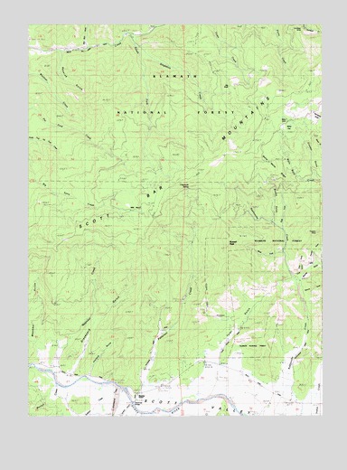
Russell Peak, CA USGS Topographic Map
Click on map above to begin viewing in our Map Viewer.

This topographic map contains these locations and features:
Feature Name Type Latitude Longitude GNIS ID View Map
Baker CabinLocaleN41.7196°W122.8920°218537View Map
Baker FlatFlatN41.7165°W122.8898°218543View Map
Big RockPillarN41.7293°W122.9153°219238View Map
Brushy GulchValleyN41.6876°W122.8967°219949View Map
Chipmunk SpringSpringN41.6977°W122.9328°1657371View Map
Crooker GulchValleyN41.7026°W122.8789°221849View Map
East Fork Rattlesnake CreekStreamN41.6854°W122.8928°222894View Map
Fort Jones DivisionCivilN41.7011°W122.9117°1935108View Map
Franklin GulchValleyN41.6735°W122.8789°252307View Map
Franklin MineMineN41.6835°W122.8784°1657386View Map
Graveyard GulchValleyN41.6396°W122.9814°224512View Map
Gumboot MineMineN41.7474°W122.8839°224737View Map
Hossick GulchValleyN41.7412°W122.9870°1657394View Map
Joyland GulchValleyN41.6390°W122.9745°226361View Map
Lone Star School (historical)SchoolN41.6307°W122.8923°1682309View Map
Marilyn CreekStreamN41.6393°W122.9945°1657405View Map
Meamber BridgeBridgeN41.6290°W122.9570°1657407View Map
Meamber CreekStreamN41.6390°W122.9909°228469View Map
Meamber GulchValleyN41.6432°W122.9925°228470View Map
Meamber SchoolSchoolN41.6315°W122.9536°228471View Map
Milk Ranch MeadowsFlatN41.6915°W122.9595°219217View Map
Moores GulchValleyN41.6696°W122.8850°234326View Map
New Barn GulchValleyN41.7437°W122.9761°229482View Map
Patterson CreekStreamN41.6291°W122.9567°2760236View Map
Russell PeakSummitN41.6790°W122.9161°232043View Map
Scott Bar MountainsRangeN41.6999°W122.9428°232718View Map
Scott Valley Fire Protection District Scott RiverBuildingN41.6336°W122.9457°2621939View Map
Shackleford CreekStreamN41.6329°W122.9609°232832View Map
Sheba MineMineN41.6765°W122.9311°276424View Map
Shelba MineMineN41.6774°W122.9289°232926View Map
Singleton CreekStreamN41.7435°W122.9539°233174View Map
Slug CreekStreamN41.6740°W122.8786°233299View Map
Slug GulchValleyN41.6707°W122.8839°252304View Map
Sniktaw CreekStreamN41.6349°W122.9706°234760View Map
South Fork Mill CreekStreamN41.7468°W122.9581°235027View Map
Titcomb GulchValleyN41.6660°W122.8839°236398View Map
Tyler GulchValleyN41.6468°W122.9181°236739View Map
Walla Walla RidgeRidgeN41.7049°W122.8964°237192View Map
West Fork Rattlesnake CreekStreamN41.6776°W122.8923°237480View Map

Note: Coordinates in the location and feature list above are referenced to NAD83 datum.


Copyright (C) 2008-2024 Ryan Niemi / Sunset Dynamics ... All Rights Reserved