TopoQuest Logo
Do you find TopoQuest useful?
Help keep TopoQuest running and adding new maps/features by donating!
Bitcoin:  19c7KJd3qBynnjoSw5npx9KScwjBe4ifkT
Litecoin:  LXs6TkuXGGXo1vDsWCkWVdjQX94eUKd6ui
Home View Maps Find Maps Find Places Resources & Links


McKinley Mountain, California Topographic Map

USGS Map Title: McKinley Mountain, CA
USGS Map MRC: 41122G7
DRG (GeoTIFF) Download: o41122g7.tif


Neighboring USGS Topographic Map Quads:


  Condrey Mountain, CA  
41122H8
 

  Buckhorn Bally, CA  
41122H7
 

  Cottonwood Peak, CA  
41122H6
 

  Horse Creek, CA  
41122G8
 

  McKinley Mountain, CA  
41122G7
 

  Badger Mountain, CA  
41122G6
 

  Russell Peak, CA  
41122F8
 

  Indian Creek Baldy, CA  
41122F7
 

  Yreka, CA  
41122F6


Map MRC Location:

N42°
W123°
N42°
W122°
H8 H7 H6 H5 H4 H3 H2 H1
G8 G7 G6 G5 G4 G3 G2 G1
F8 F7 F6 F5 F4 F3 F2 F1
E8 E7 E6 E5 E4 E3 E2 E1
D8 D7 D6 D5 D4 D3 D2 D1
C8 C7 C6 C5 C4 C3 C2 C1
B8 B7 B6 B5 B4 B3 B2 B1
A8 A7 A6 A5 A4 A3 A2 A1
N41°
W123°
N41°
W122°

McKinley Mountain, CA USGS 1:24K Topographic Map Preview:
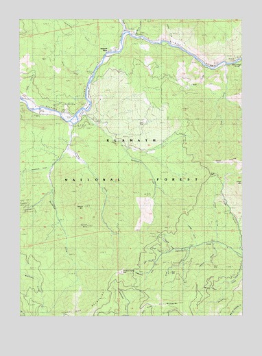
McKinley Mountain, CA USGS Topographic Map
Click on map above to begin viewing in our Map Viewer.

This topographic map contains these locations and features:
Feature Name Type Latitude Longitude GNIS ID View Map
Barkhouse CreekStreamN41.8132°W122.8581°256525View Map
Bearcat MountainSummitN41.7957°W122.8406°256744View Map
Beaver CreekStreamN41.8696°W122.8175°256765View Map
Boyer MineMineN41.7676°W122.7925°257422View Map
Cedar CoveValleyN41.8421°W122.8745°258112View Map
Cedar FlatFlatN41.8337°W122.8125°258128View Map
China GulchValleyN41.7757°W122.7973°258312View Map
Cougar GulchValleyN41.8660°W122.7917°258780View Map
Cousins GulchValleyN41.7779°W122.7900°258788View Map
Deadwood Baldy PeakSummitN41.7685°W122.8186°274731View Map
Deadwood LookoutLocaleN41.7682°W122.8192°259156View Map
Eagles Nest BarBarN41.8443°W122.8378°1657599View Map
Eagles Nest Golf CourseLocaleN41.8354°W122.8414°1657600View Map
Eliza GulchValleyN41.7762°W122.7806°259839View Map
Eliza MineMineN41.7612°W122.7836°259840View Map
Elmo GulchValleyN41.7726°W122.8006°259877View Map
Goodenough MineMineN41.7951°W122.8725°260698View Map
Grouse CreekStreamN41.8307°W122.8478°260944View Map
Haystack ButteSummitN41.7879°W122.8386°261189View Map
Headwater GulchValleyN41.7676°W122.8045°261204View Map
Hegler MineMineN41.7712°W122.7673°261228View Map
Horse Trough SpringSpringN41.8568°W122.7517°1657626View Map
Jakes GulchValleyN41.7815°W122.7648°261892View Map
Klamath RiverPopulated PlaceN41.8612°W122.8256°1682307View Map
Klamath River Post OfficePost OfficeN41.8358°W122.8515°1662303View Map
Lashes GulchValleyN41.7799°W122.7767°262322View Map
Lawson GulchValleyN41.7796°W122.7673°262373View Map
Little Barkhouse GulchValleyN41.8127°W122.8590°262521View Map
Little Humbug CreekStreamN41.8362°W122.8409°262635View Map
McKinley MineMineN41.7618°W122.7709°263389View Map
McKinley MountainSummitN41.7546°W122.7945°263390View Map
Miller GulchValleyN41.8699°W122.8103°263634View Map
Norma MineMineN41.8143°W122.7931°1682317View Map
Oak Knoll Ranger StationLocaleN41.8393°W122.8506°1655136View Map
Oaks Mobile Home And Recreational Vehicle ParkPopulated PlaceN41.8350°W122.8519°2515991View Map
Quigleys CoveValleyN41.8626°W122.8281°265110View Map
Rider GapGapN41.8090°W122.7695°1657673View Map
Rider GulchValleyN41.7782°W122.7525°265415View Map
Round BarBarN41.8376°W122.8370°265594View Map
Smith GulchValleyN41.8501°W122.8398°266325View Map
Timber GulchValleyN41.8537°W122.7703°268285View Map
United States Forest Service Oak Knoll Ranger StationBuildingN41.8393°W122.8501°2622033View Map
Vesa BluffsCliffN41.8182°W122.7539°268686View Map
Vesa CreekStreamN41.8562°W122.7620°268687View Map
Vesa Creek TrailTrailN41.8376°W122.7525°268688View Map
WalkerPopulated PlaceN41.8340°W122.8395°1682327View Map
Walker BridgeBridgeN41.8374°W122.8649°268747View Map

Note: Coordinates in the location and feature list above are referenced to NAD83 datum.


Copyright (C) 2008-2024 Ryan Niemi / Sunset Dynamics ... All Rights Reserved