TopoQuest Logo
Do you find TopoQuest useful?
Help keep TopoQuest running and adding new maps/features by donating!
Bitcoin:  19c7KJd3qBynnjoSw5npx9KScwjBe4ifkT
Litecoin:  LXs6TkuXGGXo1vDsWCkWVdjQX94eUKd6ui
Home View Maps Find Maps Find Places Resources & Links


Scott Bar, California Topographic Map

USGS Map Title: Scott Bar, CA
USGS Map MRC: 41123F1
DRG (GeoTIFF) Download: o41123f1.tif


Neighboring USGS Topographic Map Quads:


  Seiad Valley, CA  
41123G2
 

  Hamburg, CA  
41123G1
 

  Horse Creek, CA  
41122G8
 

  Grider Valley, CA  
41123F2
 

  Scott Bar, CA  
41123F1
 

  Russell Peak, CA  
41122F8
 

  Marble Mountain, CA  
41123E2
 

  Boulder Peak, CA  
41123E1
 

  Greenview, CA  
41122E8


Map MRC Location:

N42°
W124°
N42°
W123°
H8 H7 H6 H5 H4 H3 H2 H1
G8 G7 G6 G5 G4 G3 G2 G1
F8 F7 F6 F5 F4 F3 F2 F1
E8 E7 E6 E5 E4 E3 E2 E1
D8 D7 D6 D5 D4 D3 D2 D1
C8 C7 C6 C5 C4 C3 C2 C1
B8 B7 B6 B5 B4 B3 B2 B1
A8 A7 A6 A5 A4 A3 A2 A1
N41°
W124°
N41°
W123°

Scott Bar, CA USGS 1:24K Topographic Map Preview:
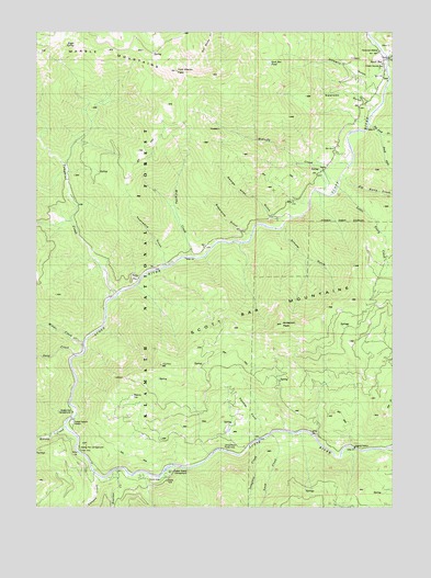
Scott Bar, CA USGS Topographic Map
Click on map above to begin viewing in our Map Viewer.

This topographic map contains these locations and features:
Feature Name Type Latitude Longitude GNIS ID View Map
Anderson PeakSummitN41.6729°W123.0398°1657930View Map
Beauty FlatFlatN41.6537°W123.0925°218938View Map
Big Ferry CreekStreamN41.7124°W123.0173°219182View Map
Bill Berry CreekStreamN41.7362°W123.0020°253681View Map
Boulder CreekStreamN41.6343°W123.0995°219690View Map
Bridge FlatFlatN41.6510°W123.1134°219824View Map
Bridge Flat CampgroundLocaleN41.6501°W123.1131°277219View Map
Canyon CreekStreamN41.6335°W123.1048°220559View Map
Deep CreekStreamN41.6646°W123.1123°222154View Map
Eagle SpringSpringN41.7465°W123.1127°253706View Map
Eagle Spring CampLocaleN41.7468°W123.1123°1657381View Map
George Allen GulchValleyN41.7018°W123.0434°224114View Map
Gold FlatFlatN41.6824°W123.0950°224268View Map
Indian Scotty CampgroundLocaleN41.6340°W123.0795°277232View Map
Isinglass CreekStreamN41.6424°W123.0478°254826View Map
Jones Beach Picnic AreaParkN41.6401°W123.0603°1657399View Map
Kelsey CampLocaleN41.6449°W123.1200°226483View Map
Kelsey CreekStreamN41.6460°W123.1162°226484View Map
Kelsey Creek Guard StationLocaleN41.6462°W123.1134°277220View Map
Little Ferry CreekStreamN41.7087°W123.0189°227257View Map
McCarthy CreekStreamN41.6907°W123.0717°228280View Map
McGuffy CreekStreamN41.7110°W123.0198°228376View Map
Middle CreekStreamN41.6687°W123.1089°228586View Map
Middle Creek CampLocaleN41.6693°W123.1125°228587View Map
Mill CreekStreamN41.7432°W123.0020°228704View Map
Panther CoveValleyN41.6454°W123.0473°230297View Map
Panther CreekStreamN41.6396°W123.0589°2037831View Map
Panther GulchValleyN41.6396°W123.0589°2037830View Map
Pat Ford CreekStreamN41.7254°W123.0089°230394View Map
Peregrine CreekStreamN41.6337°W123.0873°2037829View Map
Peregrine GulchValleyN41.6337°W123.0873°2037828View Map
Schuler GulchValleyN41.6985°W123.0400°253830View Map
Scott BarPopulated PlaceN41.7418°W123.0042°1659610View Map
Scott Bar Forest Service StationLocaleN41.7404°W123.0050°277229View Map
Scott Bar LookoutLocaleN41.6590°W123.0953°277224View Map
Scott Bar PondLakeN41.7416°W123.0442°232719View Map
Scott Bar Post OfficePost OfficeN41.7418°W123.0045°2783810View Map
Scott River Holding CorralLocaleN41.6424°W123.0506°277233View Map
Snow CreekStreamN41.6443°W123.0436°234770View Map
South Fork Pat Ford CreekStreamN41.7226°W123.0053°235040View Map
Spring Flat CampgroundLocaleN41.6404°W123.1112°277231View Map
Sugarpine GulchValleyN41.6985°W123.0562°235680View Map
Swanson GulchValleyN41.7301°W123.0084°235877View Map
Tom Martin PeakSummitN41.7393°W123.0767°236434View Map
Tompkins CreekStreamN41.6812°W123.0962°236455View Map
Townsend GulchValleyN41.6904°W123.0809°236488View Map
Tunnel MineMineN41.7171°W123.0428°277222View Map
Whites Stage Station (historical)LocaleN41.6360°W123.0753°1682357View Map
Wooliver CreekStreamN41.7343°W123.0031°238182View Map

Note: Coordinates in the location and feature list above are referenced to NAD83 datum.


Copyright (C) 2008-2024 Ryan Niemi / Sunset Dynamics ... All Rights Reserved