TopoQuest Logo
Do you find TopoQuest useful?
Help keep TopoQuest running and adding new maps/features by donating!
Bitcoin:  19c7KJd3qBynnjoSw5npx9KScwjBe4ifkT
Litecoin:  LXs6TkuXGGXo1vDsWCkWVdjQX94eUKd6ui
Home View Maps Find Maps Find Places Resources & Links


Sailes, Louisiana Topographic Map

USGS Map Title: Sailes, LA
USGS Map MRC: 32093D1
DRG (GeoTIFF) Download: o32093d1.tif


Neighboring USGS Topographic Map Quads:


  Ada, LA  
32093E2
 

  Gibsland, LA  
32093E1
 

  Arcadia, LA  
32092E8
 

  Fryeburg, LA  
32093D2
 

  Sailes, LA  
32093D1
 

  Bryceland, LA  
32092D8
 

  Jamestown, LA  
32093C2
 

  Sparta, LA  
32093C1
 

  Bienville, LA  
32092C8


Map MRC Location:

N33°
W94°
N33°
W93°
H8 H7 H6 H5 H4 H3 H2 H1
G8 G7 G6 G5 G4 G3 G2 G1
F8 F7 F6 F5 F4 F3 F2 F1
E8 E7 E6 E5 E4 E3 E2 E1
D8 D7 D6 D5 D4 D3 D2 D1
C8 C7 C6 C5 C4 C3 C2 C1
B8 B7 B6 B5 B4 B3 B2 B1
A8 A7 A6 A5 A4 A3 A2 A1
N32°
W94°
N32°
W93°

Sailes, LA USGS 1:24K Topographic Map Preview:
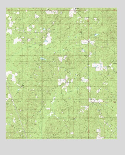
Sailes, LA USGS Topographic Map
Click on map above to begin viewing in our Map Viewer.

This topographic map contains these locations and features:
Feature Name Type Latitude Longitude GNIS ID View Map
Baltimore SchoolSchoolN32.4010°W93.0196°532297View Map
Bear Creek Gas FieldOilfieldN32.4540°W93.0063°532840View Map
Black Lake SchoolSchoolN32.4785°W93.1102°533187View Map
Blue Ridge SchoolSchoolN32.4627°W93.0171°533242View Map
Cypress Springs ChurchChurchN32.4227°W93.0968°534377View Map
Cypress Springs Oil FieldOilfieldN32.4204°W93.0582°554177View Map
Mount Lebanon CemeteryCemeteryN32.4951°W93.0630°537332View Map
Mount Lebanon SchoolSchoolN32.4960°W93.0446°537333View Map
North Bienville Fire Protection District Station 6BuildingN32.4791°W93.1210°2673063View Map
Parish Governing Authority District 3CivilN32.4866°W93.1067°1929938View Map
Pleasant HillPopulated PlaceN32.4802°W93.0766°540943View Map
Pleasant Hill ChurchChurchN32.4804°W93.0768°538258View Map
SailesPopulated PlaceN32.4254°W93.1082°541183View Map
Sailes Oil FieldOilfieldN32.4113°W93.1224°555876View Map
Shiloh SchoolSchoolN32.4115°W93.0266°539345View Map
Springfield ChurchChurchN32.4954°W93.0460°539604View Map
West Bryceland Gas FieldOilfieldN32.4696°W93.0327°549113View Map
Williamson CemeteryCemeteryN32.4203°W93.0785°540440View Map

Note: Coordinates in the location and feature list above are referenced to NAD83 datum.


Copyright (C) 2008-2024 Ryan Niemi / Sunset Dynamics ... All Rights Reserved