TopoQuest Logo
Do you find TopoQuest useful?
Help keep TopoQuest running and adding new maps/features by donating!
Bitcoin:  19c7KJd3qBynnjoSw5npx9KScwjBe4ifkT
Litecoin:  LXs6TkuXGGXo1vDsWCkWVdjQX94eUKd6ui
Home View Maps Find Maps Find Places Resources & Links


Saint Charles NW, Iowa Topographic Map

USGS Map Title: Saint Charles NW, IA
USGS Map MRC: 41093D8
DRG (GeoTIFF) Download: o41093d8.tif


Neighboring USGS Topographic Map Quads:


  Adel, IA  
41094E1
 

  Waukee, IA  
41093E8
 

  Commerce, IA  
41093E7
 

  Earlham East, IA  
41094D1
 

  Saint Charles NW, IA  
41093D8
 

  Cumming, IA  
41093D7
 

  Winterset, IA  
41094C1
 

  Patterson, IA  
41093C8
 

  Saint Charles, IA  
41093C7


Map MRC Location:

N42°
W94°
N42°
W93°
H8 H7 H6 H5 H4 H3 H2 H1
G8 G7 G6 G5 G4 G3 G2 G1
F8 F7 F6 F5 F4 F3 F2 F1
E8 E7 E6 E5 E4 E3 E2 E1
D8 D7 D6 D5 D4 D3 D2 D1
C8 C7 C6 C5 C4 C3 C2 C1
B8 B7 B6 B5 B4 B3 B2 B1
A8 A7 A6 A5 A4 A3 A2 A1
N41°
W94°
N41°
W93°

Saint Charles NW, IA USGS 1:24K Topographic Map Preview:
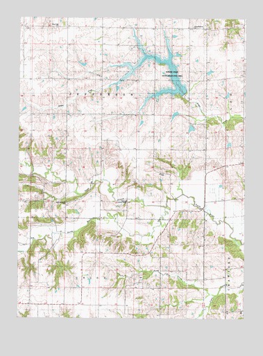
Saint Charles NW, IA USGS Topographic Map
Click on map above to begin viewing in our Map Viewer.

This topographic map contains these locations and features:
Feature Name Type Latitude Longitude GNIS ID View Map
Badger Creek State Recreation AreaParkN41.4689°W93.9088°463432View Map
Bennett - North River Stone School (historical)SchoolN41.4083°W93.9919°1969309View Map
Bloomingdale Post Office (historical)Post OfficeN41.4250°W93.9252°1969292View Map
Blue Ridge CemeteryCemeteryN41.4960°W93.9797°454713View Map
Farris CemeteryCemeteryN41.3922°W93.9333°1969355View Map
German Lutheran CemeteryCemeteryN41.4749°W93.9551°1969356View Map
Gilpin Post Office (historical)Post OfficeN41.4111°W93.9086°1969283View Map
Groth's GardensLocaleN41.3875°W93.9655°1969275View Map
Jefferson CemeteryCemeteryN41.4350°W93.9194°1823086View Map
Jefferson ChurchChurchN41.4347°W93.9191°457924View Map
KTDG-FM (Winterset)TowerN41.4005°W93.9163°467184View Map
McBridePopulated PlaceN41.4319°W93.9358°464248View Map
McBride Covered BridgeBridgeN41.4244°W93.9399°1823083View Map
McBride Post Office (historical)Post OfficeN41.4319°W93.9358°1969291View Map
Miller BridgeBridgeN41.4125°W93.9430°1969366View Map
Neal CemeteryCemeteryN41.3945°W93.9090°1969352View Map
North Branch North RiverStreamN41.4247°W93.9149°459561View Map
North Elm CreekStreamN41.3850°W93.8913°463941View Map
North McDonald CemeteryCemeteryN41.4228°W93.9730°1823084View Map
North River ChurchChurchN41.4225°W93.9747°459622View Map
Township of JeffersonCivilN41.4597°W93.9551°468141View Map
Trinity ChurchChurchN41.4758°W93.9552°462308View Map
United Brethren CemeteryCemeteryN41.4962°W93.9050°1823087View Map

Note: Coordinates in the location and feature list above are referenced to NAD83 datum.


Copyright (C) 2008-2025 Ryan Niemi / Sunset Dynamics ... All Rights Reserved