TopoQuest Logo
Do you find TopoQuest useful?
Help keep TopoQuest running and adding new maps/features by donating!
Bitcoin:  19c7KJd3qBynnjoSw5npx9KScwjBe4ifkT
Litecoin:  LXs6TkuXGGXo1vDsWCkWVdjQX94eUKd6ui
Home View Maps Find Maps Find Places Resources & Links


Saint Charles, Iowa Topographic Map

USGS Map Title: Saint Charles, IA
USGS Map MRC: 41093C7
DRG (GeoTIFF) Download: o41093c7.tif


Neighboring USGS Topographic Map Quads:


  Saint Charles NW, IA  
41093D8
 

  Cumming, IA  
41093D7
 

  Norwalk, IA  
41093D6
 

  Patterson, IA  
41093C8
 

  Saint Charles, IA  
41093C7
 

  Martensdale, IA  
41093C6
 

  East Peru, IA  
41093B8
 

  Truro, IA  
41093B7
 

  New Virginia, IA  
41093B6


Map MRC Location:

N42°
W94°
N42°
W93°
H8 H7 H6 H5 H4 H3 H2 H1
G8 G7 G6 G5 G4 G3 G2 G1
F8 F7 F6 F5 F4 F3 F2 F1
E8 E7 E6 E5 E4 E3 E2 E1
D8 D7 D6 D5 D4 D3 D2 D1
C8 C7 C6 C5 C4 C3 C2 C1
B8 B7 B6 B5 B4 B3 B2 B1
A8 A7 A6 A5 A4 A3 A2 A1
N41°
W94°
N41°
W93°

Saint Charles, IA USGS 1:24K Topographic Map Preview:
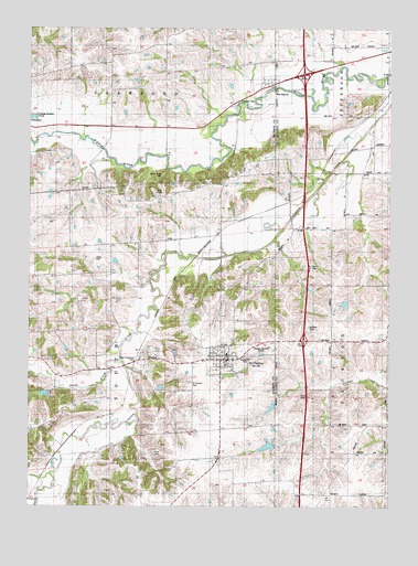
Saint Charles, IA USGS Topographic Map
Click on map above to begin viewing in our Map Viewer.

This topographic map contains these locations and features:
Feature Name Type Latitude Longitude GNIS ID View Map
Bells Ridge Post Office (historical)Post OfficeN41.3347°W93.8058°1969293View Map
BevingtonPopulated PlaceN41.3605°W93.7908°454592View Map
Bevington (historical)LocaleN41.3605°W93.7908°1969347View Map
Bevington Post OfficePost OfficeN41.3605°W93.7908°1969348View Map
Blair ChapelChurchN41.3311°W93.8302°454673View Map
Blair Chapel CemeteryCemeteryN41.3314°W93.8294°1969357View Map
Brush Ridge CemeteryCemeteryN41.3367°W93.8294°1823092View Map
Calvary Baptist ChurchChurchN41.2883°W93.8086°1969326View Map
City of BevingtonCivilN41.3595°W93.7902°2394161View Map
City of Saint CharlesCivilN41.2881°W93.8075°2396478View Map
Close CemeteryCemeteryN41.3146°W93.8525°1823091View Map
CongerPopulated PlaceN41.3519°W93.7583°464507View Map
Conger (historical)LocaleN41.3519°W93.7583°1969901View Map
Conger Post Office (historical)Post OfficeN41.3519°W93.7583°1969902View Map
Covered Bridge ParkParkN41.2889°W93.8005°1823089View Map
Dillman CemeteryCemeteryN41.2970°W93.7781°1823088View Map
EllsworthLocaleN41.3661°W93.8483°466051View Map
Ellsworth Post Office (historical)Post OfficeN41.3661°W93.8483°1969296View Map
HanleyPopulated PlaceN41.2880°W93.8341°457230View Map
Hanley (historical)LocaleN41.2880°W93.8341°1969294View Map
Hanley Post Office (historical)Post OfficeN41.2880°W93.8341°1969295View Map
Imes Covered BridgeBridgeN41.2889°W93.8002°457750View Map
Interchange 52CrossingN41.2933°W93.7799°1970112View Map
Interchange 56CrossingN41.3628°W93.7802°1970111View Map
Jones CreekStreamN41.2883°W93.8436°457990View Map
New Life Family Worship CenterChurchN41.2883°W93.8086°1969325View Map
Saint CharlesPopulated PlaceN41.2883°W93.8094°460964View Map
Saint Charles (historical)LocaleN41.2883°W93.8086°1969318View Map
Saint Charles CemeteryCemeteryN41.2820°W93.8209°460965View Map
Saint Charles City HallBuildingN41.2883°W93.8086°1969324View Map
Saint Charles Elementary SchoolSchoolN41.2883°W93.8086°1969323View Map
Saint Charles Fire and RescueBuildingN41.2880°W93.8067°2371747View Map
Saint Charles Medical ClinicHospitalN41.2883°W93.8086°1969322View Map
Saint Charles ParishChurchN41.2883°W93.8086°1969321View Map
Saint Charles Post OfficePost OfficeN41.2883°W93.8086°1969320View Map
Township of SouthCivilN41.2899°W93.8437°468727View Map
Viney CemeteryCemeteryN41.2638°W93.8292°1823090View Map
Yoke United Methodist ChurchChurchN41.2883°W93.8086°1969319View Map

Note: Coordinates in the location and feature list above are referenced to NAD83 datum.


Copyright (C) 2008-2024 Ryan Niemi / Sunset Dynamics ... All Rights Reserved