TopoQuest Logo
Do you find TopoQuest useful?
Help keep TopoQuest running and adding new maps/features by donating!
Bitcoin:  19c7KJd3qBynnjoSw5npx9KScwjBe4ifkT
Litecoin:  LXs6TkuXGGXo1vDsWCkWVdjQX94eUKd6ui
Home View Maps Find Maps Find Places Resources & Links


Cumming, Iowa Topographic Map

USGS Map Title: Cumming, IA
USGS Map MRC: 41093D7
DRG (GeoTIFF) Download: o41093d7.tif


Neighboring USGS Topographic Map Quads:


  Waukee, IA  
41093E8
 

  Commerce, IA  
41093E7
 

  Des Moines SW, IA  
41093E6
 

  Saint Charles NW, IA  
41093D8
 

  Cumming, IA  
41093D7
 

  Norwalk, IA  
41093D6
 

  Patterson, IA  
41093C8
 

  Saint Charles, IA  
41093C7
 

  Martensdale, IA  
41093C6


Map MRC Location:

N42°
W94°
N42°
W93°
H8 H7 H6 H5 H4 H3 H2 H1
G8 G7 G6 G5 G4 G3 G2 G1
F8 F7 F6 F5 F4 F3 F2 F1
E8 E7 E6 E5 E4 E3 E2 E1
D8 D7 D6 D5 D4 D3 D2 D1
C8 C7 C6 C5 C4 C3 C2 C1
B8 B7 B6 B5 B4 B3 B2 B1
A8 A7 A6 A5 A4 A3 A2 A1
N41°
W94°
N41°
W93°

Cumming, IA USGS 1:24K Topographic Map Preview:
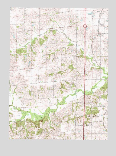
Cumming, IA USGS Topographic Map
Click on map above to begin viewing in our Map Viewer.

This topographic map contains these locations and features:
Feature Name Type Latitude Longitude GNIS ID View Map
Calvary CemeteryCemeteryN41.3953°W93.7711°455067View Map
Cedar CreekStreamN41.3992°W93.8541°455234View Map
Cherry CreekStreamN41.4772°W93.8086°455372View Map
ChurchvillePost OfficeN41.3967°W93.7511°1969905View Map
ChurchvillePopulated PlaceN41.3967°W93.7511°455413View Map
Churchville (historical)LocaleN41.3967°W93.7552°1969906View Map
City of CummingCivilN41.4875°W93.7600°2393695View Map
Community Church of CummingChurchN41.4833°W93.7624°1970061View Map
CummingPopulated PlaceN41.4833°W93.7624°455755View Map
Cumming (historical)LocaleN41.4847°W93.7633°1970058View Map
Cumming City ParkParkN41.4833°W93.7624°1969982View Map
Cumming Post OfficePost OfficeN41.4833°W93.7624°1970059View Map
Cunningham BridgeBridgeN41.4047°W93.8613°1969363View Map
Francesca's HouseBuildingN41.4667°W93.8280°1969274View Map
Great Western TrailTrailN41.4667°W93.7886°1969830View Map
Heaton Post Office (historical)Post OfficeN41.4278°W93.8572°1969281View Map
Howell Tree FarmLocaleN41.4583°W93.8322°1969235View Map
Interchange 65CrossingN41.4833°W93.7799°1970110View Map
Montpelier Post Office (historical)Post OfficeN41.3908°W93.7702°1969878View Map
Saint Johns Catholic ChurchChurchN41.4833°W93.7624°1970060View Map
Saint Johns CemeteryCemeteryN41.4950°W93.7596°461014View Map
Saint Patricks CemeteryCemeteryN41.4265°W93.7919°1969361View Map
Saint Patricks ChurchChurchN41.4278°W93.7930°461261View Map
Township of CrawfordCivilN41.3770°W93.8439°467662View Map
Township of LeeCivilN41.4641°W93.8439°468200View Map

Note: Coordinates in the location and feature list above are referenced to NAD83 datum.


Copyright (C) 2008-2024 Ryan Niemi / Sunset Dynamics ... All Rights Reserved