TopoQuest Logo
Do you find TopoQuest useful?
Help keep TopoQuest running and adding new maps/features by donating!
Bitcoin:  19c7KJd3qBynnjoSw5npx9KScwjBe4ifkT
Litecoin:  LXs6TkuXGGXo1vDsWCkWVdjQX94eUKd6ui
Home View Maps Find Maps Find Places Resources & Links


Kneecap Ridge, California Topographic Map

USGS Map Title: Kneecap Ridge, CA
USGS Map MRC: 39122E7
DRG (GeoTIFF) Download: o39122e7.tif


Neighboring USGS Topographic Map Quads:


  Plaskett Ridge, CA  
39122F8
 

  Plaskett Meadows, CA  
39122F7
 

  Alder Springs, CA  
39122F6
 

  Hull Mountain, CA  
39122E8
 

  Kneecap Ridge, CA  
39122E7
 

  Felkner Hill, CA  
39122E6
 

  Lake Pillsbury, CA  
39122D8
 

  Crockett Peak, CA  
39122D7
 

  Saint John Mountain, CA  
39122D6


Map MRC Location:

N40°
W123°
N40°
W122°
H8 H7 H6 H5 H4 H3 H2 H1
G8 G7 G6 G5 G4 G3 G2 G1
F8 F7 F6 F5 F4 F3 F2 F1
E8 E7 E6 E5 E4 E3 E2 E1
D8 D7 D6 D5 D4 D3 D2 D1
C8 C7 C6 C5 C4 C3 C2 C1
B8 B7 B6 B5 B4 B3 B2 B1
A8 A7 A6 A5 A4 A3 A2 A1
N39°
W123°
N39°
W122°

Kneecap Ridge, CA USGS 1:24K Topographic Map Preview:
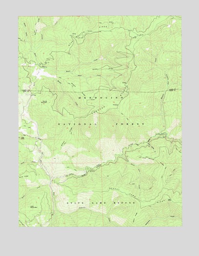
Kneecap Ridge, CA USGS Topographic Map
Click on map above to begin viewing in our Map Viewer.

This topographic map contains these locations and features:
Feature Name Type Latitude Longitude GNIS ID View Map
Anderson CreekStreamN39.5088°W122.8458°256236View Map
Basin CreekStreamN39.5927°W122.8592°256573View Map
Bear Wallow RidgeRidgeN39.6157°W122.8211°256737View Map
Brushy Camp RidgeRidgeN39.5140°W122.7797°257537View Map
Cold SpringSpringN39.6121°W122.7850°258540View Map
Corbin CreekStreamN39.5285°W122.8503°258714View Map
Corbin Work CenterLocaleN39.5340°W122.8228°258715View Map
Deafy RidgeRidgeN39.5054°W122.7875°259164View Map
Dutch Oven CreekStreamN39.5421°W122.7964°222774View Map
Estell CreekStreamN39.5946°W122.8586°259966View Map
Five Spring CreekStreamN39.5496°W122.7789°260179View Map
Five Spring RidgeRidgeN39.5388°W122.7708°260180View Map
Gibson RidgeRidgeN39.5529°W122.8381°260555View Map
Gravelly FlatFlatN39.5868°W122.7622°260818View Map
High PointSummitN39.5154°W122.7625°261326View Map
High RockSummitN39.5524°W122.8744°261334View Map
Horse CreekStreamN39.5246°W122.8514°261480View Map
Jolly Camp (historical)LocaleN39.6110°W122.8306°1666647View Map
KneecapSummitN39.5721°W122.8044°1658914View Map
Kneecap RidgeRidgeN39.5729°W122.8069°262220View Map
Little Round MountainSummitN39.5118°W122.8672°262704View Map
Low GapGapN39.5785°W122.8661°262990View Map
Middle CreekStreamN39.5949°W122.8586°263500View Map
Middle RidgeRidgeN39.5813°W122.8300°263545View Map
Provence CabinLocaleN39.5399°W122.8633°277154View Map
Round MountainSummitN39.5735°W122.8533°265607View Map
Sheep CreekStreamN39.5913°W122.8358°266068View Map
Sheep RidgeRidgeN39.5932°W122.8106°266079View Map
Spanish CreekStreamN39.6063°W122.8656°267547View Map
The BasinBasinN39.5952°W122.8583°268172View Map
Trout CreekStreamN39.5382°W122.8589°268433View Map
Wescott CreekStreamN39.5549°W122.7675°268857View Map
White Horse CreekStreamN39.6110°W122.8703°269004View Map

Note: Coordinates in the location and feature list above are referenced to NAD83 datum.


Copyright (C) 2008-2024 Ryan Niemi / Sunset Dynamics ... All Rights Reserved