TopoQuest Logo
Do you find TopoQuest useful?
Help keep TopoQuest running and adding new maps/features by donating!
Bitcoin:  19c7KJd3qBynnjoSw5npx9KScwjBe4ifkT
Litecoin:  LXs6TkuXGGXo1vDsWCkWVdjQX94eUKd6ui
Home View Maps Find Maps Find Places Resources & Links


Saint Patrick Peak, Montana Topographic Map

USGS Map Title: Saint Patrick Peak, MT
USGS Map MRC: 46114H7
DRG (GeoTIFF) Download: o46114h7.tif


Neighboring USGS Topographic Map Quads:


  Landowner Mountain, MT  
47114A8
 

  Lozeau, MT  
47114A7
 

  Tarkio, MT  
47114A6
 

  Straight Peak, MT  
46114H8
 

  Saint Patrick Peak, MT  
46114H7
 

  Williams Peak, MT  
46114H6
 

  Bruin Hill, ID  
46114G8
 

  Schley Mountain, MT  
46114G7
 

  White Mountain, MT  
46114G6


Map MRC Location:

N47°
W115°
N47°
W114°
H8 H7 H6 H5 H4 H3 H2 H1
G8 G7 G6 G5 G4 G3 G2 G1
F8 F7 F6 F5 F4 F3 F2 F1
E8 E7 E6 E5 E4 E3 E2 E1
D8 D7 D6 D5 D4 D3 D2 D1
C8 C7 C6 C5 C4 C3 C2 C1
B8 B7 B6 B5 B4 B3 B2 B1
A8 A7 A6 A5 A4 A3 A2 A1
N46°
W115°
N46°
W114°

Saint Patrick Peak, MT USGS 1:24K Topographic Map Preview:
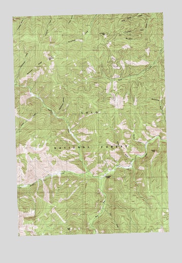
Saint Patrick Peak, MT USGS Topographic Map
Click on map above to begin viewing in our Map Viewer.

This topographic map contains these locations and features:
Feature Name Type Latitude Longitude GNIS ID View Map
Baileys LodgeLocaleN46.9133°W114.7929°779259View Map
Blacktail CreekStreamN46.9258°W114.7676°780054View Map
Cedar PeakSummitN46.8785°W114.8335°781118View Map
Clear Water Crossing Ranger StationLocaleN46.9088°W114.8037°781364View Map
Clearwater Crossing CampgroundLocaleN46.9102°W114.7982°794286View Map
Crater CreekStreamN46.9491°W114.8529°781844View Map
Fire CreekStreamN46.8888°W114.8065°783403View Map
Heineman RidgeRidgeN46.9652°W114.8523°768005View Map
Hells Thicket CreekStreamN46.9966°W114.7621°784750View Map
Hole-in-the-Wall RanchLocaleN46.9121°W114.7826°784936View Map
McMullan PeakSummitN46.9891°W114.7996°787111View Map
Needle PointSummitN46.9219°W114.7604°787927View Map
North Fork Fish CreekStreamN46.9066°W114.8062°788160View Map
Packers GulchValleyN46.9166°W114.7804°788560View Map
Rivulet PeakSummitN46.9908°W114.7504°789616View Map
Saint Patrick PeakSummitN46.9758°W114.8482°789950View Map
Straight CreekStreamN46.9102°W114.8162°791584View Map
Tanglefoot CreekStreamN46.9899°W114.7651°791885View Map
West Fork Fish CreekStreamN46.9271°W114.7512°793021View Map
Whiterock GulchValleyN46.9430°W114.8418°807023View Map

Note: Coordinates in the location and feature list above are referenced to NAD83 datum.


Copyright (C) 2008-2024 Ryan Niemi / Sunset Dynamics ... All Rights Reserved