TopoQuest Logo
Do you find TopoQuest useful?
Help keep TopoQuest running and adding new maps/features by donating!
Bitcoin:  19c7KJd3qBynnjoSw5npx9KScwjBe4ifkT
Litecoin:  LXs6TkuXGGXo1vDsWCkWVdjQX94eUKd6ui
Home View Maps Find Maps Find Places Resources & Links


Lozeau, Montana Topographic Map

USGS Map Title: Lozeau, MT
USGS Map MRC: 47114A7
DRG (GeoTIFF) Download: o47114a7.tif


Neighboring USGS Topographic Map Quads:


  Superior, MT  
47114B8
 

  Idaho Gulch, MT  
47114B7
 

  Horsehead Peak, MT  
47114B6
 

  Landowner Mountain, MT  
47114A8
 

  Lozeau, MT  
47114A7
 

  Tarkio, MT  
47114A6
 

  Straight Peak, MT  
46114H8
 

  Saint Patrick Peak, MT  
46114H7
 

  Williams Peak, MT  
46114H6


Map MRC Location:

N48°
W115°
N48°
W114°
H8 H7 H6 H5 H4 H3 H2 H1
G8 G7 G6 G5 G4 G3 G2 G1
F8 F7 F6 F5 F4 F3 F2 F1
E8 E7 E6 E5 E4 E3 E2 E1
D8 D7 D6 D5 D4 D3 D2 D1
C8 C7 C6 C5 C4 C3 C2 C1
B8 B7 B6 B5 B4 B3 B2 B1
A8 A7 A6 A5 A4 A3 A2 A1
N47°
W115°
N47°
W114°

Lozeau, MT USGS 1:24K Topographic Map Preview:
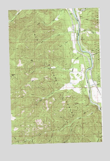
Lozeau, MT USGS Topographic Map
Click on map above to begin viewing in our Map Viewer.

This topographic map contains these locations and features:
Feature Name Type Latitude Longitude GNIS ID View Map
Bluff City (historical)LocaleN47.0321°W114.7548°1781695View Map
Brushy GulchValleyN47.0955°W114.7885°780494View Map
Cayuse CreekStreamN47.0830°W114.7651°781078View Map
Cobden (historical)LocaleN47.1166°W114.7793°1781674View Map
Cobden School (historical)SchoolN47.1166°W114.7793°1781673View Map
Crescent City (historical)Populated PlaceN47.0708°W114.8149°1781672View Map
Deep CreekStreamN47.1038°W114.7779°782202View Map
Eagle Rock SaddleGapN47.0633°W114.8737°807017View Map
Eddy CreekStreamN47.1155°W114.7748°782978View Map
Forest Grove Fishing Access SiteLocaleN47.0816°W114.7718°1744347View Map
Fortysix CreekStreamN47.0010°W114.8657°783622View Map
Interchange 55CrossingN47.1074°W114.7865°1781721View Map
Iron Mountain Mine Historical MarkerParkN47.0755°W114.7662°1781753View Map
Joe Doris MineMineN47.0108°W114.8176°794331View Map
Louisiana GulchValleyN47.0008°W114.8635°786648View Map
LozeauPopulated PlaceN47.1166°W114.7801°786694View Map
Lozeau Post Office (historical)Post OfficeN47.1174°W114.7801°1781631View Map
Lucky 7 MineMineN47.0360°W114.8407°804711View Map
Magone MountainSummitN47.1085°W114.8538°2071369View Map
McFarland CreekStreamN47.0163°W114.7946°787042View Map
Meadow CreekStreamN47.0841°W114.7732°787133View Map
Micayune GulchValleyN47.0813°W114.7601°787206View Map
Nellie CreekStreamN47.0555°W114.7921°1781766View Map
Nemote CreekStreamN47.0527°W114.7665°787950View Map
Purtle (historical)LocaleN47.0666°W114.7712°1781616View Map
QuartzPopulated PlaceN47.0519°W114.7693°789264View Map
Quartz (historical)LocaleN47.0519°W114.7693°1781614View Map
Quartz CemeteryCemeteryN47.0538°W114.7771°1781761View Map
Quartz CreekStreamN47.0308°W114.7537°789267View Map
Quartz Creek MineMineN47.0013°W114.8601°804792View Map
Quartz Fishing Access SiteLocaleN47.0674°W114.7598°1744351View Map
Quartz FlatFlatN47.0616°W114.7837°807016View Map
Quartz Flat CampgroundLocaleN47.0758°W114.7676°1781747View Map
Quartz Flats Rest AreaLocaleN47.0755°W114.7662°1781752View Map
Quartz Guard StationLocaleN47.0680°W114.7623°789272View Map
Quartz PeakSummitN47.0269°W114.7757°789280View Map
Quartz Post Office (historical)Post OfficeN47.0519°W114.7693°1781615View Map
Quartz School (historical)SchoolN47.0519°W114.7693°1781613View Map
Saint Patrick CreekStreamN47.0044°W114.8474°789949View Map
Sand GulchValleyN47.0177°W114.7951°790000View Map
Second CreekStreamN47.1219°W114.7843°790176View Map
Smith GulchValleyN47.0424°W114.8307°790727View Map
Sunrise CreekStreamN47.0669°W114.7896°791702View Map
Sunrise PointSummitN47.0588°W114.8449°791708View Map
Texas Bar (historical)LocaleN47.0416°W114.7676°1781592View Map
Triangle MineMineN47.0027°W114.8676°804794View Map
Trout Creek CampgroundLocaleN47.1169°W114.8687°792402View Map
Tucker GulchValleyN47.0096°W114.8179°792439View Map
Verde CreekStreamN47.1038°W114.7798°792688View Map
Verde SaddleGapN47.0769°W114.8440°807018View Map
Weaver GulchValleyN47.0488°W114.7951°792908View Map
WestfallPopulated PlaceN47.1210°W114.7879°793139View Map
Westfall CreekStreamN47.1227°W114.7710°793140View Map
Westfall School (historical)SchoolN47.1210°W114.7879°1781589View Map
Whiskey GulchValleyN47.0363°W114.7654°793178View Map
Wingo MineMineN47.0008°W114.8629°804710View Map
X-Ray Vision MineMineN47.0310°W114.7518°804795View Map

Note: Coordinates in the location and feature list above are referenced to NAD83 datum.


Copyright (C) 2008-2024 Ryan Niemi / Sunset Dynamics ... All Rights Reserved