TopoQuest Logo
Do you find TopoQuest useful?
Help keep TopoQuest running and adding new maps/features by donating!
Bitcoin:  19c7KJd3qBynnjoSw5npx9KScwjBe4ifkT
Litecoin:  LXs6TkuXGGXo1vDsWCkWVdjQX94eUKd6ui
Home View Maps Find Maps Find Places Resources & Links


Salt Butte, Oregon Topographic Map

USGS Map Title: Salt Butte, OR
USGS Map MRC: 44120D6
DRG (GeoTIFF) Download: o44120d6.tif


Neighboring USGS Topographic Map Quads:


  Foley Butte, OR  
44120E7
 

  Dutchman Creek, OR  
44120E6
 

  Opal Mountain, OR  
44120E5
 

  Hensley Butte, OR  
44120D7
 

  Salt Butte, OR  
44120D6
 

  Steins Pillar, OR  
44120D5
 

  Prineville, OR  
44120C7
 

  Ochoco Reservoir, OR  
44120C6
 

  Cadle Butte, OR  
44120C5


Map MRC Location:

N45°
W121°
N45°
W120°
H8 H7 H6 H5 H4 H3 H2 H1
G8 G7 G6 G5 G4 G3 G2 G1
F8 F7 F6 F5 F4 F3 F2 F1
E8 E7 E6 E5 E4 E3 E2 E1
D8 D7 D6 D5 D4 D3 D2 D1
C8 C7 C6 C5 C4 C3 C2 C1
B8 B7 B6 B5 B4 B3 B2 B1
A8 A7 A6 A5 A4 A3 A2 A1
N44°
W121°
N44°
W120°

Salt Butte, OR USGS 1:24K Topographic Map Preview:
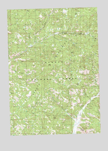
Salt Butte, OR USGS Topographic Map
Click on map above to begin viewing in our Map Viewer.

This topographic map contains these locations and features:
Feature Name Type Latitude Longitude GNIS ID View Map
A-Y SpringSpringN44.4759°W120.6722°1136990View Map
Beetle Spring (historical)SpringN44.4072°W120.7362°1137892View Map
Big TableSummitN44.4164°W120.7498°1138089View Map
Brennan PalisadesCliffN44.4012°W120.6789°1638046View Map
Burn CreekStreamN44.4040°W120.7372°1153125View Map
Cabin Guard StationLocaleN44.3915°W120.6645°1139111View Map
Cow Camp CabinLocaleN44.3912°W120.6650°1156372View Map
Deer CreekStreamN44.4635°W120.7192°1140828View Map
Dry CreekStreamN44.3976°W120.6725°1141279View Map
Evans CreekStreamN44.3829°W120.6584°1141924View Map
Green MountainSummitN44.4418°W120.6939°1143046View Map
Green SpringSpringN44.4556°W120.6643°1143057View Map
Harvey GapGapN44.4674°W120.6270°1143347View Map
Horse SpringSpringN44.4946°W120.6559°1143792View Map
Kidnap SpringSpringN44.4234°W120.6559°1144597View Map
Little McKay CreekStreamN44.4657°W120.7139°1145205View Map
Mahogany ButteSummitN44.3783°W120.6487°1145742View Map
McKay Creek Forest CampLocaleN44.4499°W120.7470°1156712View Map
Poppy CreekStreamN44.4490°W120.7464°1147892View Map
Ray SpringSpringN44.4979°W120.7234°1133887View Map
Salt ButteSummitN44.4884°W120.6833°1148989View Map
Schoolhouse CreekStreamN44.4082°W120.6384°1149138View Map
Slayton CorralLocaleN44.3912°W120.7070°1149671View Map
Strickland Spring (historical)SpringN44.4406°W120.6534°1150491View Map
Whitetail SpringSpringN44.3920°W120.6891°1152268View Map

Note: Coordinates in the location and feature list above are referenced to NAD83 datum.


Copyright (C) 2008-2024 Ryan Niemi / Sunset Dynamics ... All Rights Reserved