TopoQuest Logo
Do you find TopoQuest useful?
Help keep TopoQuest running and adding new maps/features by donating!
Bitcoin:  19c7KJd3qBynnjoSw5npx9KScwjBe4ifkT
Litecoin:  LXs6TkuXGGXo1vDsWCkWVdjQX94eUKd6ui
Home View Maps Find Maps Find Places Resources & Links


Steins Pillar, Oregon Topographic Map

USGS Map Title: Steins Pillar, OR
USGS Map MRC: 44120D5
DRG (GeoTIFF) Download: o44120d5.tif


Neighboring USGS Topographic Map Quads:


  Dutchman Creek, OR  
44120E6
 

  Opal Mountain, OR  
44120E5
 

  Stephenson Mountain, OR  
44120E4
 

  Salt Butte, OR  
44120D6
 

  Steins Pillar, OR  
44120D5
 

  Whistler Point, OR  
44120D4
 

  Ochoco Reservoir, OR  
44120C6
 

  Cadle Butte, OR  
44120C5
 

  Gerow Butte, OR  
44120C4


Map MRC Location:

N45°
W121°
N45°
W120°
H8 H7 H6 H5 H4 H3 H2 H1
G8 G7 G6 G5 G4 G3 G2 G1
F8 F7 F6 F5 F4 F3 F2 F1
E8 E7 E6 E5 E4 E3 E2 E1
D8 D7 D6 D5 D4 D3 D2 D1
C8 C7 C6 C5 C4 C3 C2 C1
B8 B7 B6 B5 B4 B3 B2 B1
A8 A7 A6 A5 A4 A3 A2 A1
N44°
W121°
N44°
W120°

Steins Pillar, OR USGS 1:24K Topographic Map Preview:
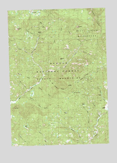
Steins Pillar, OR USGS Topographic Map
Click on map above to begin viewing in our Map Viewer.

This topographic map contains these locations and features:
Feature Name Type Latitude Longitude GNIS ID View Map
BarneyLocaleN44.4165°W120.6150°1153128View Map
Barney Post Office (historical)Post OfficeN44.4165°W120.6150°1164886View Map
Belknap CreekStreamN44.4626°W120.5367°1137895View Map
Benefield CreekStreamN44.4226°W120.6078°1137917View Map
Brogan CreekStreamN44.4690°W120.5314°1138645View Map
Cayuse Forest CampLocaleN44.4679°W120.5928°1156713View Map
Desolation CanyonValleyN44.4757°W120.5070°1140922View Map
Doe CreekStreamN44.4271°W120.6000°1141108View Map
Dorn SpringSpringN44.4847°W120.5808°1141257View Map
East Fork Mill CreekStreamN44.4387°W120.5820°1141584View Map
Fintcher CreekStreamN44.4315°W120.5906°1142107View Map
Forked Horn ButteSummitN44.4550°W120.5610°1142305View Map
Harvey CreekStreamN44.4585°W120.5970°1143342View Map
Hash RockSummitN44.4826°W120.6145°1143352View Map
Hash Rock CreekStreamN44.4740°W120.5878°1143353View Map
Hawthorne SpringSpringN44.4783°W120.5858°1143388View Map
Jackson SpringSpringN44.4197°W120.5093°1144209View Map
Jesse SpringSpringN44.4976°W120.5954°1144264View Map
Jim Elliott CreekStreamN44.3821°W120.5200°1144276View Map
King SpringSpringN44.4088°W120.5832°1144615View Map
Lakin PlaceLocaleN44.4349°W120.5861°1144794View Map
Lemon CreekStreamN44.4226°W120.6081°1144942View Map
Mill Creek WildernessReserveN44.4743°W120.5156°1133889View Map
Prineville DivisionCivilN44.3944°W120.5960°1938087View Map
Riley CreekStreamN44.4443°W120.5650°1153129View Map
Rock SpringSpringN44.4879°W120.5855°1148623View Map
Rocky ButteSummitN44.3921°W120.6069°1148655View Map
Sears CreekStreamN44.3985°W120.5131°1149197View Map
Squirrel RidgeRidgeN44.4387°W120.6036°1150312View Map
Steins PillarPillarN44.4099°W120.6213°1150403View Map
Swamp SpringSpringN44.4101°W120.5312°1150753View Map
Twin PillarsPillarN44.4829°W120.5368°1151577View Map
West Fork Mill CreekStreamN44.4387°W120.5820°1152093View Map
White Fir SpringSpringN44.4048°W120.5536°1128979View Map
White Rock Recreation SiteLocaleN44.4235°W120.5442°1167041View Map
White Rock SpringSpringN44.4229°W120.5451°1128998View Map
Wildcat MountainSummitN44.4280°W120.5488°1129065View Map
Wildcat Recreation SiteLocaleN44.4390°W120.5784°1135935View Map

Note: Coordinates in the location and feature list above are referenced to NAD83 datum.


Copyright (C) 2008-2024 Ryan Niemi / Sunset Dynamics ... All Rights Reserved