TopoQuest Logo
Do you find TopoQuest useful?
Help keep TopoQuest running and adding new maps/features by donating!
Bitcoin:  19c7KJd3qBynnjoSw5npx9KScwjBe4ifkT
Litecoin:  LXs6TkuXGGXo1vDsWCkWVdjQX94eUKd6ui
Home View Maps Find Maps Find Places Resources & Links


San Geronimo, Texas Topographic Map

USGS Map Title: San Geronimo, TX
USGS Map MRC: 29098E7
DRG (GeoTIFF) Download: o29098e7.tif


Neighboring USGS Topographic Map Quads:


  Pipe Creek, TX  
29098F8
 

  Jack Mountain, TX  
29098F7
 

  Van Raub, TX  
29098F6
 

  Medina Lake, TX  
29098E8
 

  San Geronimo, TX  
29098E7
 

  Helotes, TX  
29098E6
 

  Riomedina, TX  
29098D8
 

  La Coste NE, TX  
29098D7
 

  Culebra Hill, TX  
29098D6


Map MRC Location:

N30°
W99°
N30°
W98°
H8 H7 H6 H5 H4 H3 H2 H1
G8 G7 G6 G5 G4 G3 G2 G1
F8 F7 F6 F5 F4 F3 F2 F1
E8 E7 E6 E5 E4 E3 E2 E1
D8 D7 D6 D5 D4 D3 D2 D1
C8 C7 C6 C5 C4 C3 C2 C1
B8 B7 B6 B5 B4 B3 B2 B1
A8 A7 A6 A5 A4 A3 A2 A1
N29°
W99°
N29°
W98°

San Geronimo, TX USGS 1:24K Topographic Map Preview:
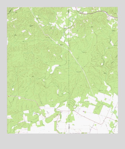
San Geronimo, TX USGS Topographic Map
Click on map above to begin viewing in our Map Viewer.

This topographic map contains these locations and features:
Feature Name Type Latitude Longitude GNIS ID View Map
Alamo Seventh Day Church of GodChurchN29.5314°W98.8007°2469514View Map
Bear SpringSpringN29.5567°W98.8451°1330247View Map
Blue HeavenSummitN29.6091°W98.8481°1330904View Map
Cedar SpringsSpringN29.5822°W98.8175°1998457View Map
Cepeda CemeteryCemeteryN29.6132°W98.7603°1332589View Map
Cherry SpringSpringN29.6227°W98.8664°1332716View Map
CliffLocaleN29.5230°W98.8142°1332985View Map
East WindmillLocaleN29.5819°W98.7892°1335022View Map
Gallagher RanchLocaleN29.6063°W98.8092°1336347View Map
Geronimo Creek QuarryMineN29.5292°W98.8464°2710194View Map
Government CanyonValleyN29.5621°W98.7607°1336759View Map
Government Canyon State Natural AreaParkN29.5758°W98.7528°2028264View Map
High Lonesome WellWellN29.5966°W98.8261°1337709View Map
Honeymoon SpringSpringN29.5891°W98.8150°1338029View Map
Indian Mound SpringsSpringN29.6143°W98.8422°1338441View Map
Kallison RanchLocaleN29.5436°W98.7709°1338948View Map
KKYX-AM (San Antonio)TowerN29.5011°W98.8320°1387883View Map
Lee CemeteryCemeteryN29.6211°W98.7514°1339775View Map
Limekiln CreekStreamN29.5108°W98.8350°1339932View Map
Little WindmillLocaleN29.5888°W98.7556°1340220View Map
Maverick SchoolSchoolN29.5125°W98.8203°1341092View Map
Moses WindmillLocaleN29.5622°W98.7956°1341963View Map
Pastora SpringSpringN29.6072°W98.7800°1343645View Map
Pecan SpringSpringN29.5997°W98.8673°1343784View Map
River WindmillLocaleN29.5683°W98.8142°1345270View Map
San GeronimoPopulated PlaceN29.6230°W98.7939°1346349View Map
San Geronimo AirparkAirportN29.5105°W98.7984°1387458View Map
San Geronimo Recharge DamDamN29.5352°W98.8070°1862938View Map
San Geronimo Recharge LakeReservoirN29.5352°W98.8070°1862939View Map
Schuchart LakeReservoirN29.5204°W98.8455°1863215View Map
Schuchart Lake DamDamN29.5202°W98.8453°1863214View Map
West WindmillLocaleN29.6105°W98.8275°1349831View Map
Wildcat CanyonValleyN29.5621°W98.7607°1350059View Map
Wildcat WindmillLocaleN29.5608°W98.7634°1350076View Map
Zapeta WindmillLocaleN29.6038°W98.7556°1350722View Map

Note: Coordinates in the location and feature list above are referenced to NAD83 datum.


Copyright (C) 2008-2024 Ryan Niemi / Sunset Dynamics ... All Rights Reserved