TopoQuest Logo
Do you find TopoQuest useful?
Help keep TopoQuest running and adding new maps/features by donating!
Bitcoin:  19c7KJd3qBynnjoSw5npx9KScwjBe4ifkT
Litecoin:  LXs6TkuXGGXo1vDsWCkWVdjQX94eUKd6ui
Home View Maps Find Maps Find Places Resources & Links


Sand Point, Montana Topographic Map

USGS Map Title: Sand Point, MT
USGS Map MRC: 46110G5
DRG (GeoTIFF) Download: o46110g5.tif


Neighboring USGS Topographic Map Quads:


  Neihart, MT  
46110H6
 

  Yogo Peak, MT  
46110H5
 

  Bandbox Mountain, MT  
46110H4
 

  Kings Hill, MT  
46110G6
 

  Sand Point, MT  
46110G5
 

  Ettien Spring, MT  
46110G4
 

  Volcano Butte, MT  
46110F6
 

  Hoover Spring, MT  
46110F5
 

  Russian Flat, MT  
46110F4


Map MRC Location:

N47°
W111°
N47°
W110°
H8 H7 H6 H5 H4 H3 H2 H1
G8 G7 G6 G5 G4 G3 G2 G1
F8 F7 F6 F5 F4 F3 F2 F1
E8 E7 E6 E5 E4 E3 E2 E1
D8 D7 D6 D5 D4 D3 D2 D1
C8 C7 C6 C5 C4 C3 C2 C1
B8 B7 B6 B5 B4 B3 B2 B1
A8 A7 A6 A5 A4 A3 A2 A1
N46°
W111°
N46°
W110°

Sand Point, MT USGS 1:24K Topographic Map Preview:
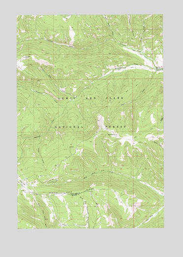
Sand Point, MT USGS Topographic Map
Click on map above to begin viewing in our Map Viewer.

This topographic map contains these locations and features:
Feature Name Type Latitude Longitude GNIS ID View Map
Ant ParkFlatN46.7516°W110.5869°779055View Map
Cleveland CreekStreamN46.8425°W110.5066°781377View Map
Collins CreekStreamN46.8038°W110.6066°781512View Map
Doerr CreekStreamN46.8425°W110.5063°782435View Map
Grendah MountainSummitN46.8502°W110.6185°784328View Map
Harrison CreekStreamN46.8425°W110.5066°784578View Map
King CreekStreamN46.8266°W110.5755°785740View Map
Lenny MineMineN46.8425°W110.6238°803639View Map
Lost Fork RidgeRidgeN46.7708°W110.5858°786595View Map
Middle Fork RanchLocaleN46.8436°W110.5072°787299View Map
Our Only Chance MineMineN46.8363°W110.6066°803614View Map
Sand PointSummitN46.8047°W110.5416°790004View Map
SE SE Section 21 MineMineN46.7788°W110.5916°803615View Map
Spur ParkFlatN46.7758°W110.6210°791359View Map
Stiner CreekStreamN46.8525°W110.5188°791530View Map
SW SE Section 29 MineMineN46.8522°W110.6008°803630View Map
Warm Springs CreekStreamN46.8597°W110.5419°792837View Map
Weatherwax CreekStreamN46.8222°W110.5830°792907View Map

Note: Coordinates in the location and feature list above are referenced to NAD83 datum.


Copyright (C) 2008-2025 Ryan Niemi / Sunset Dynamics ... All Rights Reserved