TopoQuest Logo
Do you find TopoQuest useful?
Help keep TopoQuest running and adding new maps/features by donating!
Bitcoin:  19c7KJd3qBynnjoSw5npx9KScwjBe4ifkT
Litecoin:  LXs6TkuXGGXo1vDsWCkWVdjQX94eUKd6ui
Home View Maps Find Maps Find Places Resources & Links


Volcano Butte, Montana Topographic Map

USGS Map Title: Volcano Butte, MT
USGS Map MRC: 46110F6
DRG (GeoTIFF) Download: o46110f6.tif


Neighboring USGS Topographic Map Quads:


  Moose Mountain, MT  
46110G7
 

  Kings Hill, MT  
46110G6
 

  Sand Point, MT  
46110G5
 

  Charcoal Gulch, MT  
46110F7
 

  Volcano Butte, MT  
46110F6
 

  Hoover Spring, MT  
46110F5
 

  Pinchout Creek, MT  
46110E7
 

  Fourmile Spring, MT  
46110E6
 

  Checkerboard, MT  
46110E5


Map MRC Location:

N47°
W111°
N47°
W110°
H8 H7 H6 H5 H4 H3 H2 H1
G8 G7 G6 G5 G4 G3 G2 G1
F8 F7 F6 F5 F4 F3 F2 F1
E8 E7 E6 E5 E4 E3 E2 E1
D8 D7 D6 D5 D4 D3 D2 D1
C8 C7 C6 C5 C4 C3 C2 C1
B8 B7 B6 B5 B4 B3 B2 B1
A8 A7 A6 A5 A4 A3 A2 A1
N46°
W111°
N46°
W110°

Volcano Butte, MT USGS 1:24K Topographic Map Preview:
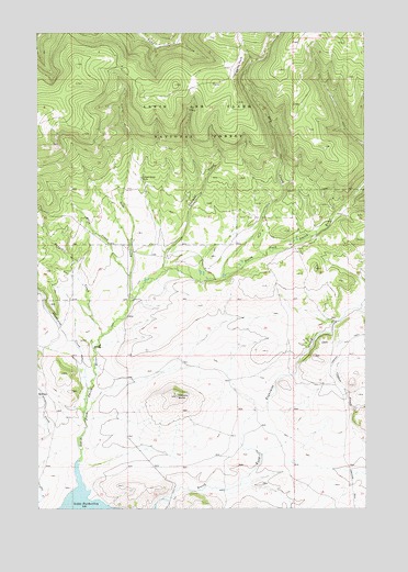
Volcano Butte, MT USGS Topographic Map
Click on map above to begin viewing in our Map Viewer.

This topographic map contains these locations and features:
Feature Name Type Latitude Longitude GNIS ID View Map
Bangtail CreekStreamN46.6705°W110.7255°779326View Map
Copper State MineMineN46.7119°W110.7099°781662View Map
Copper State MineMineN46.7119°W110.7110°804687View Map
Dry CreekStreamN46.6858°W110.6791°782579View Map
Eightmile CreekStreamN46.6258°W110.7266°783011View Map
Geis CreekStreamN46.6794°W110.7149°783876View Map
Higgins ParkFlatN46.7411°W110.6749°784853View Map
Jamison TrailTrailN46.6641°W110.6374°794276View Map
Mass CreekStreamN46.6863°W110.7149°786920View Map
North Fork Eightmile CreekStreamN46.6277°W110.7027°788151View Map
NW NE Section 22 MineMineN46.7077°W110.7024°804689View Map
NW NW Section 15 MineMineN46.7208°W110.7141°804702View Map
Sawmill CreekStreamN46.6877°W110.7013°790052View Map
South Fork Eightmile CreekStreamN46.6277°W110.7024°790957View Map
Studhorse CreekStreamN46.6563°W110.7310°791619View Map
Volcano ButteSummitN46.6541°W110.6972°792730View Map

Note: Coordinates in the location and feature list above are referenced to NAD83 datum.


Copyright (C) 2008-2025 Ryan Niemi / Sunset Dynamics ... All Rights Reserved