TopoQuest Logo
Do you find TopoQuest useful?
Help keep TopoQuest running and adding new maps/features by donating!
Bitcoin:  19c7KJd3qBynnjoSw5npx9KScwjBe4ifkT
Litecoin:  LXs6TkuXGGXo1vDsWCkWVdjQX94eUKd6ui
Home View Maps Find Maps Find Places Resources & Links


Sandrock Mountain, Oregon Topographic Map

USGS Map Title: Sandrock Mountain, OR
USGS Map MRC: 44120F4
DRG (GeoTIFF) Download: o44120f4.tif


Neighboring USGS Topographic Map Quads:


  Arrastra Butte, OR  
44120G5
 

  Muddy Ranch, OR  
44120G4
 

  Jennies Peak, OR  
44120G3
 

  Horse Heaven Creek, OR  
44120F5
 

  Sandrock Mountain, OR  
44120F4
 

  Painted Hills, OR  
44120F3
 

  Opal Mountain, OR  
44120E5
 

  Stephenson Mountain, OR  
44120E4
 

  Lawson Mountain, OR  
44120E3


Map MRC Location:

N45°
W121°
N45°
W120°
H8 H7 H6 H5 H4 H3 H2 H1
G8 G7 G6 G5 G4 G3 G2 G1
F8 F7 F6 F5 F4 F3 F2 F1
E8 E7 E6 E5 E4 E3 E2 E1
D8 D7 D6 D5 D4 D3 D2 D1
C8 C7 C6 C5 C4 C3 C2 C1
B8 B7 B6 B5 B4 B3 B2 B1
A8 A7 A6 A5 A4 A3 A2 A1
N44°
W121°
N44°
W120°

Sandrock Mountain, OR USGS 1:24K Topographic Map Preview:
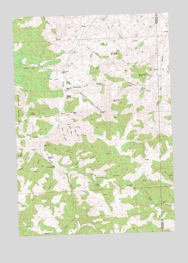
Sandrock Mountain, OR USGS Topographic Map
Click on map above to begin viewing in our Map Viewer.

This topographic map contains these locations and features:
Feature Name Type Latitude Longitude GNIS ID View Map
Balanced RocksPillarN44.7082°W120.4600°1117164View Map
Black RockSummitN44.7276°W120.4214°1117774View Map
Blind GulchValleyN44.6874°W120.4595°1117815View Map
Broken Shovel SpringSpringN44.7145°W120.4014°1118100View Map
Buck GulchValleyN44.6865°W120.4670°1118187View Map
Cherry Creek DamDamN44.6540°W120.4588°1133486View Map
Cherry SpringSpringN44.7104°W120.4355°1118868View Map
Dry CreekStreamN44.6754°W120.4811°1120138View Map
Grade (historical)LocaleN44.7493°W120.3803°1131429View Map
Grade Post Office (historical)Post OfficeN44.7493°W120.3803°1165332View Map
Hells Half AcreAreaN44.6929°W120.4872°1121744View Map
Hole in Wall RockPillarN44.6760°W120.4797°1121918View Map
Horse CreekStreamN44.6343°W120.4556°1143754View Map
Horse Heaven MountainSummitN44.7050°W120.4998°1122003View Map
Indian RocksSummitN44.7032°W120.4567°1122241View Map
Kaser RanchLocaleN44.6665°W120.4706°1639045View Map
Kinney CanyonValleyN44.7115°W120.3856°1122774View Map
Little Sandrock GulchValleyN44.7137°W120.4606°1123273View Map
Log House SpringSpringN44.6691°W120.4762°1123349View Map
Long HollowValleyN44.6618°W120.4639°1123421View Map
Oler SpringSpringN44.7214°W120.4818°1124979View Map
Pine CreekStreamN44.6654°W120.4720°1125394View Map
Pine SpringSpringN44.6527°W120.4384°1125411View Map
Pine Spring HollowValleyN44.6601°W120.4606°1125412View Map
Quail GulchValleyN44.6860°W120.4545°1125721View Map
Red GapGapN44.7343°W120.4056°1125881View Map
Root GulchValleyN44.6882°W120.4647°1126287View Map
Ryestack GulchValleyN44.7149°W120.4642°1126395View Map
Sandrock GulchValleyN44.7074°W120.4614°1126588View Map
Sandrock MountainSummitN44.7004°W120.4228°1126589View Map
Sandrock SpringsSpringN44.6943°W120.4334°1126590View Map
Sheep HollowValleyN44.6701°W120.4797°1126824View Map
Sheep RockPillarN44.6946°W120.4522°1126835View Map
Studhorse CanyonValleyN44.6737°W120.4961°1127672View Map
Tompkins PassGapN44.6521°W120.4089°1128154View Map
Upper Cherry Creek RanchLocaleN44.6646°W120.4709°1128440View Map
White Rock GulchValleyN44.7179°W120.4639°1128994View Map
White Rock SpringSpringN44.7178°W120.4627°1128999View Map
Wyman CreekStreamN44.6737°W120.4903°1129342View Map

Note: Coordinates in the location and feature list above are referenced to NAD83 datum.


Copyright (C) 2008-2025 Ryan Niemi / Sunset Dynamics ... All Rights Reserved