TopoQuest Logo
Do you find TopoQuest useful?
Help keep TopoQuest running and adding new maps/features by donating!
Bitcoin:  19c7KJd3qBynnjoSw5npx9KScwjBe4ifkT
Litecoin:  LXs6TkuXGGXo1vDsWCkWVdjQX94eUKd6ui
Home View Maps Find Maps Find Places Resources & Links


Painted Hills, Oregon Topographic Map

USGS Map Title: Painted Hills, OR
USGS Map MRC: 44120F3
DRG (GeoTIFF) Download: o44120f3.tif


Neighboring USGS Topographic Map Quads:


  Muddy Ranch, OR  
44120G4
 

  Jennies Peak, OR  
44120G3
 

  Rowe Creek, OR  
44120G2
 

  Sandrock Mountain, OR  
44120F4
 

  Painted Hills, OR  
44120F3
 

  Sutton Mountain, OR  
44120F2
 

  Stephenson Mountain, OR  
44120E4
 

  Lawson Mountain, OR  
44120E3
 

  Mitchell, OR  
44120E2


Map MRC Location:

N45°
W121°
N45°
W120°
H8 H7 H6 H5 H4 H3 H2 H1
G8 G7 G6 G5 G4 G3 G2 G1
F8 F7 F6 F5 F4 F3 F2 F1
E8 E7 E6 E5 E4 E3 E2 E1
D8 D7 D6 D5 D4 D3 D2 D1
C8 C7 C6 C5 C4 C3 C2 C1
B8 B7 B6 B5 B4 B3 B2 B1
A8 A7 A6 A5 A4 A3 A2 A1
N44°
W121°
N44°
W120°

Painted Hills, OR USGS 1:24K Topographic Map Preview:
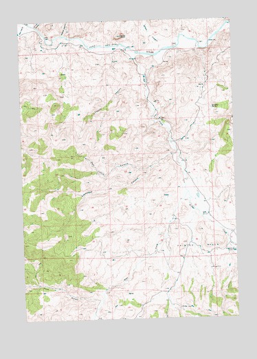
Painted Hills, OR USGS Topographic Map
Click on map above to begin viewing in our Map Viewer.

This topographic map contains these locations and features:
Feature Name Type Latitude Longitude GNIS ID View Map
Bear CreekStreamN44.6804°W120.2817°1137687View Map
Bridge CreekStreamN44.7362°W120.3084°1138616View Map
Bridge Creek (historical)LocaleN44.6990°W120.2859°1131060View Map
Bridge Creek Post Office (historical)Post OfficeN44.6990°W120.2859°1164952View Map
Brown GrottoValleyN44.6546°W120.2806°1987794View Map
Burnt RanchLocaleN44.7379°W120.3197°1118358View Map
Burnt Ranch Boat RampLocaleN44.7461°W120.3642°2699167View Map
Burnt Ranch Post Office (historical)Post OfficeN44.7379°W120.3197°1164987View Map
Byrds PointSummitN44.7431°W120.3165°1118428View Map
Carroll RimRidgeN44.6579°W120.2675°1158712View Map
Coyote CanyonValleyN44.7265°W120.3059°1119450View Map
Dugout CanyonValleyN44.7443°W120.3506°1120203View Map
John Day GulchValleyN44.7482°W120.3731°1122447View Map
Juniper CanyonValleyN44.7479°W120.3661°1122575View Map
Lockwood CanyonValleyN44.6940°W120.2859°1123336View Map
Painted HillsSummitN44.6615°W120.2731°1125129View Map
Painted Hills DamDamN44.6694°W120.2773°1133634View Map
Painted Hills ReservoirReservoirN44.6699°W120.2761°1133635View Map
Painted Hills State Park (historical)ParkN44.6546°W120.2531°1125130View Map
Pass GulchValleyN44.6329°W120.3322°1125209View Map
Pats Cabin CanyonValleyN44.6882°W120.3014°1125223View Map
Priest Hole Boat LaunchLocaleN44.7387°W120.2827°2699726View Map
Rainbow HillSummitN44.6460°W120.2700°1891228View Map
Red Scar KnollSummitN44.6346°W120.2906°1891231View Map
Seward Post Office (historical)Post OfficeN44.6790°W120.2734°1131059View Map
Shaw CanyonValleyN44.7379°W120.2939°1126804View Map
Stovepipe SpringSpringN44.7125°W120.2634°1127644View Map
Taylor RanchLocaleN44.6682°W120.2681°1127909View Map

Note: Coordinates in the location and feature list above are referenced to NAD83 datum.


Copyright (C) 2008-2025 Ryan Niemi / Sunset Dynamics ... All Rights Reserved