TopoQuest Logo
Do you find TopoQuest useful?
Help keep TopoQuest running and adding new maps/features by donating!
Bitcoin:  19c7KJd3qBynnjoSw5npx9KScwjBe4ifkT
Litecoin:  LXs6TkuXGGXo1vDsWCkWVdjQX94eUKd6ui
Home View Maps Find Maps Find Places Resources & Links


Stephenson Mountain, Oregon Topographic Map

USGS Map Title: Stephenson Mountain, OR
USGS Map MRC: 44120E4
DRG (GeoTIFF) Download: o44120e4.tif


Neighboring USGS Topographic Map Quads:


  Horse Heaven Creek, OR  
44120F5
 

  Sandrock Mountain, OR  
44120F4
 

  Painted Hills, OR  
44120F3
 

  Opal Mountain, OR  
44120E5
 

  Stephenson Mountain, OR  
44120E4
 

  Lawson Mountain, OR  
44120E3
 

  Steins Pillar, OR  
44120D5
 

  Whistler Point, OR  
44120D4
 

  Ochoco Butte, OR  
44120D3


Map MRC Location:

N45°
W121°
N45°
W120°
H8 H7 H6 H5 H4 H3 H2 H1
G8 G7 G6 G5 G4 G3 G2 G1
F8 F7 F6 F5 F4 F3 F2 F1
E8 E7 E6 E5 E4 E3 E2 E1
D8 D7 D6 D5 D4 D3 D2 D1
C8 C7 C6 C5 C4 C3 C2 C1
B8 B7 B6 B5 B4 B3 B2 B1
A8 A7 A6 A5 A4 A3 A2 A1
N44°
W121°
N44°
W120°

Stephenson Mountain, OR USGS 1:24K Topographic Map Preview:
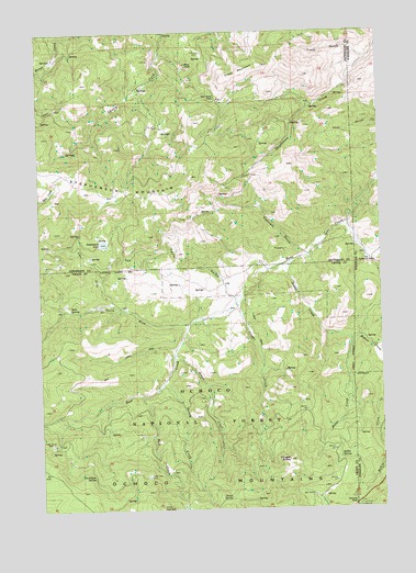
Stephenson Mountain, OR USGS Topographic Map
Click on map above to begin viewing in our Map Viewer.

This topographic map contains these locations and features:
Feature Name Type Latitude Longitude GNIS ID View Map
Bear SpringSpringN44.5526°W120.4901°1137748View Map
Cougar ButteSummitN44.5126°W120.4108°1140202View Map
Cougar CreekStreamN44.5537°W120.4295°1119372View Map
Dodds CreekStreamN44.5643°W120.4097°1141099View Map
Dodds SpringSpringN44.5130°W120.3927°1141100View Map
Flannery GulchValleyN44.5665°W120.4036°1120823View Map
Grant CreekStreamN44.5401°W120.4522°1142941View Map
Grant SpringSpringN44.5029°W120.4325°1121301View Map
Heflin CreekStreamN44.5396°W120.3761°1143449View Map
Jackalope SpringSpringN44.5087°W120.4824°1144176View Map
Lake ForkStreamN44.5529°W120.4739°1144777View Map
Lucky Strike MineMineN44.5176°W120.4972°1145668View Map
Ludwick CabinLocaleN44.6196°W120.4425°1145670View Map
North Fork Bear CreekStreamN44.5485°W120.4472°1146904View Map
Ochoco Agate BedsMineN44.5001°W120.4581°1147139View Map
Ochoco Divide Recreation SiteLocaleN44.5001°W120.3858°1147143View Map
Ochoco PassGapN44.5015°W120.3867°1147146View Map
Old Stephenson RanchLocaleN44.5649°W120.3797°1147208View Map
Rail CreekStreamN44.5301°W120.4636°1148152View Map
Red RockSummitN44.6162°W120.4463°1148330View Map
Red Rock PassGapN44.6068°W120.4364°1148332View Map
Scotty CreekStreamN44.5337°W120.4559°1149181View Map
Stephenson LakeReservoirN44.5699°W120.4774°1150406View Map
Stephenson MountainSummitN44.5823°W120.4513°1150407View Map
Taylor GulchValleyN44.5549°W120.4295°1150920View Map
Tracy GulchValleyN44.6174°W120.3806°1151360View Map
Tracy MountainSummitN44.6126°W120.4320°1151361View Map
Valley View MineMineN44.5090°W120.4622°1151718View Map

Note: Coordinates in the location and feature list above are referenced to NAD83 datum.


Copyright (C) 2008-2024 Ryan Niemi / Sunset Dynamics ... All Rights Reserved