TopoQuest Logo
Do you find TopoQuest useful?
Help keep TopoQuest running and adding new maps/features by donating!
Bitcoin:  19c7KJd3qBynnjoSw5npx9KScwjBe4ifkT
Litecoin:  LXs6TkuXGGXo1vDsWCkWVdjQX94eUKd6ui
Home View Maps Find Maps Find Places Resources & Links


Sands, Michigan Topographic Map

USGS Map Title: Sands, MI
USGS Map MRC: 46087D4
DRG (GeoTIFF) Download: o46087d4.tif


Neighboring USGS Topographic Map Quads:


  Negaunee, MI  
46087E5
 

  Marquette, MI  
46087E4


  Palmer, MI  
46087D5
 

  Sands, MI  
46087D4
 

  Harvey, MI  
46087D3
 

  Cataract Basin, MI  
46087C5
 

  Gwinn, MI  
46087C4
 

  Little Lake, MI  
46087C3


Map MRC Location:

N47°
W88°
N47°
W87°
H8 H7 H6 H5 H4 H3 H2 H1
G8 G7 G6 G5 G4 G3 G2 G1
F8 F7 F6 F5 F4 F3 F2 F1
E8 E7 E6 E5 E4 E3 E2 E1
D8 D7 D6 D5 D4 D3 D2 D1
C8 C7 C6 C5 C4 C3 C2 C1
B8 B7 B6 B5 B4 B3 B2 B1
A8 A7 A6 A5 A4 A3 A2 A1
N46°
W88°
N46°
W87°

Sands, MI USGS 1:24K Topographic Map Preview:
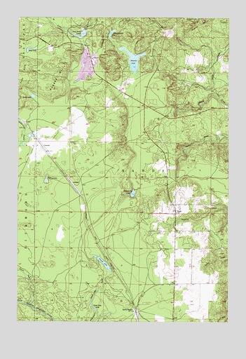
Sands, MI USGS Topographic Map
Click on map above to begin viewing in our Map Viewer.

This topographic map contains these locations and features:
Feature Name Type Latitude Longitude GNIS ID View Map
Carp River LakeReservoirN46.4929°W87.4625°622757View Map
CascadePopulated PlaceN46.4469°W87.4854°1617477View Map
GentianPopulated PlaceN46.4310°W87.4668°1617580View Map
Goose Lake OutletStreamN46.3816°W87.4926°626980View Map
Grace Korean ChurchChurchN46.3911°W87.3944°2336715View Map
Grace LakeLakeN46.4674°W87.4913°627060View Map
Harvey LakeLakeN46.4331°W87.4833°627906View Map
Lake Superior Christian ChurchChurchN46.4650°W87.4200°2130600View Map
Little Pelissier LakeLakeN46.4934°W87.4449°630721View Map
Marquette County FairgroundsLocaleN46.4333°W87.4125°2130635View Map
Migisy BluffCliffN46.4972°W87.3918°632294View Map
Mud LakeLakeN46.4872°W87.4924°633044View Map
Pelissier LakeLakeN46.4826°W87.4320°634566View Map
Powell LakeLakeN46.3992°W87.4493°635375View Map
Powell Lake OutletStreamN46.3822°W87.4571°635376View Map
Ragged HillsSummitN46.4758°W87.4771°635592View Map
SandsPopulated PlaceN46.4208°W87.4068°637214View Map
Sands Post Office (historical)Post OfficeN46.4208°W87.4069°2336634View Map
Sands StationLocaleN46.3794°W87.4299°637216View Map
Sands Township Fire Hall 1BuildingN46.4625°W87.4262°2626734View Map
Sands Trailer CourtPopulated PlaceN46.3967°W87.4056°2336714View Map
Shiloh Baptist ChurchChurchN46.4247°W87.4064°2336716View Map
Strawberry LakeLakeN46.4276°W87.4319°638946View Map
Township of SandsCivilN46.4222°W87.4296°1627040View Map
Uncle Tom LakeLakeN46.3807°W87.4546°1615323View Map
WHWL-FM (Marquette)TowerN46.4977°W87.4165°1625432View Map

Note: Coordinates in the location and feature list above are referenced to NAD83 datum.


Copyright (C) 2008-2025 Ryan Niemi / Sunset Dynamics ... All Rights Reserved