TopoQuest Logo
Do you find TopoQuest useful?
Help keep TopoQuest running and adding new maps/features by donating!
Bitcoin:  19c7KJd3qBynnjoSw5npx9KScwjBe4ifkT
Litecoin:  LXs6TkuXGGXo1vDsWCkWVdjQX94eUKd6ui
Home View Maps Find Maps Find Places Resources & Links


Palmer, Michigan Topographic Map

USGS Map Title: Palmer, MI
USGS Map MRC: 46087D5
DRG (GeoTIFF) Download: o46087d5.tif


Neighboring USGS Topographic Map Quads:


  Negaunee SW, MI  
46087E6
 

  Negaunee, MI  
46087E5
 

  Marquette, MI  
46087E4
 

  Ishpeming, MI  
46087D6
 

  Palmer, MI  
46087D5
 

  Sands, MI  
46087D4
 

  Green Hills, MI  
46087C6
 

  Cataract Basin, MI  
46087C5
 

  Gwinn, MI  
46087C4


Map MRC Location:

N47°
W88°
N47°
W87°
H8 H7 H6 H5 H4 H3 H2 H1
G8 G7 G6 G5 G4 G3 G2 G1
F8 F7 F6 F5 F4 F3 F2 F1
E8 E7 E6 E5 E4 E3 E2 E1
D8 D7 D6 D5 D4 D3 D2 D1
C8 C7 C6 C5 C4 C3 C2 C1
B8 B7 B6 B5 B4 B3 B2 B1
A8 A7 A6 A5 A4 A3 A2 A1
N46°
W88°
N46°
W87°

Palmer, MI USGS 1:24K Topographic Map Preview:
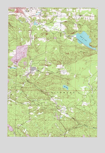
Palmer, MI USGS Topographic Map
Click on map above to begin viewing in our Map Viewer.

This topographic map contains these locations and features:
Feature Name Type Latitude Longitude GNIS ID View Map
Athens MineMineN46.4988°W87.5968°620298View Map
Breitung ParkParkN46.4992°W87.6083°2336504View Map
Buffalo Hills PlaygroundParkN46.4925°W87.5792°2336508View Map
City of NegauneeCivilN46.4969°W87.5967°1626790View Map
Episcopal Church of Saint JohnsChurchN46.4997°W87.6072°2336482View Map
Fifteen CreekStreamN46.3861°W87.5229°625940View Map
Finnish ChurchChurchN46.4072°W87.5579°625975View Map
Goose LakeLakeN46.4702°W87.5201°626975View Map
Jackson ParkParkN46.4958°W87.6217°2336506View Map
Jamros Airport (historical)AirportN46.4983°W87.5129°2717700View Map
Kona HillsSummitN46.4760°W87.5029°629851View Map
Lake GribbenLakeN46.4222°W87.5402°627425View Map
Lucy Hill Naturbahn Luge TrackLocaleN46.4922°W87.6028°2336507View Map
NegauneePopulated PlaceN46.4991°W87.6118°633261View Map
Negaunee City LibraryBuildingN46.4997°W87.6117°2336492View Map
Negaunee Police DepartmentBuildingN46.4996°W87.6116°2336490View Map
Negaunee Volunteer Fire DepartmentBuildingN46.4985°W87.6088°2336489View Map
New Richmond MineMineN46.4372°W87.5471°633337View Map
New Volunteer MineMineN46.4469°W87.6154°633345View Map
Old Richmond MineMineN46.4358°W87.5696°634014View Map
Our Lady of Perpetual Help Catholic ChurchChurchN46.4406°W87.5914°2336480View Map
PalmerPopulated PlaceN46.4408°W87.5932°634306View Map
Palmer Census Designated PlaceCensusN46.4436°W87.5817°2393176View Map
Palmer LakeLakeN46.4414°W87.6181°634315View Map
Palmer Post OfficePost OfficeN46.4411°W87.5928°2336688View Map
Palmer StationLocaleN46.4375°W87.5986°2336687View Map
Palmer-Suomi Lutheran ParishChurchN46.4406°W87.5878°2336481View Map
Richmond Township Fire Department / Richmond Township Emergency Medical ServicesBuildingN46.4411°W87.5870°2626775View Map
Richmond Township LibraryBuildingN46.4414°W87.5858°2336689View Map
Schweitzer CreekStreamN46.4016°W87.5454°637449View Map
Schweitzer FallsFallsN46.4078°W87.5975°2336595View Map
Standard SchoolSchoolN46.4922°W87.5257°638713View Map
Tiger FallsFallsN46.4039°W87.5756°2336594View Map
Township of RichmondCivilN46.4037°W87.5510°1626977View Map
Tracy MineMineN46.4922°W87.5915°1615025View Map
Warner CreekStreamN46.4013°W87.5454°1623195View Map
Warner FallsFallsN46.4333°W87.5989°2336609View Map
Wewe HillsSummitN46.4569°W87.5190°1616246View Map
WMQT-FM (Ishpeming)TowerN46.4783°W87.6226°1625425View Map

Note: Coordinates in the location and feature list above are referenced to NAD83 datum.


Copyright (C) 2008-2024 Ryan Niemi / Sunset Dynamics ... All Rights Reserved