TopoQuest Logo
Do you find TopoQuest useful?
Help keep TopoQuest running and adding new maps/features by donating!
Bitcoin:  19c7KJd3qBynnjoSw5npx9KScwjBe4ifkT
Litecoin:  LXs6TkuXGGXo1vDsWCkWVdjQX94eUKd6ui
Home View Maps Find Maps Find Places Resources & Links


Negaunee, Michigan Topographic Map

USGS Map Title: Negaunee, MI
USGS Map MRC: 46087E5
DRG (GeoTIFF) Download: o46087e5.tif


Neighboring USGS Topographic Map Quads:


  Negaunee NW, MI  
46087F6
 

  Buckroe, MI  
46087F5
 

  Marquette NW, MI  
46087F4
 

  Negaunee SW, MI  
46087E6
 

  Negaunee, MI  
46087E5
 

  Marquette, MI  
46087E4
 

  Ishpeming, MI  
46087D6
 

  Palmer, MI  
46087D5
 

  Sands, MI  
46087D4


Map MRC Location:

N47°
W88°
N47°
W87°
H8 H7 H6 H5 H4 H3 H2 H1
G8 G7 G6 G5 G4 G3 G2 G1
F8 F7 F6 F5 F4 F3 F2 F1
E8 E7 E6 E5 E4 E3 E2 E1
D8 D7 D6 D5 D4 D3 D2 D1
C8 C7 C6 C5 C4 C3 C2 C1
B8 B7 B6 B5 B4 B3 B2 B1
A8 A7 A6 A5 A4 A3 A2 A1
N46°
W88°
N46°
W87°

Negaunee, MI USGS 1:24K Topographic Map Preview:
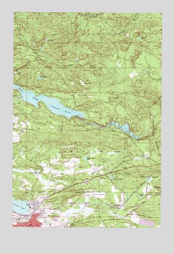
Negaunee, MI USGS Topographic Map
Click on map above to begin viewing in our Map Viewer.

This topographic map contains these locations and features:
Feature Name Type Latitude Longitude GNIS ID View Map
Baldwin Kiln LakeLakeN46.5403°W87.5636°620510View Map
Beaver Farm CreekStreamN46.5694°W87.6057°620924View Map
Bethany Lutheran ChurchChurchN46.5064°W87.6025°2336486View Map
Beverly HillsPopulated PlaceN46.5135°W87.6068°621262View Map
Calvary Baptist ChurchChurchN46.5181°W87.5958°2336488View Map
Calvary Church of NegauneeChurchN46.5042°W87.6100°2336485View Map
Charter Township of MarquetteCivilN46.6047°W87.5090°1626698View Map
Cherry Street FieldParkN46.5050°W87.6050°2336499View Map
Church of Our SaviourChurchN46.5339°W87.5469°2336478View Map
Club LakeLakeN46.5977°W87.5715°623502View Map
Eagle MillsPopulated PlaceN46.5127°W87.5337°625090View Map
Eagle Mills Post Office (historical)Post OfficeN46.5128°W87.5336°2336656View Map
Eagle Mills StationLocaleN46.5125°W87.5389°2336657View Map
Eastwood Apostolic Lutheran ChurchChurchN46.5133°W87.5964°2336487View Map
Eastwood Nursing CenterHospitalN46.5139°W87.5994°2336491View Map
Eastwood PlaylotParkN46.5111°W87.5944°2336501View Map
Harkin LakeLakeN46.6100°W87.5189°627795View Map
Holyoke TrailTrailN46.5927°W87.6176°628504View Map
Horseshoe LakeLakeN46.5290°W87.5411°628628View Map
Immanuel Lutheran ChurchChurchN46.5100°W87.6061°2336477View Map
Jackson Mine Historical MarkerParkN46.5139°W87.6011°2336768View Map
Lakeview Elementary SchoolSchoolN46.5114°W87.6102°2336496View Map
Long LakeLakeN46.5439°W87.5344°630962View Map
Maas MineMineN46.5094°W87.5982°631258View Map
Marquette County Airport (historical)AirportN46.5338°W87.5618°1624026View Map
Marquette Iron Range Historical MarkerParkN46.5125°W87.6022°2336767View Map
Mather Mine BMineN46.5044°W87.6190°631732View Map
McClure DamDamN46.5519°W87.5199°631832View Map
McClure Storage BasinReservoirN46.5574°W87.5315°631834View Map
Michigan Iron Industry MuseumBuildingN46.5217°W87.5639°2336510View Map
Michigan State Police District 8 Negaunee Post 81BuildingN46.5293°W87.5517°2737508View Map
Miners ParkParkN46.5133°W87.6019°2336502View Map
Mitchell United Methodist ChurchChurchN46.5036°W87.6094°2336484View Map
Morgan Heights SanatoriumHospitalN46.5222°W87.5021°632692View Map
Morgan PondLakeN46.5177°W87.5167°632697View Map
Morgan Post Office (historical)Post OfficeN46.5167°W87.5111°2336644View Map
Morgan Station (historical)LocaleN46.5167°W87.5111°2336645View Map
Nash LakeLakeN46.6087°W87.5972°633221View Map
Nealy CreekStreamN46.5333°W87.6201°633249View Map
Negaunee CemeteryCemeteryN46.5191°W87.5526°633262View Map
Negaunee High SchoolSchoolN46.5044°W87.6189°2336495View Map
Negaunee Historical Society MuseumBuildingN46.5008°W87.6031°2336493View Map
Negaunee Middle SchoolSchoolN46.5014°W87.6092°2336494View Map
Negaunee MineMineN46.5019°W87.5929°633263View Map
Negaunee Post OfficePost OfficeN46.5003°W87.6117°2336497View Map
Negaunee StationLocaleN46.5056°W87.6142°2336498View Map
Negaunee Township Fire DepartmentBuildingN46.5276°W87.5435°2626726View Map
Northland Chapel GardensCemeteryN46.5389°W87.5014°2336777View Map
Peter Waara ParkParkN46.5250°W87.5444°2336509View Map
Picket LakeLakeN46.5323°W87.6039°634805View Map
Pine Hill QuarryMineN46.5294°W87.5079°634944View Map
Reany LakeLakeN46.5865°W87.6026°635696View Map
Reany PondSwampN46.5838°W87.5665°635697View Map
Saint Paul ParishChurchN46.5006°W87.6106°2336483View Map
Seventh Day Adventist ChurchChurchN46.5331°W87.5389°2336479View Map
Teal Lake BeachParkN46.5119°W87.6111°2336500View Map
Township of NegauneeCivilN46.5448°W87.5534°1626791View Map
Trestle FallsFallsN46.5547°W87.5072°2336592View Map
Upper Carp River FallsFallsN46.5214°W87.5764°2336605View Map
WMVN-AM (Ishpeming)TowerN46.5055°W87.5401°1625237View Map

Note: Coordinates in the location and feature list above are referenced to NAD83 datum.


Copyright (C) 2008-2024 Ryan Niemi / Sunset Dynamics ... All Rights Reserved