TopoQuest Logo
Do you find TopoQuest useful?
Help keep TopoQuest running and adding new maps/features by donating!
Bitcoin:  19c7KJd3qBynnjoSw5npx9KScwjBe4ifkT
Litecoin:  LXs6TkuXGGXo1vDsWCkWVdjQX94eUKd6ui
Home View Maps Find Maps Find Places Resources & Links


Sarcoxie, Missouri Topographic Map

USGS Map Title: Sarcoxie, MO
USGS Map MRC: 37094A1
DRG (GeoTIFF) Download: o37094a1.tif


Neighboring USGS Topographic Map Quads:


  Avilla, MO  
37094B2
 

  La Russell, MO  
37094B1
 

  Rescue, MO  
37093B8
 

  Reeds, MO  
37094A2
 

  Sarcoxie, MO  
37094A1
 

  Stotts City, MO  
37093A8
 

  Newtonia, MO  
36094H2
 

  Pierce City, MO  
36094H1
 

  Monett, MO  
36093H8


Map MRC Location:

N38°
W95°
N38°
W94°
H8 H7 H6 H5 H4 H3 H2 H1
G8 G7 G6 G5 G4 G3 G2 G1
F8 F7 F6 F5 F4 F3 F2 F1
E8 E7 E6 E5 E4 E3 E2 E1
D8 D7 D6 D5 D4 D3 D2 D1
C8 C7 C6 C5 C4 C3 C2 C1
B8 B7 B6 B5 B4 B3 B2 B1
A8 A7 A6 A5 A4 A3 A2 A1
N37°
W95°
N37°
W94°

Sarcoxie, MO USGS 1:24K Topographic Map Preview:
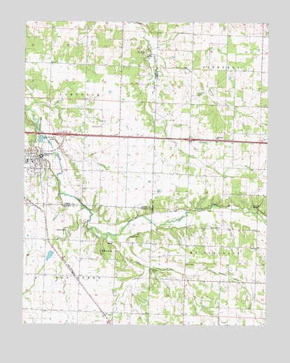
Sarcoxie, MO USGS Topographic Map
Click on map above to begin viewing in our Map Viewer.

This topographic map contains these locations and features:
Feature Name Type Latitude Longitude GNIS ID View Map
Bethany ChurchChurchN37.1078°W94.1116°714015View Map
Bethel ChurchChurchN37.0320°W94.0055°714045View Map
Big Spring School (historical)SchoolN37.0516°W94.0102°2710495View Map
Bleuins LakeReservoirN37.0285°W94.1114°763128View Map
Button SpringSpringN37.0387°W94.1024°715139View Map
Cave SpringSpringN37.1098°W94.0610°715531View Map
Cave Spring CemeteryCemeteryN37.1128°W94.0624°715542View Map
Cave Springs School (historical)SchoolN37.1084°W94.0647°746129View Map
City of SarcoxieCivilN37.0680°W94.1230°2396536View Map
ClarksonPopulated PlaceN37.0489°W94.0049°739499View Map
Clarkson School (historical)SchoolN37.0484°W94.0055°746405View Map
Clarkson SpringSpringN37.0487°W94.0060°715895View Map
Downey ChurchChurchN37.0759°W94.0347°717029View Map
Downey School (historical)SchoolN37.0759°W94.0319°746404View Map
Dry ValleyPopulated PlaceN37.0251°W94.0416°740816View Map
Dry Valley BranchStreamN37.0367°W94.0819°717134View Map
Dry Valley CemeteryCemeteryN37.0223°W94.0588°717135View Map
Dry Valley ChurchChurchN37.0248°W94.0416°746407View Map
Dry Valley School (historical)SchoolN37.0256°W94.0416°746406View Map
Forest School (historical)SchoolN37.1073°W94.1188°746130View Map
Haddock SpringSpringN37.0303°W94.0849°718964View Map
Independence ChurchChurchN37.0814°W94.0852°720091View Map
Independence School (historical)SchoolN37.0809°W94.0858°746131View Map
Linn SpringSpringN37.0370°W94.0699°721134View Map
Marblehead (historical)LocaleN37.0864°W94.1166°740553View Map
Morningside ChurchChurchN37.0770°W94.0260°722631View Map
Pepper Lake DamDamN37.0301°W94.1102°763127View Map
Pleasant Hill School (historical)SchoolN37.1195°W94.0105°746402View Map
Pleasant ValleyValleyN37.0209°W94.0422°724612View Map
Pleasant Valley School (historical)SchoolN37.0173°W94.0019°746408View Map
Rickman CreekStreamN37.1117°W94.0585°725288View Map
Round Prairie School (historical)SchoolN37.0637°W94.0730°746132View Map
SarcoxiePopulated PlaceN37.0692°W94.1166°729960View Map
Sarcoxie Police DepartmentBuildingN37.0693°W94.1171°2621060View Map
Sarcoxie Post OfficePost OfficeN37.0706°W94.1157°2783075View Map
Sarcoxie Volunteer Fire DepartmentBuildingN37.0698°W94.1154°2621033View Map
Schooling CemeteryCemeteryN37.0401°W94.0235°726117View Map
Spring Valley School (historical)SchoolN37.0209°W94.1216°746323View Map
Talmage CityPopulated PlaceN37.0120°W94.0908°740062View Map
Township of SarcoxieCivilN37.1004°W94.1166°766818View Map
Trinity Lutheran CemeteryCemeteryN37.0499°W94.1235°727784View Map
Union College School (historical)SchoolN37.0309°W94.0747°746322View Map
Wildwood Elementary SchoolSchoolN37.0668°W94.1210°2709715View Map
Wilson Union Church (historical)ChurchN37.1139°W94.0397°746403View Map

Note: Coordinates in the location and feature list above are referenced to NAD83 datum.


Copyright (C) 2008-2025 Ryan Niemi / Sunset Dynamics ... All Rights Reserved